- All
- AFRICA
- ▪ Central Africa
- ▪ East Africa
- ▪ North Africa
- ▪ Southern Africa
- ▪ West Africa
- ▪ Atlantic Islands
- AMERICAS
-
▪ United States (USA)
- USA - East
- USA - Midwest
- USA - Northeast
- USA - Southeast
- USA - West & Southwest
- Alabama
- Alaska
- Arizona
- Arkansas
- California
- Colorado
- Connecticut
- Delaware
- Florida
- Georgia
- Hawaii
- Idaho
- Illinois
- Indiana
- Iowa
- Kansas
- Kentucky
- Louisiana
- Maine
- Maryland
- Massachusetts
- Michigan
- Minnesota
- Mississippi
- Missouri
- Montana
- Nebraska
- Nevada
- New Hampshire
- New Jersey
- New Mexico
- New York
- New York City
- North Carolina
- North Dakota
- Ohio
- Oklahoma
- Oregon
- Pennsylvania
- Rhode Island
- South Carolina
- South Dakota
- Tennessee
- Texas
- Utah
- Vermont
- Virginia
- Washington
- Washington, D.C.
- West Virginia
- Wisconsin
- Wyoming
- ▪ North America
- ▪ South America
- ▪ Caribbean
- ASIA
- ▪ East Asia
- ▪ Southeast Asia
- ▪ India & South Asia
- ▪ Middle East & Turkey
- BRITISH ISLES
- ▪ London
-
▪ England
- English Cities
- Bedfordshire
- Berkshire
- Buckinghamshire
- Cambridgeshire
- Cheshire
- Cornwall
- Cumbria
- Derbyshire
- Devon
- Dorset
- Durham
- Essex
- Gloucestershire
- Hampshire
- Herefordshire
- Hertfordshire
- Huntingdonshire
- Isle of Wight
- Kent
- Lancashire
- Leicestershire
- Lincolnshire
- Middlesex
- Norfolk
- Northamptonshire
- Northumberland
- Nottinghamshire
- Oxfordshire
- Rutland
- Shropshire
- Somerset
- Staffordshire
- Suffolk
- Surrey
- Sussex
- Warwickshire
- Wiltshire
- Worcestershire
- Yorkshire
- Yorkshire East Riding
- Yorkshire North Riding
- Yorkshire West Riding
- ▪ Ireland
- ▪ Scotland
- ▪ Wales
- EUROPE
- ▪ Austria & Switzerland
- ▪ Benelux Region
- ▪ Central & Eastern Europe
- ▪ France & Monaco
- ▪ Germany
- ▪ Greece
- ▪ Italy
- ▪ Mediterranean Sea
- ▪ Spain & Portugal
- ▪ Scandinavia & Baltics
- ▪ Russia, Ukraine & Caucasus
- OCEANIA
- ▪ Australia
- ▪ New Zealand
- ▪ Pacific Ocean & Islands
- ▪ Papua New Guinea
- POLAR
- CELESTIAL
- WORLD
- GLOBES & INSTRUMENTS
- THEMATIC
- COLLABORATIONS
Victor Levasseur
Decorative map of the Asia, 1847
13 ½ x 19 in
34 x 48 cm
34 x 48 cm
AS1264
£ 150.00
Victor Levasseur, Decorative map of the Asia, 1847
Sold
%3Cdiv%20class%3D%22artist%22%3EVictor%20Levasseur%3C/div%3E%3Cdiv%20class%3D%22title_and_year%22%3E%3Cspan%20class%3D%22title_and_year_title%22%3EDecorative%20map%20of%20the%20Asia%3C/span%3E%2C%20%3Cspan%20class%3D%22title_and_year_year%22%3E1847%3C/span%3E%3C/div%3E%3Cdiv%20class%3D%22dimensions%22%3E13%20%C2%BD%20x%2019%20in%3Cbr/%3E%0A34%20x%2048%20cm%3C/div%3E
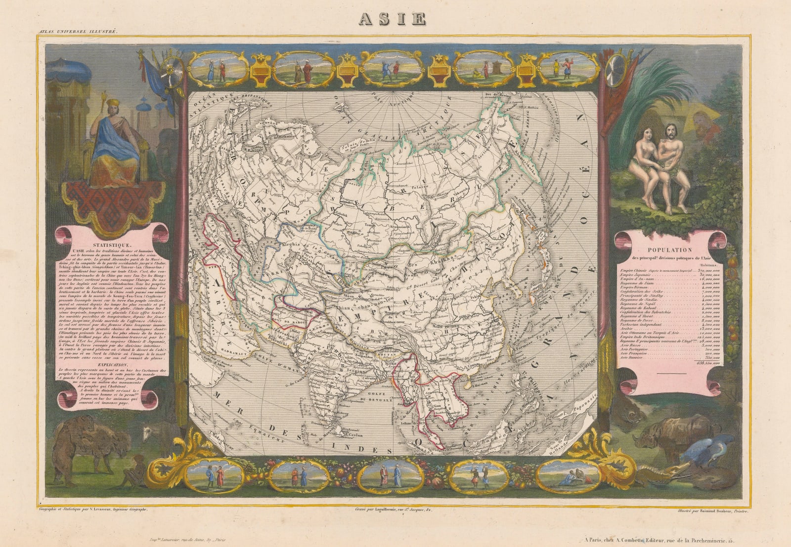
Asie Decorative map of the Asian continent originating from one of the last decorative atlases of the 19th Century. The map itself is full of information and coloured outlines...
Asie
Decorative map of the Asian continent originating from one of the last decorative atlases of the 19th Century.
The map itself is full of information and coloured outlines denote the boundary lines for the countries. The map radiates from the North Pole, outlining in colour only the countries belonging to Asia missing some of the South East Asian archipelago south of the Malay Peninsula, but does show part of Europe, the north of Australia and Polynesia.
To the left of the map, a crowned figure sits atop a scroll of 'statistics' about the continent, which also briefly describes the history and the Empires of such important figures as Genghis Khan and Confucius.
To the right of the map, Adam and Eve, looked over by God, sit in the Garden of Eden above another scroll titled "Population" which lists the inhabitants of the principal countries and Empires within Asia.
Above and below the map, ten charmingly framed miniature portraits of Asian peoples in traditional dress, between a collection of weapons, animals, fruit and flowers.
Engraved by Raymond Bonheur (1796-1849) for the "Universal Illustrated Atlas". Coloured. [AS1264]
Share
- Tumblr
Join our mailing list
* denotes required fields
We will process the personal data you have supplied to communicate with you in accordance with our Privacy Policy. You can unsubscribe or change your preferences at any time by clicking the link in our emails.
Contact
The Map House
54 Beauchamp Place,
London SW3 1NY,
United Kingdom
maps@themaphouse.com
+44 (0)20 7589 4325

Copyright © 2025 The Map House
This website uses cookies
This site uses cookies to help make it more useful to you. Please contact us to find out more about our Cookie Policy.

