-

-
Girolamo Ruscelli, Septentrionalivm Partivm Nova Tabvla, 1574£ 985.00
-
Frederick De Wit, Terra Nova, ac Maris Tractus circa Novam Franciam, Angliam, Belgium, Venezuelam Novam, Andalusiam Novam, et Brasiliam, 1690 c.£ 2,275.00
-
Vincenzo Coronelli, Mare del Nord, 1692£ 2,750.00
-
Pierre Mortier, Carte de la Mer Meridional Contenant une Partie des Costes de L'Afrique et de L'Amerique Meridionale, 1700£ 1,650.00
-
Pierre Mortier, Ocean Atlantique ou Mer du Nord, 1700 c.£ 1,950.00
-
Jeremiah Seller, A New General Chart for the West Indies, 1703£ 1,750.00
-
Pieter van der Aa, H. Benzos Scheep-Togt uit Italie over Spanje nade Westindize Eylanden, en Kusten vant Zuider America, 1706£ 275.00
-
Pieter van der Aa, A. Knivets Zeldsaame Reystogt door de Straat Magellaan na de Zuyd Zee tot aan ayn Vlugt in Angola agtervolgt, 1707£ 455.00
-
Pieter van der Aa, Scheepstogt nad Africanze Kusten van Confo en Angola tot agter om beoosten Caap de Bonne Esperance, 1707£ 295.00
-
Emanuel Bowen, A Map of the King of Great Britain's Dominions in Europe, Africa, and America, 1740 c.£ 1,800.00
-
Herman Moll, A General Chart of the Sea Coast of Europe, Africa and America, 1745£ 895.00
-
Jacques-Nicolas Bellin, Carte Reduite de L'Ocean Meridional, 1753£ 985.00
-
Jacques-Nicolas Bellin, Carte Reduite de L'Ocean Occidental, 1757£ 985.00
-
Emanuel Bowen, A New & Accurate Chart of the Western or Atlantic Ocean, 1766£ 725.00
-
Depot de la Marine, Carte Reduite D'Une Partie de L'Ocean Atlantique ou Occidental, 1775£ 825.00
-
Sayer & Bennett, [Atlantic Ocean], 1775£ 675.00
-
Jacques-Nicolas Bellin, Carte Generale de L'Ocean Atlantique ou Occidental, 1786£ 1,200.00
-
Laurie & Whittle, A New Chart of the Southern Ocean, 1794£ 750.00
-
William Heather, [The Southern Atlantic Ocean], 1799£ 2,250.00
-
Laurie & Whittle, A New and Correct Chart exhibiting the Atlantic and Western Ocean and the greatest part of the Ethiopic or Southern Ocean, 1802£ 4,450.00
-
Isidoro de Antillon, El Oceano Atlantico, 1802£ 2,800.00
-
William Heather, A New Chart of the Atlantic or the Western Ocean, 1807£ 4,500.00
-
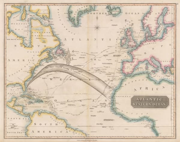
John Thomson, Atlantic or Western Ocean, 1820 c.£ 525.00
-
Daniel & William Lizars, Chart of the Atlantic Ocean, 1840 c.£ 145.00
-
Aimé Robiquet, Carte Generale de L'Ocean Atlantique Septentrional, 1855£ 785.00
-
Carl Christian Franz Radefeld, Karte von Atlantischen Ocean, 1858£ 68.00
-
Royal Geographical Society (RGS), Surface Temperatures of the North Atlantic between Shetland & Greenland, 1870£ 155.00
-
Royal Geographical Society (RGS), Sketch Map of the Countries Referred to in the Zeno Narrative, 1873£ 95.00
-
G. & J. Bartholomew, North Atlantic Ocean, 1887£ 44.00
-
Justus Perthes, Die Nordatlantische Sargasso See, 1891£ 88.00
-
Justus Perthes, Atlantischer Ocean, 1895£ 36.00
-
George Philip & Son Ltd., The Atlantic Ocean, 1896£ 32.00
-
George Bradshaw, Pacific Line of Royal Mail Steamers, 1907£ 44.00
-
-
-
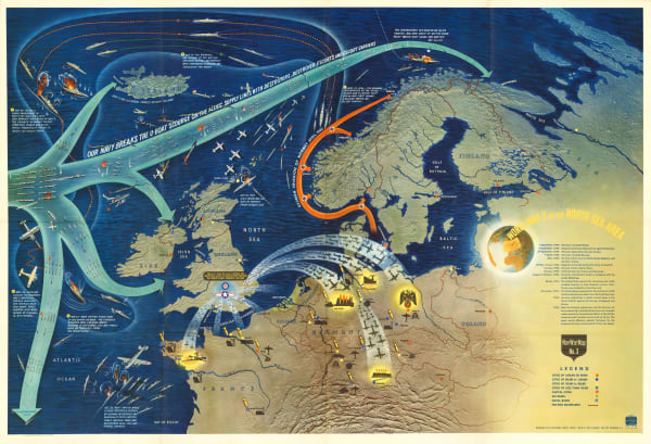
Her Majesty's Stationery Office (HMSO), The Bay Offensive, 1950 c.£ 125.00
-
British Admiralty, Steamship Routes Atlantic Ocean, 1951£ 475.00
Close
Search Inventory
Our entire inventory of over 10,000 antique and vintage maps is now available to browse by region, date, cartographer, and subject


![Sayer & Bennett, [Atlantic Ocean], 1775](https://artlogic-res.cloudinary.com/w_600,c_limit,f_auto,fl_lossy,q_auto/artlogicstorage/themaphouse/images/view/086cb15650bb42126407286bf71b9bc7j/themaphouse-sayer-bennett-atlantic-ocean-1775.jpg)


![William Heather, [The Southern Atlantic Ocean], 1799](https://artlogic-res.cloudinary.com/w_600,c_limit,f_auto,fl_lossy,q_auto/artlogicstorage/themaphouse/images/view/3d24096a48d644fd3a05bea29b033b3ej/themaphouse-william-heather-the-southern-atlantic-ocean-1799.jpg)


Join our mailing list
* denotes required fields
We will process the personal data you have supplied to communicate with you in accordance with our Privacy Policy. You can unsubscribe or change your preferences at any time by clicking the link in our emails.
![]()