-
 Charles Frederick Cheffins, Map of the English and Scottish Railways, 1843£ 475.00
 -
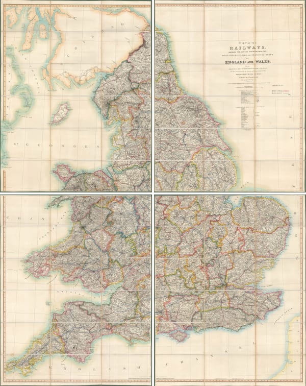
Aaron Arrowsmith, Map of the Railways Showing the Various Stations with the Hills, Rivers, Canals and Principal Roads of England and Wales, 1845£ 2,450.00
-
James Wyld, Post Map of Europe, 1845£ 450.00
-
James Wyld, Railway Map of England Wales and Scotland, 1845£ 1,850.00
-
John Tallis, Tallis's Railway Map of Great Britain, 1851£ 475.00
-
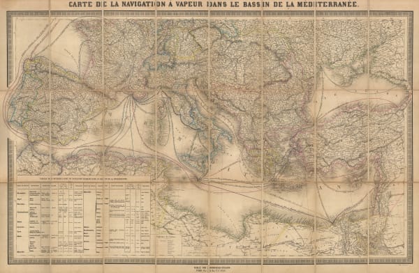
Andriveau-Goujon, Mediterranean Steamship Routes, 1851£ 650.00
-
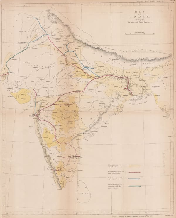
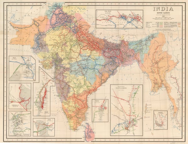
Hansard, Railway and Cotton District Map of India, 1857£ 950.00
-
Aimé Thomé de Gamond, An Early Channel Tunnel Plan, 1858£ 950.00
-
Archibald Fullarton, Railway Map of the British Isles, 1860 c.£ 325.00
-
Edward Stanford, Railway Map of the British Isles, 1866£ 385.00
-
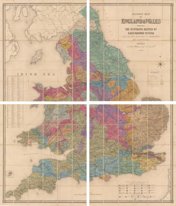
Edward Stanford, Railway Map of the England and Wales Shewing the Districts Served by Each Railway System, 1872£ 3,950.00
-
James Wyld, Road, Railway & Telegraphic Map of India, 1872 c.£ 1,550.00
-
Edward Stanford, Railway and Road Map of England and Wales, 1875£ 345.00
-
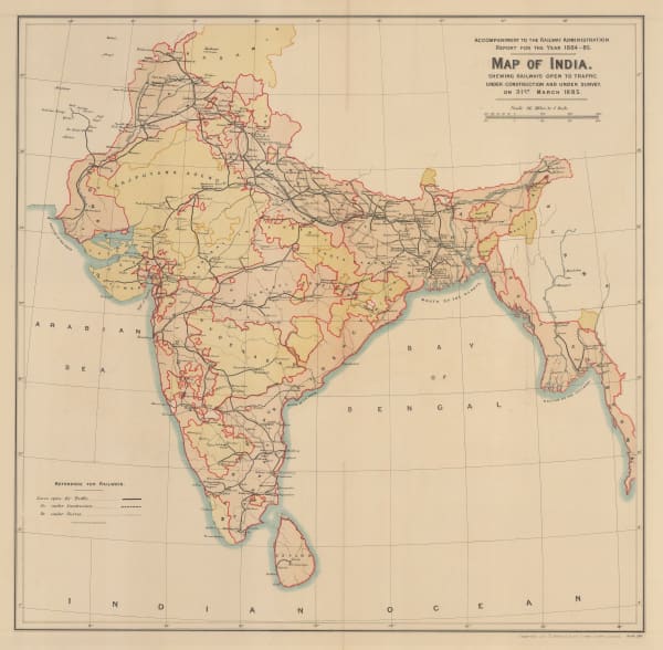
Survey of India, Map of India shewing Railways open to traffic, under construction and under survey onm 31st March 1885, 1885£ 585.00
-
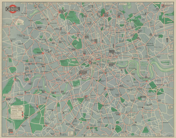
John Bartholomew & Co., Railway Map of London and Suburbs, 1889£ 55.00
-
Royal Geographical Society (RGS), A Railway Map of the Argentine Republic, 1898£ 185.00
-
George Philip, Map of the Eastern Indian Railway, 1900 c.£ 385.00
-
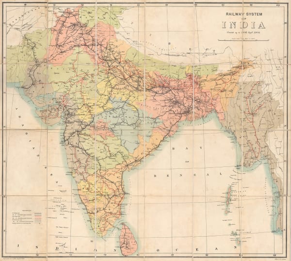
Survey of India, Railway System of India, 1902£ 585.00
-
Railway Clearing House, Official Railway Map of London and its Environs, 1907£ 525.00
-
Royal Geographical Society (RGS), South Africa showing Railways, 1910£ 135.00
-
Joseph Pearson, Pearson's Cycling, Motoring, and Traveller's Road Map of 50 Miles around Sydney, 1910 c.£ 395.00
-
Joseph Pearson, Road Map of 50 Miles around Sydney, 1910 c.£ 395.00
-
G. De Kelsch, Схематическая карта Уссурийской, Манджурской и Корейской железных дорог. [Schematic map of the Ussuri, Mandzhur and Korean railways.], 1910 c.£ 525.00
-
-
-
Walter Boldero Paton, Railway Map of Victoria, 1912£ 295.00
-
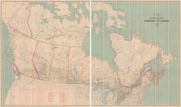
Edward Stanford, Railway Map of the US & Canada, 1913£ 1,450.00
-
Royal Geographical Society (RGS), Map to Illustrate the Paper on Railway Development of Africa, Present and Future, 1916£ 485.00
-
Edward Stanford, Trans-Siberian Railway, 1917£ 1,250.00
-
Railway Clearing House, Official Railway Map of the West of England, 1918£ 395.00
-
Royal Geographical Society (RGS), Map to Illustrate the Paper on : The Cape to Cairo Railway & Train Ferries, 1920£ 345.00
-
O.A. Smith, Relief Map of the Territory Served by the Lines of the Pacific Electric Railway in Southern California, 1920£ 950.00
-
Waterlow & Sons, Railway Map of Argentina, 1921£ 1,350.00
-
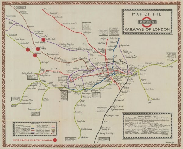
Kennedy North, British Empire Exhibition 1924, 1923£ 650.00
-
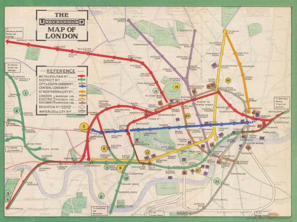
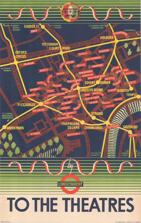
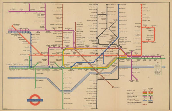
Macdonald Gill, Map of the Underground Railways of London, 1923£ 1,750.00
-
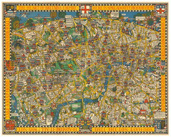
Macdonald Gill, The Wonderground Map of London, 1924 c.£ 4,800.00
-
London Underground, London Tramways, 1927£ 150.00
-
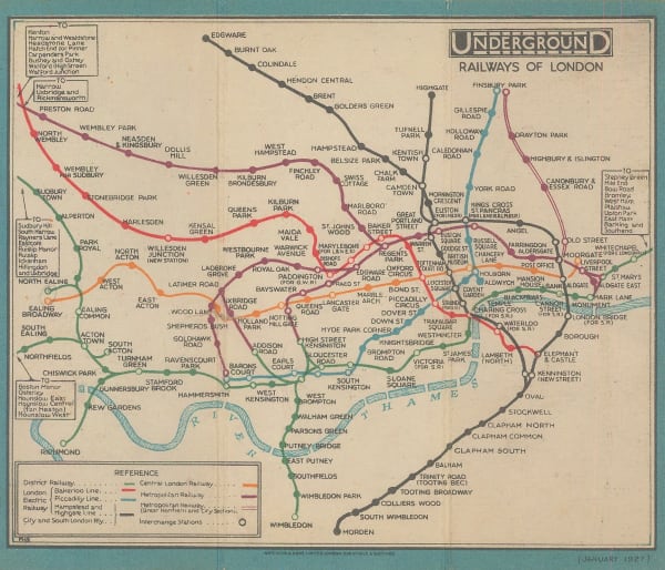
Fred H. Stingemore, Underground Railways of London, 1927£ 795.00
-
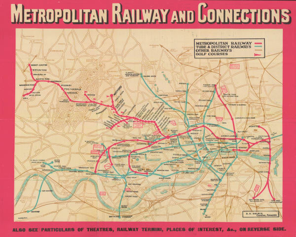
London Underground, Metropolitan Railway and Connections, 1928£ 550.00
-
Railway Clearing House, Railway Map of NW London, 1928£ 75.00
-
Railway Clearing House, Cardiff, 1928£ 55.00
-
-
London General Omnibus Co., General Omnibus Map of London, 1929£ 195.00
-
Anonymous, Railway Map of the Western USA, 1930£ 115.00
-
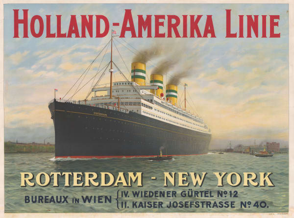
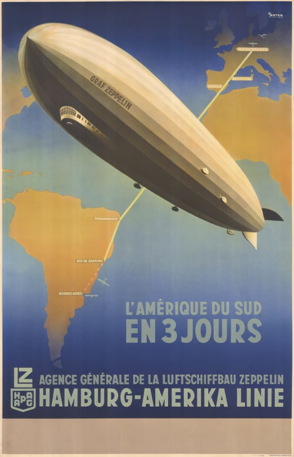
Van LL, Holland-Amerika Linie, 1930 c.£ 4,950.00
-
Survey of India, India Showing Railways, 1932£ 475.00
-
-
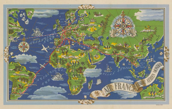
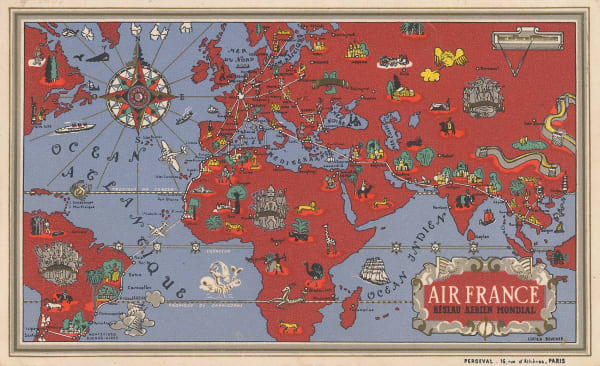
Air France, Air France - 'Reseau Aerien Mondial', 1934£ 3,500.00
-
-
-
London Transport, Trolleybus and Tram Map, 1934£ 175.00
-
London General Omnibus Co., General Omnibus Map of London, 1934£ 195.00
-
-
Geographia Ltd., The Coronation Area, 1937£ 445.00
-
Harry Beck, Underground Pamphlet Map, 1937£ 550.00
-
Air France, Air France 'Reseau Aerien Mondial', 1937 c.£ 4,000.00
-
Air France, Postcard - Air France 'Reseau Aerien Mondial', 1937 c.£ 275.00
-
G. & J. Bartholomew, Environs of Paris: Rail and Automobile Routes, 1938£ 28.00
-
Hans Schleger, 1938 Tube Map, 1938£ 500.00
-
H.E.C. Robinson, Sydney, 1939£ 85.00
-
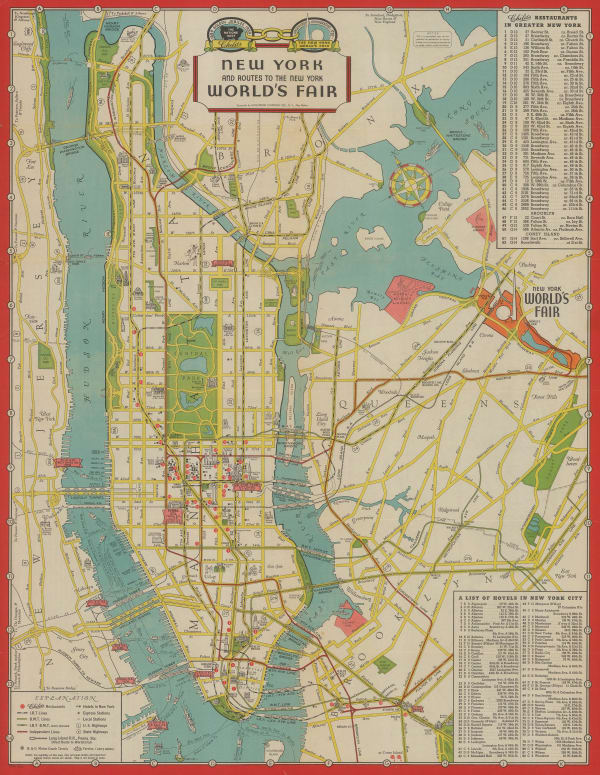
Hagstrom Co. Inc., New York and Routes to the New York World's Fair, 1939£ 325.00
-
-
C.S. Hammond & Co., Rapid Transit Map of Greater New York, 1939£ 195.00
-
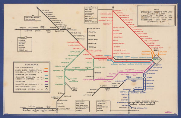
London Underground, [Bakerloo Line Extension], 1939£ 225.00
-
Hans Schleger, 1940 Wartime Tube Map, 1940£ 500.00
-
General Drafting Co., The Seamen's Bank for Savings: Rapid Transit map of Greater New York, 1943£ 325.00
-
Harry Beck, London Underground Transport, 1945£ 500.00
-
-
Air France, Air France - Orient Extreme-Orient, 1947£ 4,750.00
-
Air France, Air France - Réseau Aérien Mondial, 1948 c.£ 1,100.00
-
Harry Beck, Underground Pamphlet Map, 1949£ 450.00
-
Air France, Air France Celestial Planisphere, 1950£ 4,000.00
-
Air France, Postcard - Air France 'Reseau Aerien Mondial', 1950 c.£ 275.00
-
Air France, North America Travel Poster, 1951£ 3,500.00
-
Air France, Air France Route Map, 1952 c£ 4,250.00
-
Harry Beck, Underground Pamphlet Map, 1953£ 400.00
-
Charles Edward Turner, Cunard - UK to USA, 1954£ 3,500.00
-
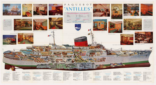
Michel Lezla, Compagnie Generale Transatlantique - Paquebot Antilles, 1955£ 1,800.00
-
Harry Beck, Underground Pamphlet Map, 1957£ 350.00
-
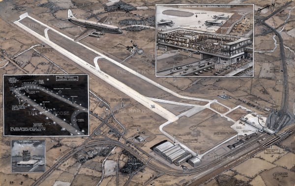
George Horace Davis, As It Will Be - London's New Airport at Gatwick, which was to be opened by the Queen on June 9, 1958£ 2,500.00


![G. De Kelsch, Схематическая карта Уссурийской, Манджурской и Корейской железных дорог. [Schematic map of the Ussuri, Mandzhur and Korean railways.], 1910 c.](https://artlogic-res.cloudinary.com/w_600,c_limit,f_auto,fl_lossy,q_auto/artlogicstorage/themaphouse/images/view/ed0fe94d443fd069221482ec6184b1d7j/themaphouse-g.-de-kelsch-.-schematic-map-of-the-ussuri-mandzhur-and-korean-railways.-1910-c..jpg)


![London Underground, [Bakerloo Line Extension], 1939](https://artlogic-res.cloudinary.com/w_600,c_limit,f_auto,fl_lossy,q_auto/artlogicstorage/themaphouse/images/view/09c2e1c75f2563ddd787bfa713b3613fj/themaphouse-london-underground-bakerloo-line-extension-1939.jpg)


Page
1
of 2