-
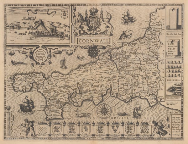
 John Speed, Cornwall, 1611£ 3,750.00
 -
John Speed, Cornwall, 1627£ 3,750.00
-
William Kip, Cornwall, 1637£ 975.00
-
Jan Jansson, Cornubia sive Cornwallia, 1650 (c.)£ 1,200.00
-
Willem & Jan Blaeu, Cornubia sive Cornwallia, 1650 c.£ 1,600.00
-
Capt. Greenvile Collins, [Cornwall and the Scilly Isles], 1693£ 445.00
-
Capt. Greenvile Collins, The Islands of Scilly, 1700 c.£ 1,450.00
-
Robert Morden, Cornwall, 1701£ 295.00
-
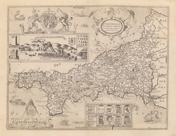
Christopher Saxton & Philip Lea, Cornwall, 1749£ 3,250.00
-
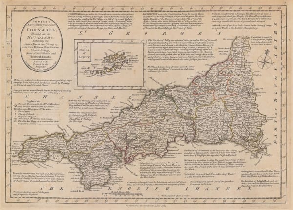
Emanuel Bowen, A New Improved Map of Cornwall, 1760 c£ 2,200.00
-
Carington Bowles, Bowles's New Medium Map of Cornwall, Divided into its Hundreds, 1785£ 295.00
-
Capt. Greenvile Collins, [Cornwall and the Scilly Isles], 1785£ 445.00
-
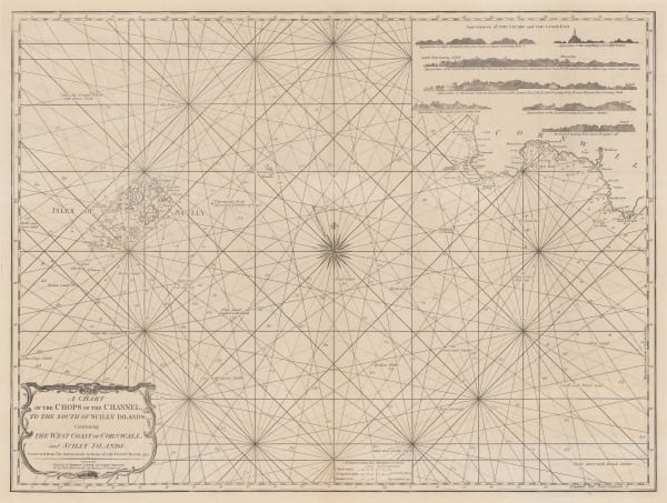
Laurie & Whittle, A Chart of the Chops of the Channel, to the South of Scilly Islands: Containing the West Coast of Cornwall and Scilly Islands, 1795£ 545.00
-
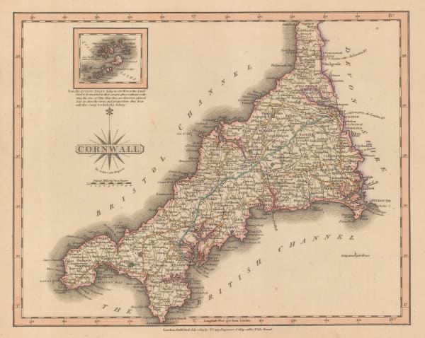
John Wilkes, Cornwall, 1802£ 115.00
-
Charles Smith, A New Map of the County of Cornwall, 1804£ 395.00
-
Charles Smith, A New Map of the County of Cornwall, 1808£ 275.00
-
John Cary, Cornwall, 1809£ 155.00
-
John Pinkerton, Remote British Isles, 1814£ 225.00
-
Christopher & John Greenwood, Map of the County of Cornwall, 1829£ 975.00
-
James Pigot, Cornwall, 1840£ 225.00
-
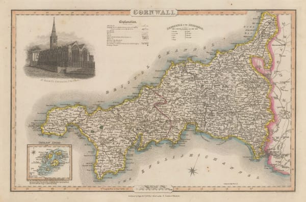
Thomas Moule, Cornwall, 1840 c.£ 195.00
-
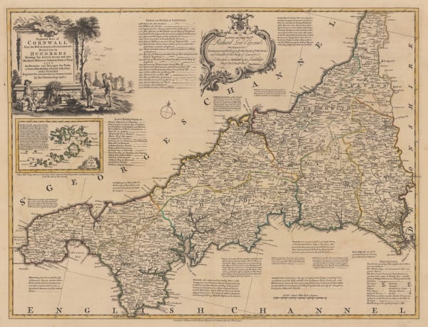
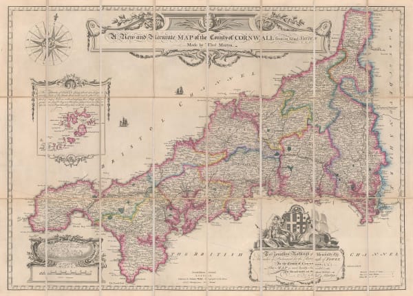
Thomas Martyn, A New and Accurate Map of the County of Cornwall, 1870 c.£ 1,550.00
-
Ordnance Survey, Cornwall - Padstow to Camelford, 1880 (c.)£ 145.00
-
J. & C. Walker, Cornwall, 1880 c.£ 125.00
-
W. & A.K. Johnston, Cornwall, 1880 c.£ 65.00
-
Baddeley and Ward, Penzance, 1903£ 45.00
-
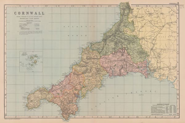
George W. Bacon, Cornwall, 1910 c.£ 85.00
-
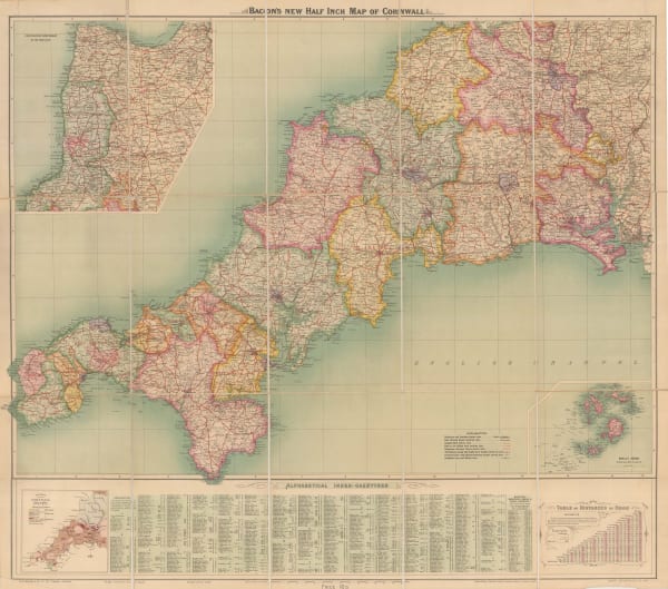
George W. Bacon, Map of Cornwall, 1910 c.£ 485.00
-
Ordnance Survey, Ordnance Survey Road Map of S.W. Cornwall & Scilly Isles, 1929£ 125.00
-
William Thomas Harding, Map of Cornwall, 1929£ 125.00
-
William Thomas Harding, Map of Cornwall, 1929£ 145.00
-
William Thomas Harding, Map of Cornwall, 1929£ 145.00
-
J.W. Harding & Co., Touring Map of the Cornish Riviera, 1930 c.£ 375.00
-
Ordnance Survey, Bodmin - O.S.Sheet 136, 1942£ 125.00
-
War Office, Looe, 1943£ 45.00
-
War Office, Mousehole / Marazion, 1943£ 45.00
-
War Office, St. Ives / Hayle, 1943£ 55.00
-
Ward, Lock & Co, Newquay, 1946£ 52.00
-
Ward, Lock & Co, Bude, 1946£ 55.00
-
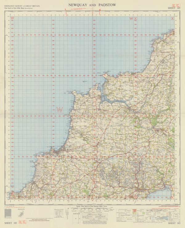
War Office, Newquay and Padstow, 1962£ 350.00
Close
Search Inventory
Our entire inventory of over 10,000 antique and vintage maps is now available to browse by region, date, cartographer, and subject


![Capt. Greenvile Collins, [Cornwall and the Scilly Isles], 1693](https://artlogic-res.cloudinary.com/w_600,c_limit,f_auto,fl_lossy,q_auto/artlogicstorage/themaphouse/images/view/35d58f26812465a86b2584a42f82e422j/themaphouse-capt.-greenvile-collins-cornwall-and-the-scilly-isles-1693.jpg)


![Capt. Greenvile Collins, [Cornwall and the Scilly Isles], 1785](https://artlogic-res.cloudinary.com/w_600,c_limit,f_auto,fl_lossy,q_auto/artlogicstorage/themaphouse/images/view/bf60eb6ad8a343cf3d4b681e615ca1efj/themaphouse-capt.-greenvile-collins-cornwall-and-the-scilly-isles-1785.jpg)


Join our mailing list
* denotes required fields
We will process the personal data you have supplied to communicate with you in accordance with our Privacy Policy. You can unsubscribe or change your preferences at any time by clicking the link in our emails.
![]()