-
 Giovanni Battista Ramusio, The First Printed Map of Canada & New England, 1606£ 2,500.00
 -
-
-
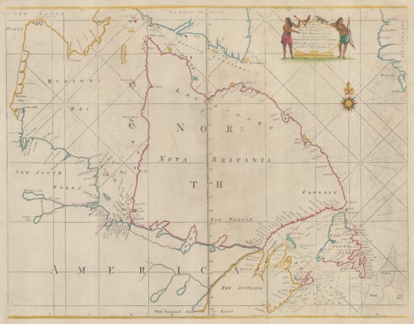
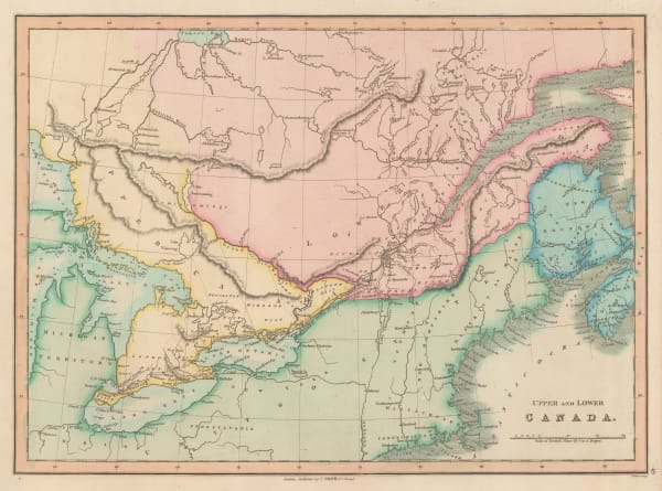
Willem & Jan Blaeu, Extrema Americae Versus Boream ubi Terra Nova Nova Francia, 1662£ 3,950.00
-
Vincenzo Coronelli, Canada Orientale nell' America Settentrionali, 1695£ 2,150.00
-
Pierre Mortier, Le Canada ou Partie de la Nouvelle France, 1700£ 4,450.00
-
Nicolas & Guillaume Sanson, Le Canada, ou Nouvelle France, &c., 1700£ 1,250.00
-
-
-
Guillaume De L'Isle, Carte du Canada ou de la Nouvelle France, 1718 c.£ 2,450.00
-
Alain Manesson Mallet, Canada ou Nouvelle France, 1719£ 345.00
-
Covens (Jean) & Mortier (Cornelius), Canada ou Nouvelle France, 1730 c.£ 895.00
-
Matthaus Seutter, Accurata delineatio celeberrinier Regionis Ludovicianae vel Galliee Louisiane, 1740 c.£ 3,950.00
-
Jacques-Nicolas Bellin, Carte de la Partie Orientale de la Nouvelle France ou du Canada, 1744£ 1,250.00
-
Homann Heirs, Partie Orientale de la Nouvelle France ou du Canada, 1755£ 1,150.00
-
Tobias Conrad Lotter, Partie Orientale de la Nouvelle France ou du Canada, 1755 c.£ 2,200.00
-
Jacques-Nicolas Bellin, Suite du Cours du Fleuve de St. Laurent, Depuis Quebec jusqu'au Lac Ontario, 1757£ 325.00
-
London Magazine, A New Chart of the River St. Lawrence from the Island of Anticosti to Lake Ontario, 1759£ 165.00
-
Mount & Page, New Foundland to Hudson's Bay, 1760 c.£ 925.00
-
Georges-Louis Le Rouge, Partie Orientale du Canada, 1760 c.£ 1,250.00
-
-
Andrew Dury, Canada, 1763£ 325.00
-
Isaac Tirion, Quebek, de Hoofstad van Kanadaaan de Rivier van St. Laurens, 1765£ 845.00
-
Isaac Tirion, Nieuwe Kaart van Kanada, 1769£ 495.00
-
Johann Heinrich Heidegger, Carte Generale des Decouvertes de L'Amiral de Fonte, 1770 c.£ 795.00
-
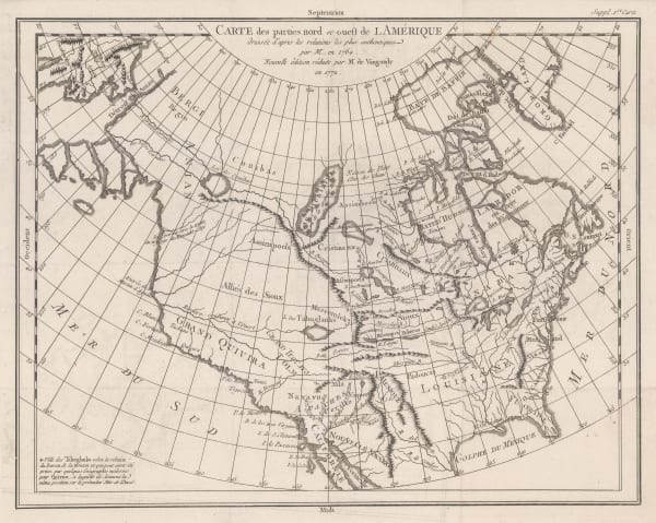
Robert de Vaugondy, Carte des Parties Nord et Ouest de l'Amerique, 1772£ 695.00
-
Thomas Jefferys, An Exact Chart of the River St. Laurence, 1775£ 1,250.00
-
Thomas Kitchin, Map of the European Settlements in North America, 1776£ 875.00
-
Antonio Zatta, Parte Orientale del Canada, Nuova Scozia Settentrionale, E Partie di Labrador, 1780 c.£ 180.00
-
John Wilkes, British Colonies in North America, 1797£ 175.00
-
John Russell, British Colonies in North America, 1799£ 395.00
-
William Guthrie, British Colonies in North America, 1801£ 185.00
-
Thomas and Andrews, British Possessions in America, 1805£ 295.00
-
John Russell, British Colonies in North America, from the Best Authorities, 1805 c.£ 115.00
-
John Cary, A New Map of Upper & Lower Canada, from the Latest Authorities, 1807£ 985.00
-
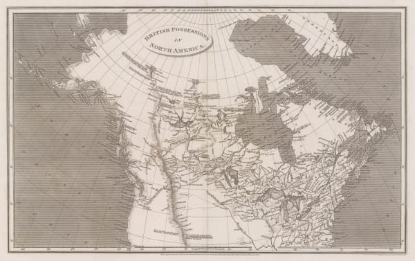
Aaron Arrowsmith, British Possessions in North America, 1809£ 345.00
-
Richard Phillips, British America, 1813£ 58.00
-
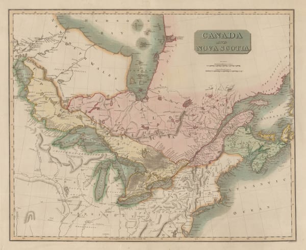
John Thomson, Canada and Nova Scotia, 1816£ 985.00
-
Thomas Myers, Map of the North Part of America, 1821£ 145.00
-
Carey & Lea, Geographical, Statistical and Historical map of Upper and Lower Canada, 1822£ 925.00
-
Philippe Vandermaelen, Partie du Bas Canada, 1827£ 150.00
-
Thomas Starling, British Possessions in North America, 1830 c.£ 88.00
-
Thomas Starling, Canada, 1830 c.£ 48.00
-
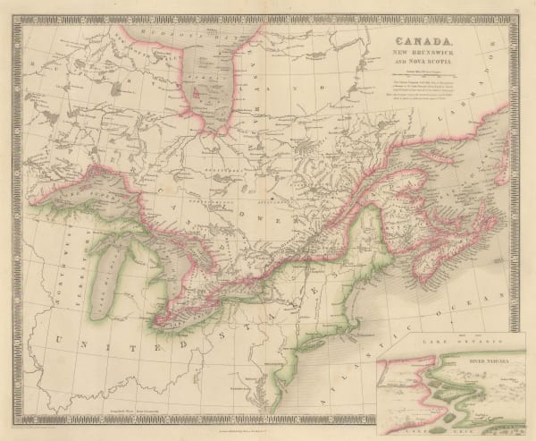
Sidney Hall, Canada, New Brunswick and Nova Scotia, 1830 c.£ 525.00
-
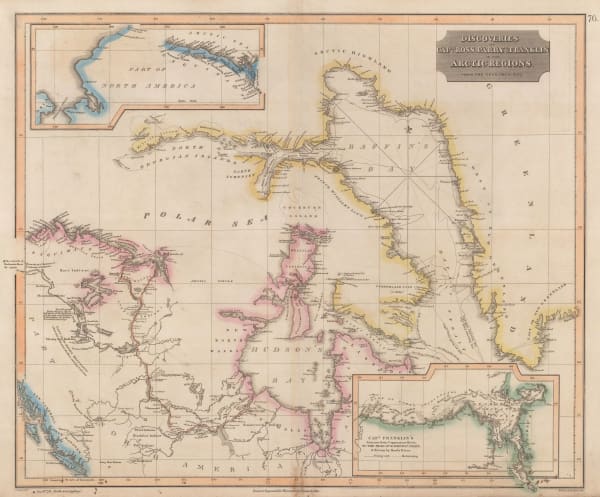
John Thomson, Discoveries of Ross, Parry & Franklin in the Arctic , 1830 c.£ 2,950.00
-
Royal Geographical Society (RGS), Sketch of North America, 1833£ 145.00
-
Charles Smith, Upper and Lower Canada, 1834£ 225.00
-
Thomas Bradford, Upper & Lower Canada, 1835£ 55.00
-
Daniel & William Lizars, North America | British Possessions, 1835 c.£ 425.00
-
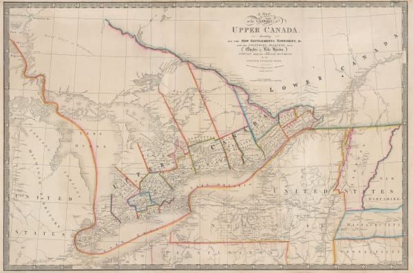
James Wyld, A Map of the Province of Upper Canada, 1840 c.£ 925.00
-
Thomas Kelly, Canada, 1840 c.£ 85.00
-
W. & A.K. Johnston, Canada, 1840 c.£ 150.00
-
Joseph Meyer, Neuste Carte von Lower Canada, 1844£ 88.00
-
Henry Teesdale, Canada, New Brunswick and Nova Scotia, 1845£ 185.00
-
George Frederick Cruchley, North America, 1845£ 120.00
-
Samuel Augustus Mitchell, Canada East Formerly Lower Canada, 1850£ 90.00
-
Peter Jackson, Canada, 1850 c.£ 68.00
-
Joshua Archer, Canada, New Brunswick, Nova Scotia etc., 1850 c.£ 55.00
-
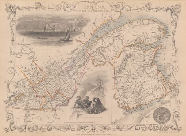
John Tallis, British America, 1851£ 395.00
-
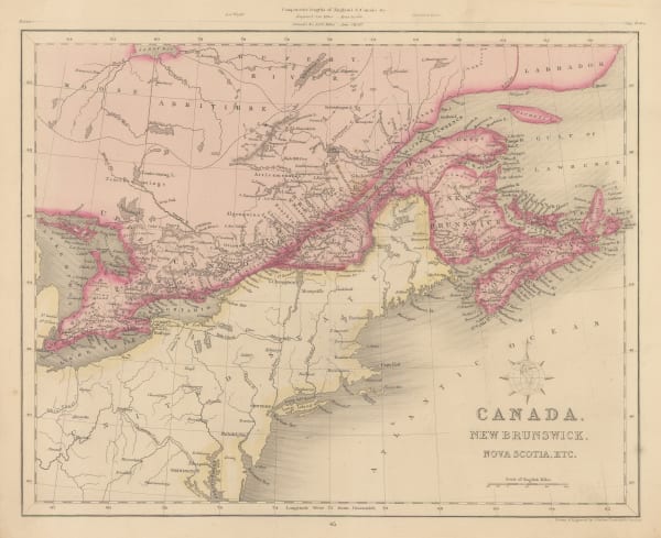
John Tallis, Canada, New Brunswick, 1851£ 235.00
-
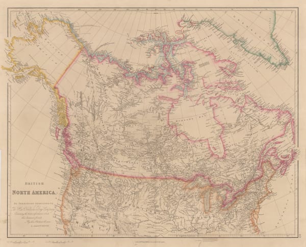
John Arrowsmith, British North America, 1852£ 895.00
-
Royal Geographical Society (RGS), Map of British North America, 1852£ 325.00
-
George Matthews, Montreal Herald - Railway Map of Canada, 1853£ 195.00
-
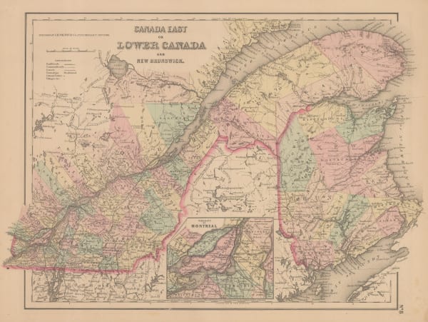
Joseph Hutchins Colton, Canada East or Lower Canada and New Brunswick, 1855£ 95.00
-
Joseph Meyer, Karte von Britisch Nord-Amerika, Alaska und Gronland, 1855 c.£ 165.00
-
George Philip, Canada, Nova Scotia & New Brunswick &c., 1856£ 220.00
-
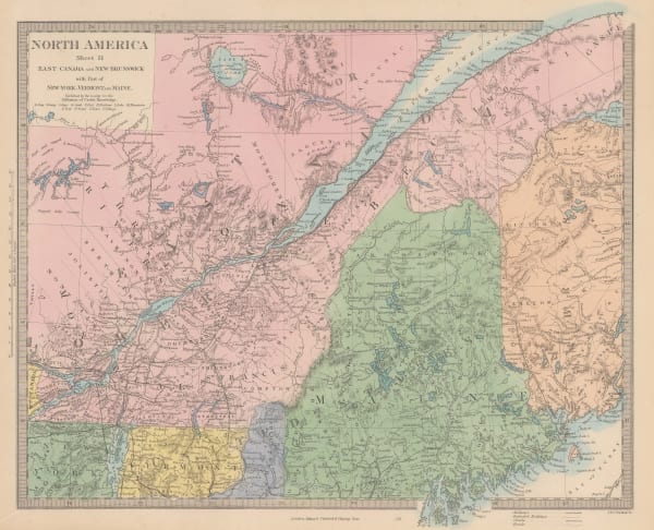
Society for the Diffusion of Useful Knowledge (SDUK), East Canada and New Brunswick, 1860 c.£ 95.00
-
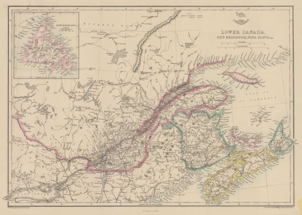
Edward Weller, Lower Canada, New Brunswick, Nova Scotia, 1863£ 45.00
-
Johnson & Ward, Johnson's Lower Canada and new Brunswick, 1863 c.£ 150.00
-
Royal Geographical Society (RGS), Sketch Map Showing Proposed Communication Between Canada & British Columbia, 1868£ 58.00
-
John Dower, Canada &c., 1870 c.£ 78.00
-
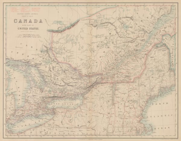
Archibald Fullarton, Canada with part of the United States, 1870 c.£ 125.00
-
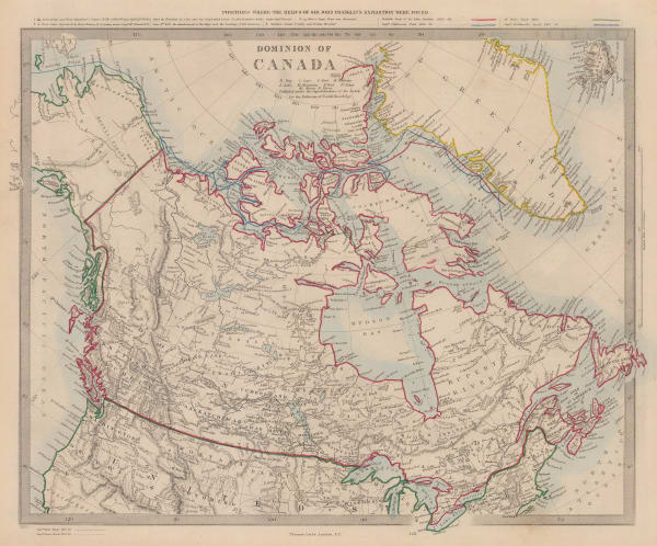
Society for the Diffusion of Useful Knowledge (SDUK), Dominion of Canada, 1880 c.£ 345.00
-
Letts & Son, Statistical Map of the Dominions of Canada, 1883£ 165.00
-
Justus Perthes, Übersichtskarte über die Endmoräne der Zweiten Glacial Epoche Nord Amerikas, 1885£ 68.00
-
G. & J. Bartholomew, Dominion of Canada, 1887£ 56.00
-
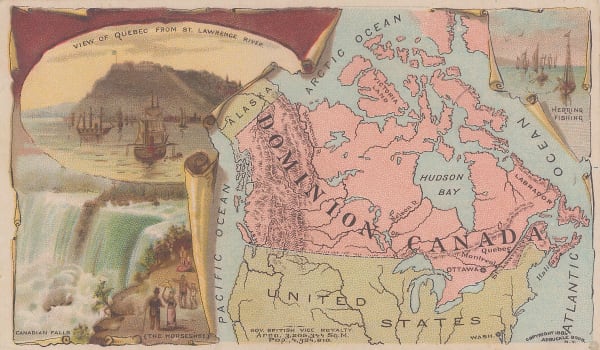
Arbuckle Brothers Company, Dominion of Canada, 1889£ 98.00
-
G. & J. Bartholomew, Dominion of Canada, 1891£ 48.00
-
Scottish Geographical Society (SGS), Map of the Labrador Peninsula, 1895£ 325.00
-
Karl Baedeker, Canada, 1900 c.£ 58.00


Page
1
of 2