-
![Michael Drayton, [Staffordshire], 1612](data:image/gif;base64,R0lGODlhAQABAIAAAAAAAP///yH5BAEAAAAALAAAAAABAAEAAAIBRAA7) Michael Drayton, [Staffordshire], 1612£ 495.00
Michael Drayton, [Staffordshire], 1612£ 495.00 -
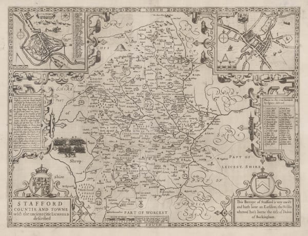
Stafford Countie and Towne with the Ancient Citie Lichfield described., 1614John SpeedSeries: LondonJohn Speed, Stafford Countie and Towne with the Ancient Citie Lichfield described., 1614£ 875.00
-
Saxton & Kip, Staffordiae Comitatus Pars olim Cornauiorum, 1637£ 325.00
-
Richard Blome, A Mapp of Staffordshire with its Hundreds, 1673£ 245.00
-
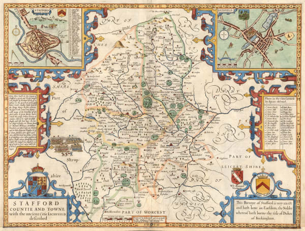
John Speed, Stafford Countie and Towne with the ancient Citie Lichfeild described, 1676£ 450.00
-
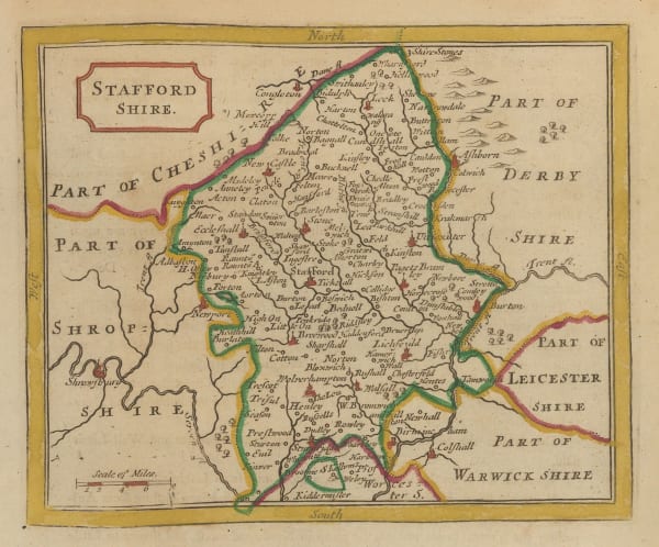
Robert Morden, Stafford Shire, 1695£ 245.00
-
Robert Morden, Staffordshire, 1708£ 165.00
-
Bowen & Owen, Staffordshire, 1720£ 115.00
-
Herman Moll, Stafford Shire, 1724£ 165.00
-
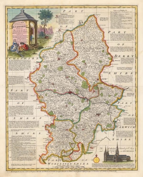
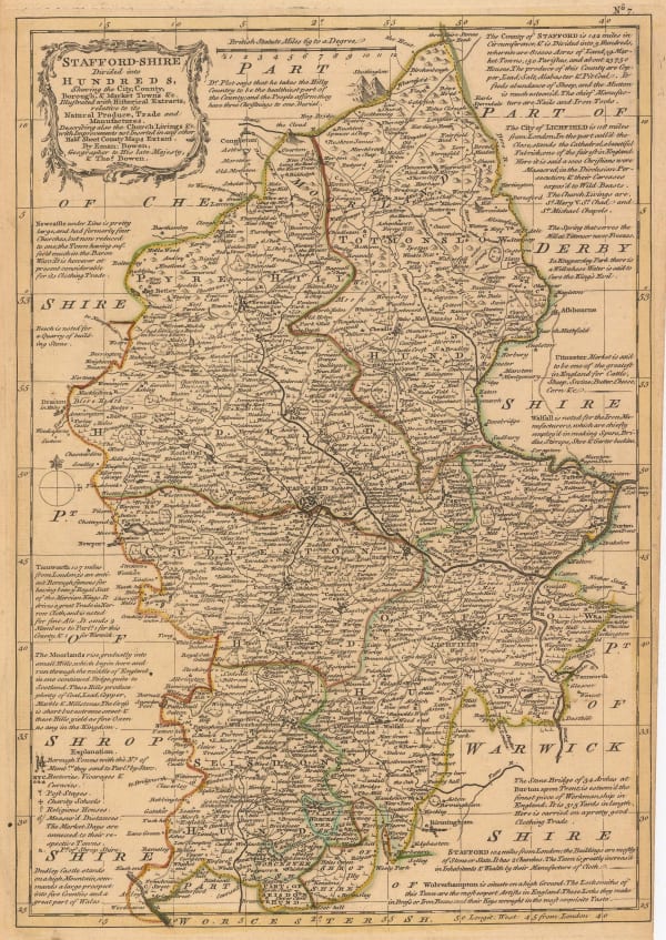
T. & E. Bowen, A Corrected Map of the County of Stafford Divided into Hundreds, 1760 c.£ 475.00
-
Russell & Price, Stafford Shire, 1769£ 72.00
-
John Seller, Staffordshire, 1787£ 58.00
-
T. & E. Bowen, Staffordshire Divided into Hundreds, 1790 c.£ 185.00
-
John Cary, Staffordshire, 1793£ 72.00
-
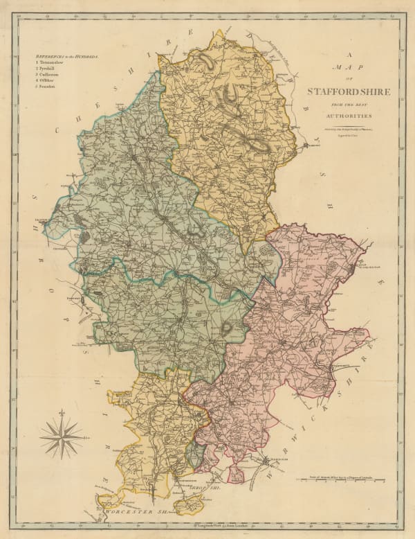
John Cary, Map of Staffordshire from the Best Authorities, 1805£ 165.00
-
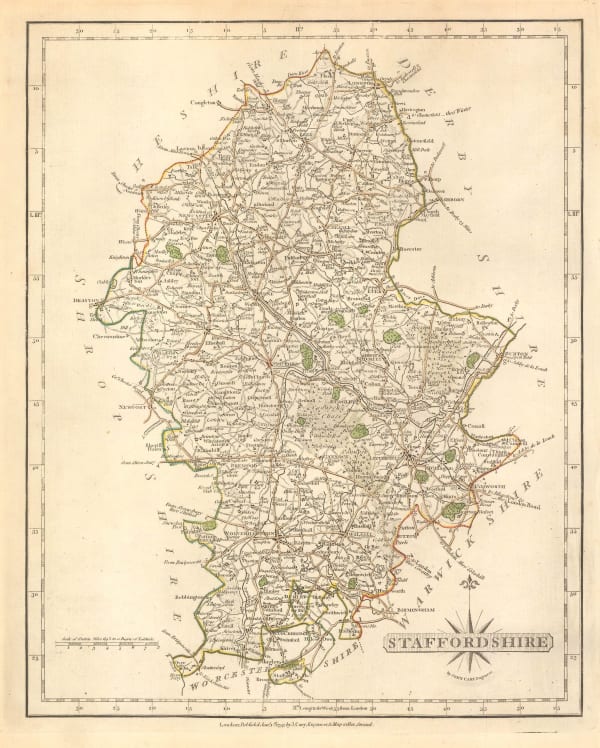
John Cary, A New Map of Staffordshire, 1806£ 295.00
-
Langley & Belch, Langley's New Map of Staffordshire, 1817£ 115.00
-
John Wilkes, Staffordshire, 1827£ 72.00
-
Christopher & John Greenwood, Map of the County of Stafford, 1830£ 385.00
-
Henry Teesdale, Staffordshire, 1830 c.£ 115.00
-
Henry Teesdale, A Map of the County of Stafford, 1832£ 985.00
-
James Pigot, Staffordshire, 1835 c.£ 90.00
-
Thomas Moule, Staffordshire, 1840 c.£ 115.00
-
Ashford & Loader, Map and Sections of the Staffordshire Coal Field, 1845£ 125.00
-
Henry George Collins, Staffordshire, 1850 c.£ 88.00
-
George W. Bacon, Staffordshire, 1895£ 35.00
Close
Search Inventory
Our entire inventory of over 10,000 antique and vintage maps is now available to browse by region, date, cartographer, and subject
![Michael Drayton, [Staffordshire], 1612](https://artlogic-res.cloudinary.com/w_600,c_limit,f_auto,fl_lossy,q_auto/artlogicstorage/themaphouse/images/view/aebf9c58be9357fbcaa51e8f2c8faafaj/themaphouse-michael-drayton-staffordshire-1612.jpg)


Join our mailing list
* denotes required fields
We will process the personal data you have supplied to communicate with you in accordance with our Privacy Policy. You can unsubscribe or change your preferences at any time by clicking the link in our emails.
![]()