-
 Jan Jansson, Mar di India, 1650 c.£ 2,450.00
 -
Pierre Mortier, Carte Particuliere d'une Partie D'Asie, 1690 c.£ 3,450.00
-
Cornelis de Bruyn, De Nette Koers wysing van de Reys van Gamron na Batavia, 1714£ 445.00
-
Herman Moll, A Map of the Continent of the East Indies &c., 1720 c.£ 975.00
-
François Valentyn, Tabula Indiae Orientalis et Regnorum Adjacentium, 1726£ 4,500.00
-
Jacques-Nicolas Bellin, Carte des Costes de Perse Gusarat et Malabar, 1740£ 245.00
-
Herman Moll, A Chart of the ye East Indies, 1745£ 795.00
-
Jacques-Nicolas Bellin, Carte du Golphe de Bengale, 1747£ 245.00
-
London Magazine, Map of the Isle of Bourbon formerly Mascarehnas, 1761£ 325.00
-
Laurie & Whittle, A Chart of the Mahe and Amirantes Islands, 1794£ 2,450.00
-
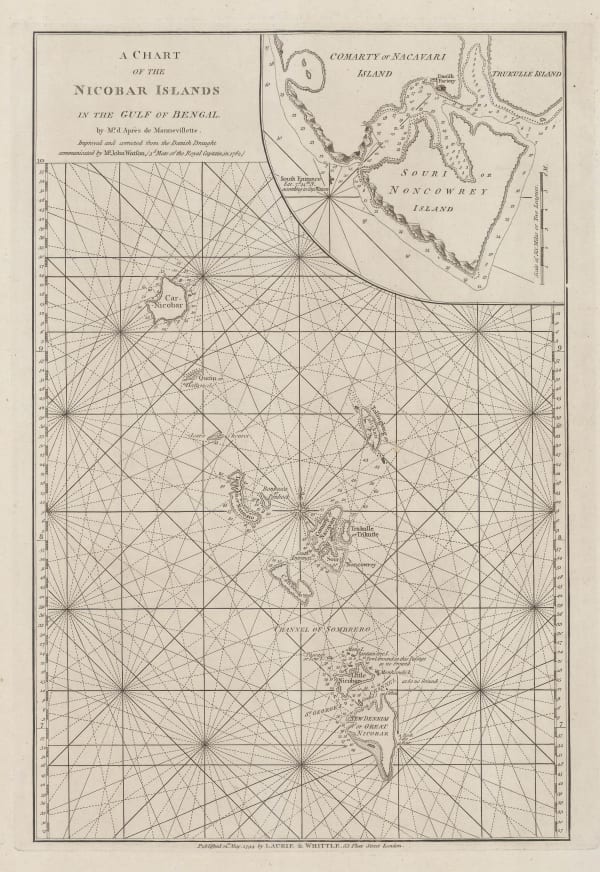
Laurie & Whittle, A Chart of the Nicobar Islands in the Gulf of Bengal, 1794£ 750.00
-
Laurie & Whittle, The Mahe Islands, 1794£ 2,450.00
-
Society for the Diffusion of Useful Knowledge (SDUK), Asia & the Indian Ocean, 1831£ 45.00
-
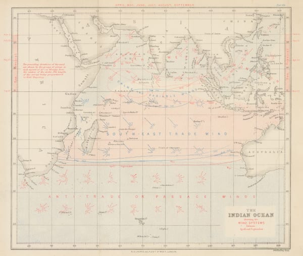
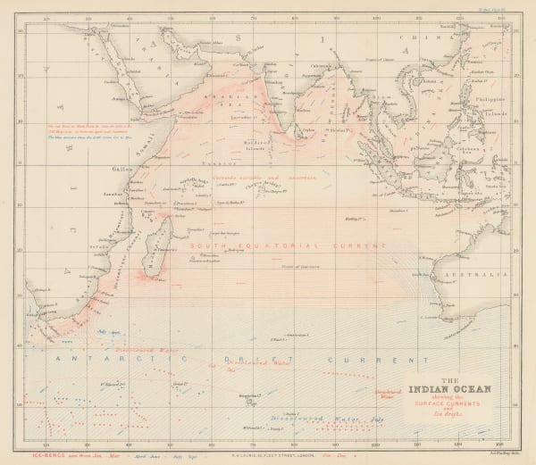
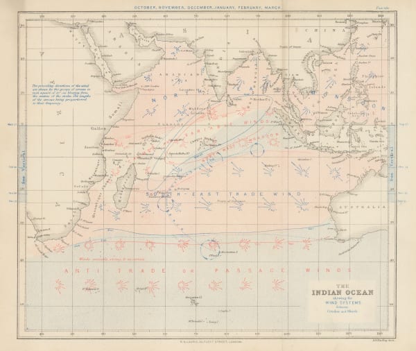
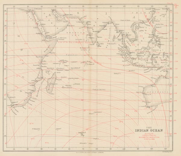
W. & A.K. Johnston, Physical Chart of the Indian Ocean, 1848£ 295.00
-
Royal Geographical Society (RGS), Sketch Showing the Courses of the Hurricane of April 1847, 1849£ 48.00
-
James Imray, Indian Ocean, 1868£ 1,500.00
-
Royal Geographical Society (RGS), Sketch Map of South Andaman and Adjacent Islands / Map of the Andaman Islands, 1880£ 125.00
-
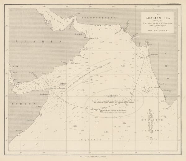
Richard Holmes Laurie, The Arabian Sea, 1882£ 58.00
-
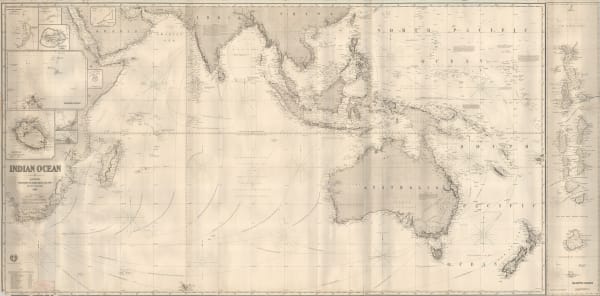
James Imray, The Indian Ocean, 1882£ 52.00
-
James Imray, The Indian Ocean, 1882£ 52.00
-
James Imray, The Indian Ocean, 1882£ 52.00
-
James Imray, The Indian Ocean, 1882£ 52.00
-
Justus Perthes, Indischer Ocean, 1895£ 38.00
-
Royal Geographical Society (RGS), The Indian Ocean, 1906£ 145.00
-
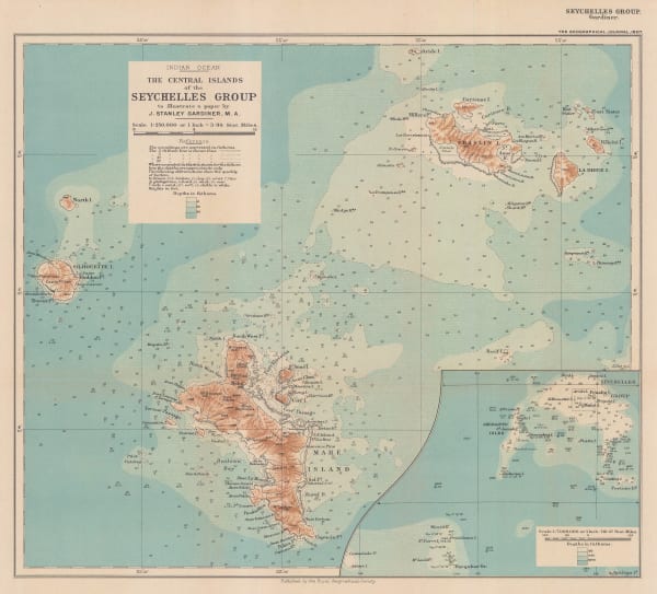
Royal Geographical Society (RGS), The Central Islands of the Seychelles Group, 1907£ 375.00
-
British Admiralty, Mahe Island and Approaches, 1935£ 525.00
-
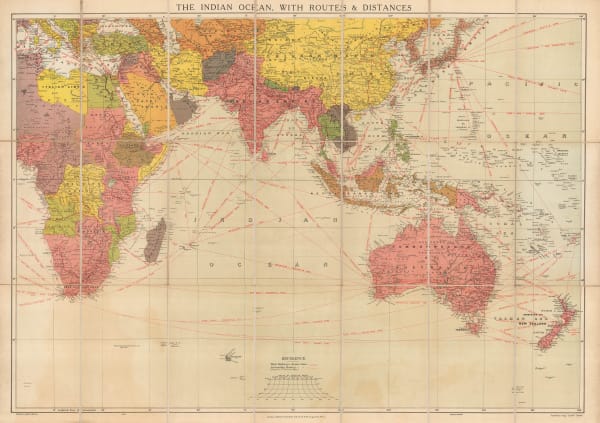
Edward Stanford, The Indian Ocean with Routes and Distances, 1937 c.£ 375.00
-
British Admiralty, Steamship Routes Indian Ocean, 1951£ 575.00
-
British Admiralty, The Maldives, 1976£ 650.00
-
British Admiralty, Sea Chart of the Maldives to Sri Lanka, 1977£ 650.00
Close
Search Inventory
Our entire inventory of over 10,000 antique and vintage maps is now available to browse by region, date, cartographer, and subject


Join our mailing list
* denotes required fields
We will process the personal data you have supplied to communicate with you in accordance with our Privacy Policy. You can unsubscribe or change your preferences at any time by clicking the link in our emails.
![]()