-
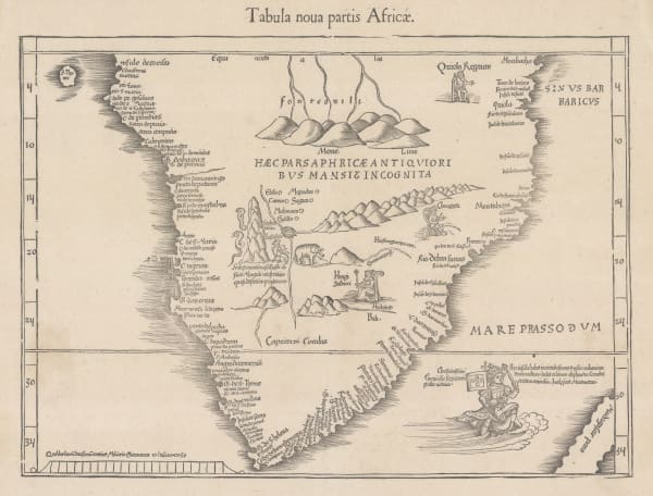
 Martin Waldseemüller & Laurent Fries, The Second Printed Map of Southern Africa, 1541£ 4,950.00
 -
Petrus Bertius, Africae pars meridional., 1618£ 450.00
-
Willem & Jan Blaeu, Southern & Central Africa, 1640 c.£ 1,250.00
-
Nicolas & Guillaume Sanson, Pays, et Coste des Caffres: Empires du Monomotapa Monoemugi, 1656£ 695.00
-
Athanasius Kircher, The Source of the Nile in the Mountains of the Moon, 1665£ 1,750.00
-
Robert Morden, Southern & Central Africa, 1688£ 375.00
-
Pierre Duval, Southern & Central Africa, 1694£ 295.00
-
Vincenzo Coronelli, Madagascar & East Africa (Globe Gore), 1696£ 895.00
-
Nicolas de Fer, Southern & Central Africa, 1702£ 795.00
-
Pierre Mortier, Map of the Coasts of Africa, 1708£ 1,750.00
-
Pierre Mortier, Carte Particuliere des Costes d'Afrique depuis C. Del Gado jusques Rio Mocambo, 1708£ 795.00
-
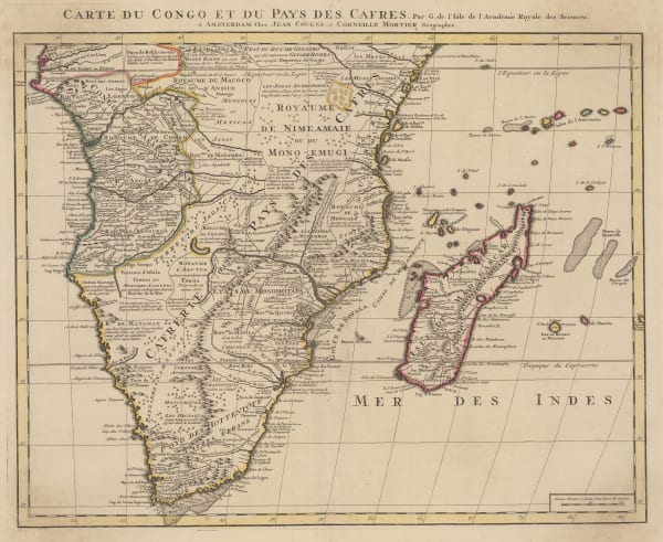
Covens (Jean) & Mortier (Cornelius), Southern & Central Africa, 1730 c.£ 1,250.00
-
Jacob van der Schley, Carte de la Coste Occidentale D'Afrique depuis le Cap de Bonne Esperance, 1747£ 175.00
-
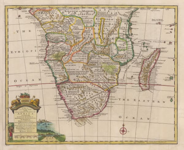
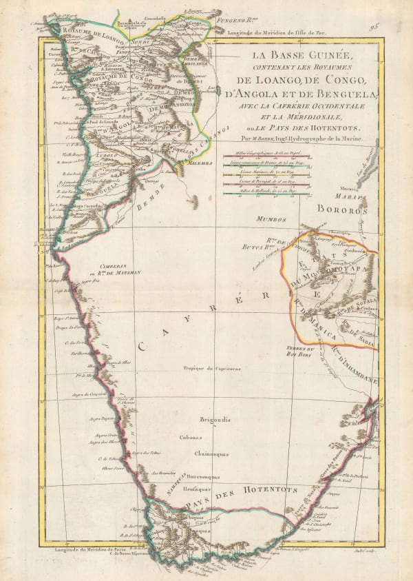
Emanuel Bowen, A New & Accurate Map of the Southern Parts of Africa, 1747£ 695.00
-
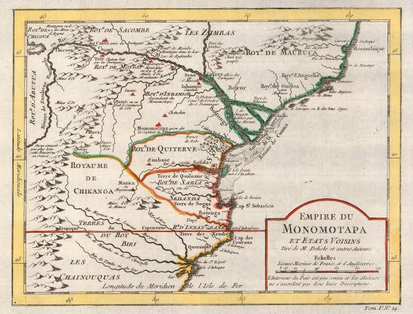
Jacques-Nicolas Bellin, Empire du Monomotapa, 1748£ 175.00
-
Herman Moll, Southern & Central Africa, 1755 c.£ 345.00
-
Jacques-Nicolas Bellin, Carte de la Baye de Mosambique, 1764£ 125.00
-
Tobias Conrad Lotter, Southern Africa & the Cape of Good Hope, 1778£ 745.00
-
Rigobert Bonne, Southern Africa, 1790 c.£ 150.00
-
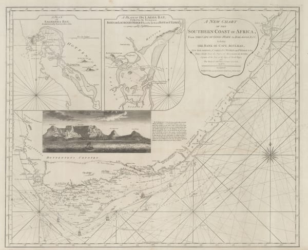
Laurie & Whittle, A New Chart of the Southern Coast of Africa, 1794£ 3,250.00
-
Charles Francois Delamarche, Southern & Central Africa, 1795£ 325.00
-
Charles Smith, South & Central Africa, 1828£ 285.00
-
British Admiralty, Sea Chart of the coast of Mozambique, 1828£ 145.00
-
British Admiralty, Sea Chart of the coast of Mozambique, 1828£ 225.00
-
Adrien Brue, Southern Africa & the Cape Colony, 1828 c.£ 250.00
-
Royal Geographical Society (RGS), Outline Map of Southern Africa, 1833£ 82.00
-
John Tallis, Natal and Kaffraria, 1851£ 325.00
-
Royal Geographical Society (RGS), Africa between 10 and 30 degree South Latitude. Map to illustrate the routes of Galton. Livingstone, Oswell and Gassiot, 1852£ 495.00
-
Royal Geographical Society (RGS), Southern Central Africa, 1856£ 225.00
-
Royal Geographical Society (RGS), Livingstone's crossing of Africa, 1857£ 795.00
-
Royal Geographical Society (RGS), Portuguese Exploration in Central Africa, 1859£ 385.00
-
Royal Geographical Society (RGS), The Discovery of Lake Malawi (Nyasa), 1863£ 175.00
-
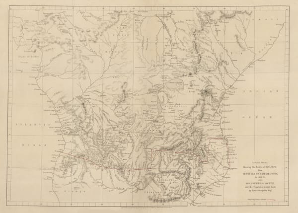
Royal Geographical Society (RGS), A Sketch map of Part of South Eastern Africa to Illustrate the Journeys of Dr Lacerda (1798) the Pombeiros (1806-11) and Major Monteiro (1831-32), 1873£ 395.00
-
Royal Geographical Society (RGS), Route Map of the Gasa Country, 1875£ 175.00
-
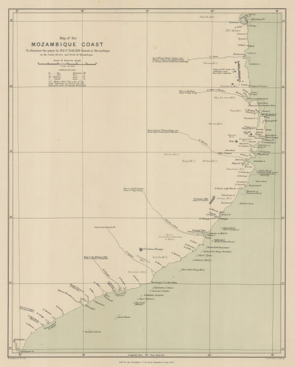
Royal Geographical Society (RGS), Map of the Mozambique Coast, 1882£ 195.00
-
Royal Geographical Society (RGS), The Interior of South Africa, 1884£ 795.00
-
Royal Geographical Society (RGS), East Africa between the Zambesi and Rovuma Rivers, 1885£ 495.00
-
Royal Geographical Society (RGS), The Kaap Goldfields, 1888£ 112.00
-
Royal Geographical Society (RGS), Eastern Africa between the Rovuma and Zambesi Rivers, 1890£ 495.00
-
Scottish Geographical Society (SGS), Political Sketch-Map of Central Africa, 1890£ 495.00
-
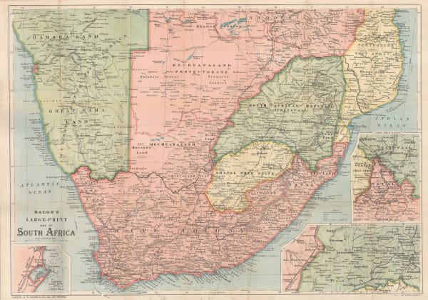
George W. Bacon, Bacon's Large-Print Map of South Africa, 1890 c.£ 775.00
-
Royal Geographical Society (RGS), A Map of Matabililand and Mashonaland Manica and Gazaland, 1891£ 395.00
-
Royal Geographical Society (RGS), Map of Gaza Land showing route taken by Mr.D. Doyle from Manica to the Mouth of the Limpopo, 1891£ 115.00
-
Scottish Geographical Society (SGS), Map of the Country between the Shire and Zambesi Rivers, 1892£ 80.00
-
Scottish Geographical Society (SGS), Orographical map of Southern Rhodesia, 1897£ 375.00
-
Edward Stanford, The Boer Republics, 1899£ 385.00
-
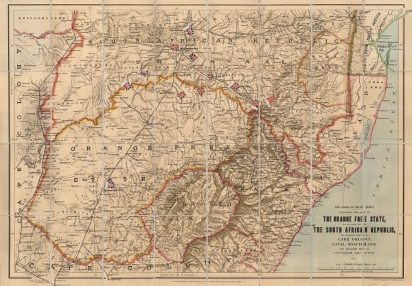
Edward Stanford, The Orange Free State and the Southern Part of The South African Republic, 1899£ 845.00
-
W. & A.K. Johnston, W & A.K. Johnstons Map to Illustrate the Transvaal Question, 1899£ 445.00
-
F Bianconi, Nouvelle Carte Physique & Miniere du Transvaal, 1900£ 495.00
-
Royal Geographical Society (RGS), Portuguese East Africa between the Zambezi and Pungwe Rivers, 1907£ 78.00
-
Edward Hertslet, Anglo-Portuguese Boundary in Manica and Adjoining Regions, 1909£ 82.00
-
G. & J. Bartholomew, Central and South Africa, 1910 c.£ 495.00
-
Walter Boldero Paton, Map of the Union of South Africa, 1912£ 295.00
-
S. Africa Newspaper, Central and South Africa, 1916£ 975.00
Close
Search Inventory
Our entire inventory of over 10,000 antique and vintage maps is now available to browse by region, date, cartographer, and subject


Join our mailing list
* denotes required fields
We will process the personal data you have supplied to communicate with you in accordance with our Privacy Policy. You can unsubscribe or change your preferences at any time by clicking the link in our emails.
![]()