- All
- AFRICA
- ▪ Central Africa
- ▪ East Africa
- ▪ North Africa
- ▪ Southern Africa
- ▪ West Africa
- ▪ Atlantic Islands
- AMERICAS
-
▪ United States (USA)
- USA - East
- USA - Midwest
- USA - Northeast
- USA - Southeast
- USA - West & Southwest
- Alabama
- Alaska
- Arizona
- Arkansas
- California
- Colorado
- Connecticut
- Delaware
- Florida
- Georgia
- Hawaii
- Idaho
- Illinois
- Indiana
- Iowa
- Kansas
- Kentucky
- Louisiana
- Maine
- Maryland
- Massachusetts
- Michigan
- Minnesota
- Mississippi
- Missouri
- Montana
- Nebraska
- Nevada
- New Hampshire
- New Jersey
- New Mexico
- New York
- New York City
- North Carolina
- North Dakota
- Ohio
- Oklahoma
- Oregon
- Pennsylvania
- Rhode Island
- South Carolina
- South Dakota
- Tennessee
- Texas
- Utah
- Vermont
- Virginia
- Washington
- Washington, D.C.
- West Virginia
- Wisconsin
- Wyoming
- ▪ North America
- ▪ South America
- ▪ Caribbean
- ASIA
- ▪ East Asia
- ▪ Southeast Asia
- ▪ India & South Asia
- ▪ Middle East & Turkey
- BRITISH ISLES
- ▪ London
-
▪ England
- English Cities
- Bedfordshire
- Berkshire
- Buckinghamshire
- Cambridgeshire
- Cheshire
- Cornwall
- Cumbria
- Derbyshire
- Devon
- Dorset
- Durham
- Essex
- Gloucestershire
- Hampshire
- Herefordshire
- Hertfordshire
- Huntingdonshire
- Isle of Wight
- Kent
- Lancashire
- Leicestershire
- Lincolnshire
- Middlesex
- Norfolk
- Northamptonshire
- Northumberland
- Nottinghamshire
- Oxfordshire
- Rutland
- Shropshire
- Somerset
- Staffordshire
- Suffolk
- Surrey
- Sussex
- Warwickshire
- Wiltshire
- Worcestershire
- Yorkshire
- Yorkshire East Riding
- Yorkshire North Riding
- Yorkshire West Riding
- ▪ Ireland
- ▪ Scotland
- ▪ Wales
- EUROPE
- ▪ Austria & Switzerland
- ▪ Benelux Region
- ▪ Central & Eastern Europe
- ▪ France & Monaco
- ▪ Germany
- ▪ Greece
- ▪ Italy
- ▪ Mediterranean Sea
- ▪ Spain & Portugal
- ▪ Scandinavia & Baltics
- ▪ Russia, Ukraine & Caucasus
- OCEANIA
- ▪ Australia
- ▪ New Zealand
- ▪ Pacific Ocean & Islands
- ▪ Papua New Guinea
- POLAR
- CELESTIAL
- WORLD
- GLOBES & INSTRUMENTS
- THEMATIC
- COLLABORATIONS
James Kirkwood & Sons
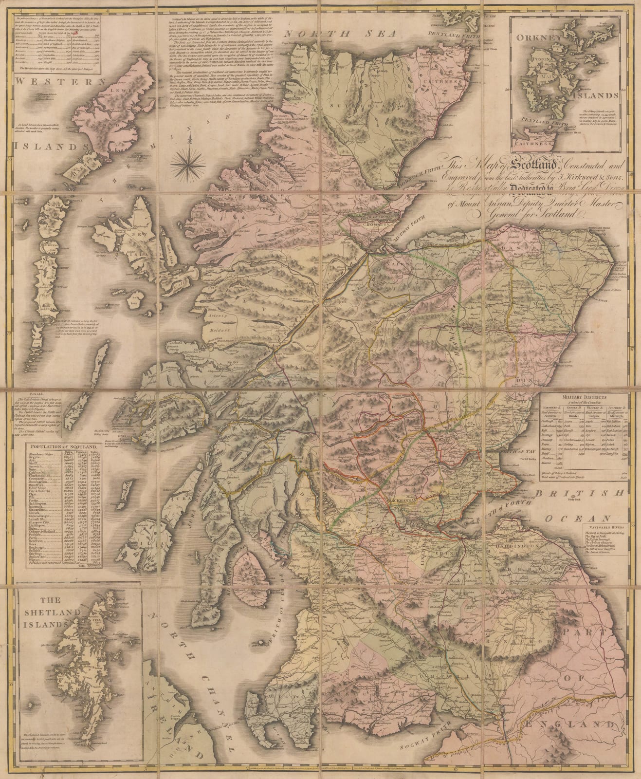
Kirkwood & Sons' Travelling Map of Scotland, 1804
27 1/2 x 22 1/2 in
70 x 57 cm
70 x 57 cm
SCOT1771
£ 975.00
James Kirkwood & Sons, Kirkwood & Sons' Travelling Map of Scotland, 1804
Sold
%3Cdiv%20class%3D%22artist%22%3EJames%20Kirkwood%20%26%20Sons%3C/div%3E%3Cdiv%20class%3D%22title_and_year%22%3E%3Cspan%20class%3D%22title_and_year_title%22%3EKirkwood%20%26%20Sons%27%20Travelling%20Map%20of%20Scotland%3C/span%3E%2C%20%3Cspan%20class%3D%22title_and_year_year%22%3E1804%3C/span%3E%3C/div%3E%3Cdiv%20class%3D%22dimensions%22%3E27%201/2%20x%2022%201/2%20in%3Cbr/%3E%0A70%20x%2057%20cm%3C/div%3E
A beautiful linen-backed folding map of Scotland intended for the use of travellers. Military and post roads are highlighted, and the distances between coach stops are marked. The distances of...
A beautiful linen-backed folding map of Scotland intended for the use of travellers. Military and post roads are highlighted, and the distances between coach stops are marked. The distances of various major towns from Edinburgh are also provided.
Perhaps as suggestions for travellers, the routes of four authors who had written accounts of their travels through Scotland are drawn on the map with red, yellow, green, and orange lines. These represent the tours of Thomas Pennant (1772), Dr Thomas Garnett (1798), John Lettice (1792), and Alexander Campbell (1802). These would have been the authoritative accounts of Scotland at the time, and certainly would have been used by travellers in search of advice on places to visit and stay.
Surrounding the map are several insets, two of which feature maps of Shetland and Orkney whilst the others contain statistical information about the population of Scotland, the height of its mountains, and the size of the counties.
Sold with original slip case. Original hand colour. [Folded]
Share
- Tumblr
Join our mailing list
* denotes required fields
We will process the personal data you have supplied to communicate with you in accordance with our Privacy Policy. You can unsubscribe or change your preferences at any time by clicking the link in our emails.
Contact
The Map House
54 Beauchamp Place,
London SW3 1NY,
United Kingdom
maps@themaphouse.com
+44 (0)20 7589 4325

Copyright © 2025 The Map House
This website uses cookies
This site uses cookies to help make it more useful to you. Please contact us to find out more about our Cookie Policy.

