Aaron Arrowsmith
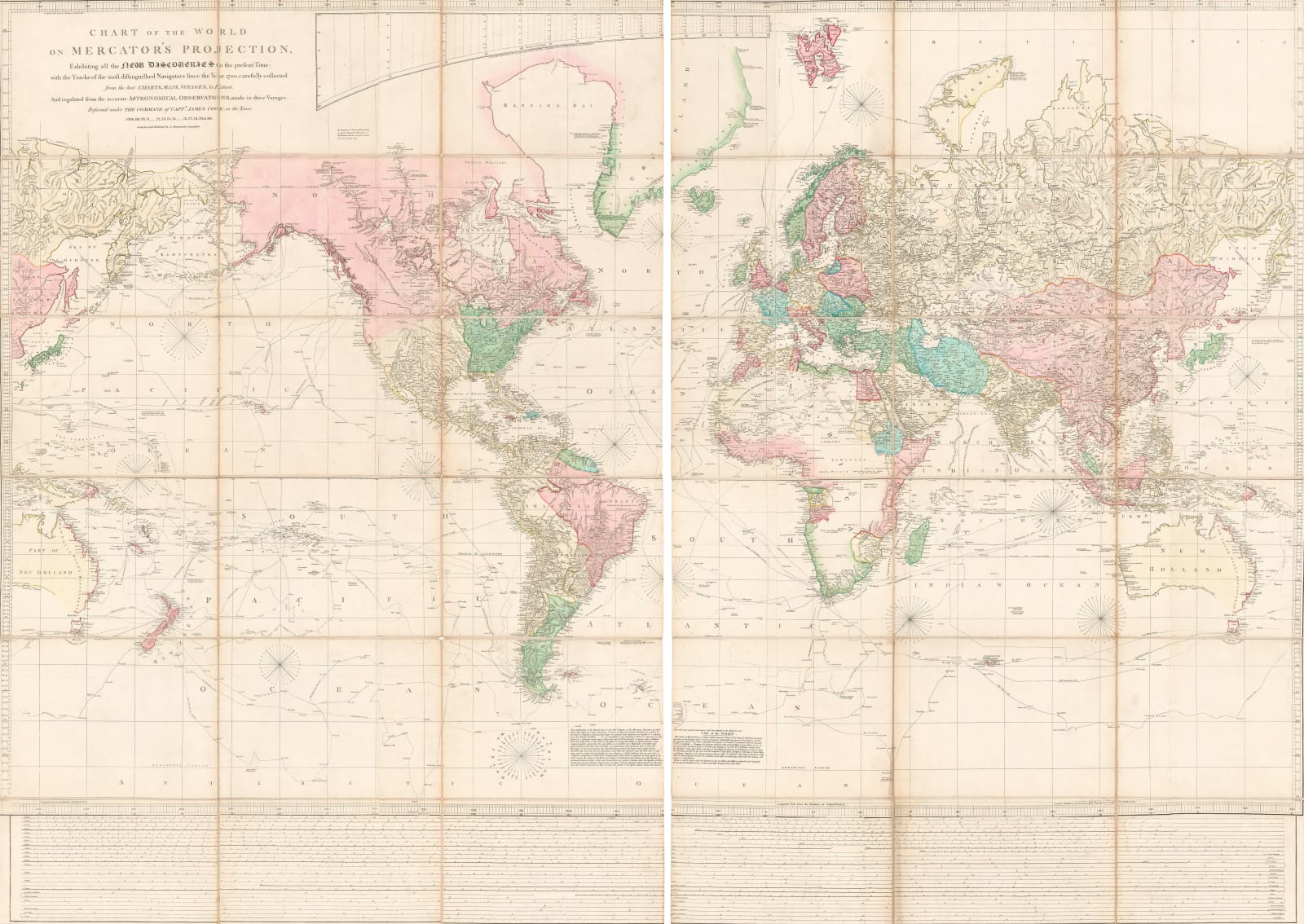
A Chart of the World on Mercator's Projection, 1802 c.
57 ½ x 80 ½ in
146 x 204 cm
146 x 204 cm
WLD4033
Further images
This is a fine example of Arrowsmith’s chart of the world on Mercator’s Projection. It was his first map as an independent publisher and set a standard which ensured immediate...
This is a fine example of Arrowsmith’s chart of the world on Mercator’s Projection. It was his first map as an independent publisher and set a standard which ensured immediate financial success for the firm. Arrowsmith’s diverse network of contacts and sources included Thomas Curson Hansard, the first official printer of the Parliamentary Papers, allowing access to official government maps rarely seen on the commercial market, the Hudson’s Bay Company, the Northwest Company and the British East India Company.
Added to these were other eminent English map makers of the period. Arrowsmith had been connected with Andrew Dury, William Faden and John Cary in one capacity or other earlier in his career. He also consulted the work of other important French map makers such as D’Anville and Bellin.
This chart was the first and arguably the greatest of a series of wall maps which the Arrowsmith firm produced during the late 18th and early 19th centuries which are now considered to be essential pieces not only for collectors but also for researchers and scholars of all aspects of Georgian history.
It was first issued in 1790 but is known in at least eight other issues or states up to a last traceable date of 1808. The printed date on the map does not change but the address on the imprint does. Arrowsmith was also assiduous in revising, correcting and updating this map and its date can often be traced by its geography. It was separately issued, linen backed and on two sheets. Commercially speaking, it was an expensive object and thus likely to have been appreciated by its owner. This in combination with its durability due to the linen backing and segmentation meant that while very rare, it is not unknown on the market.
By studying the geography and researching the carto-bibliographies, we have been to date this example c.1802. This is the first state of the map to show Bass Straits, discovered by Flinders and Bass on their expedition in 1798-9 and the first to showcase Vancouver’s discoveries of 1791-5.
It is in full original hand colour and also bears the rare measurements on the lower margin used by Arrowsmith to explain his scale. All examples of this map are considered extremely rare. Folded.
[WLD4033]
To find out more about this monumental map, read our Map of the Month feature on The Map House Blog.
Publications
Stevens & Tree: Comparative Cartography 90 (f)Join our mailing list
* denotes required fields
We will process the personal data you have supplied to communicate with you in accordance with our Privacy Policy. You can unsubscribe or change your preferences at any time by clicking the link in our emails.


