-
 Georges-Louis Le Rouge, Chart of North and South Carolina coast, 1777£ 3,850.00
 -
Antoine de Sartine, Chart of Delaware Bay and River, 1778£ 1,350.00
-
-
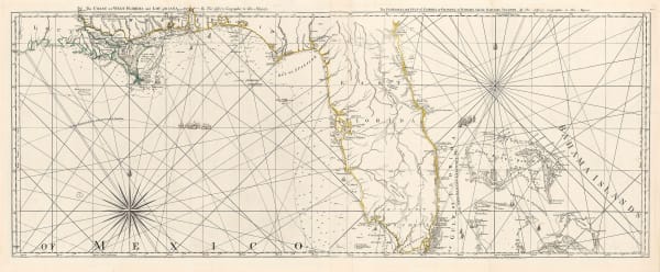
Antoine de Sartine, Chart of the coast from New Jersey to Georgia, 1778£ 3,950.00
-
Antonio Zatta, Eastern North America, 1778£ 985.00
-
-
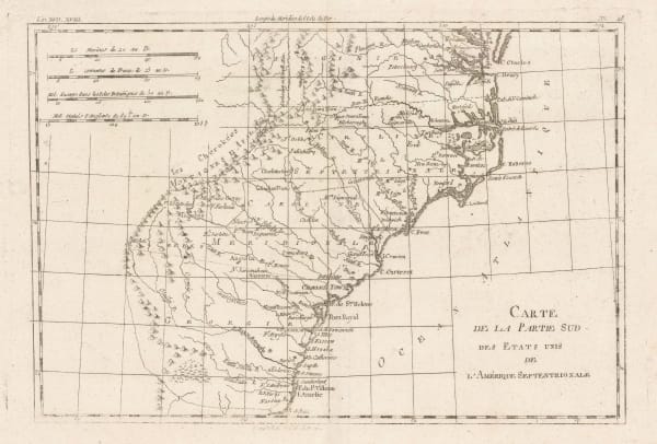
Antonio Zatta, Southern United States just after the signing of the Declaration of Independence, 1778£ 545.00
-
London Magazine, New York State during the Revolutionary War, 1778£ 950.00
-
London Magazine, New York State during the Revolutionary War, 1778£ 950.00
-
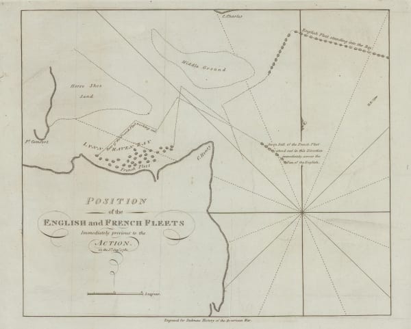
London Magazine, Battle of Rhode Island, 1778£ 525.00
-
Charles Francois Delamarche, Canada, Louisiana, États-Unis, 1778£ 525.00
-
-
Antonio Zatta, The confluences of the Ohio, Missouri and Mississippi Rivers, 1779£ 685.00
-
Antonio Zatta, North-eastern North America, 1779£ 675.00
-
Antonio Zatta, New York and Pennsylvania, 1779£ 825.00
-
-
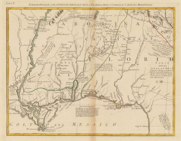
John Bew, A New and Accurate Map of the Chief Parts of South Carolina and Georgia, 1780£ 1,450.00
-
John Bew, New York and part of the Jerseys, New England and Canada, 1780£ 1,495.00
-
Rigobert Bonne, Great Lakes, 1780 c£ 495.00
-
Rigobert Bonne, Ontario, the Great Lakes & the US Midwest, 1780 c£ 495.00
-
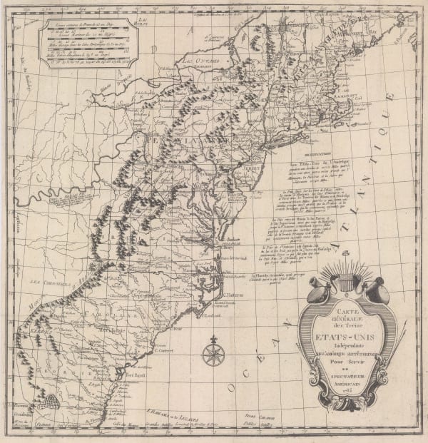
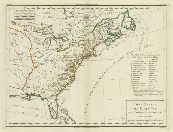
John Obadiah Justamond, Eastern United States, 1780 c.£ 1,750.00
-
Rigobert Bonne, North and South Carolina and Georgia, 1780 c.£ 395.00
-
Rigobert Bonne, Etats Unis de L'Amerique, 1780 c.£ 375.00
-
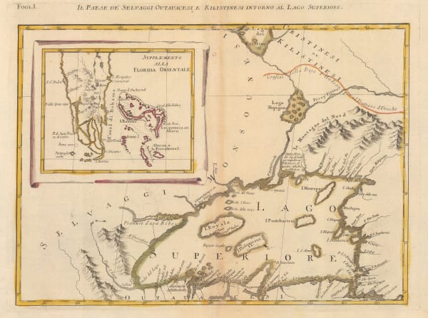
Antonio Zatta, Early Italian map of Lake Superior, 1780 c.£ 395.00
-
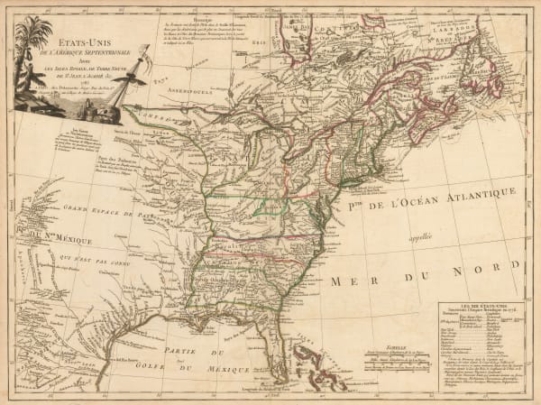
Rigobert Bonne, Eastern United States, 1780 c.£ 375.00
-
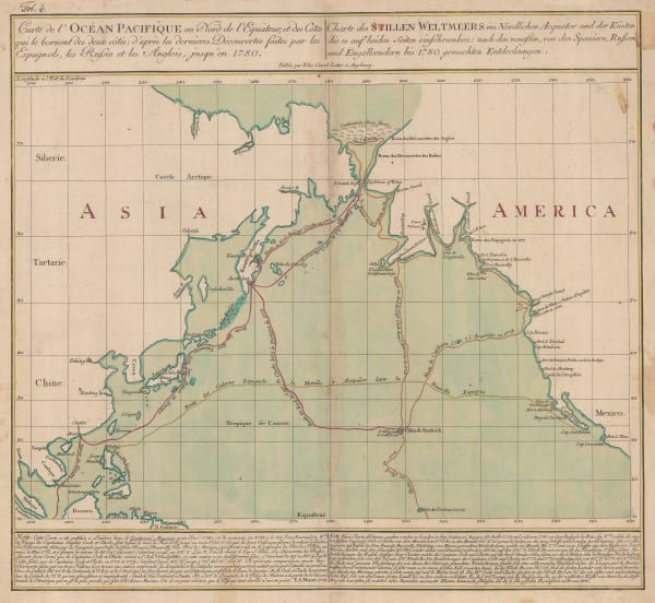
Tobias Conrad Lotter, James Cook's Voyage to the North Pacific & Bering Strait, 1781£ 2,750.00
-
Michel René Hilliard d' Auberteuil, Scarce and important Revolutionary War battle plan of the Battle of Monmouth, 1782£ 2,250.00
-
Guillaume De L'Isle, Carte du Mexique et des Etats Unis D'Amerique, partie Meridionale, 1783£ 3,500.00
-
Gerhard Friedrich Muller, Russian Discoveries in Siberia, Alaska & the Bering Strait, 1784£ 1,200.00
-
Hendrik Klockhoff, One of the earliest maps to recognize the newly-independent United States, 1785£ 2,450.00
-
Charles Francois Delamarche, Scarce early map of the newly-independent USA, 1785£ 1,850.00
-
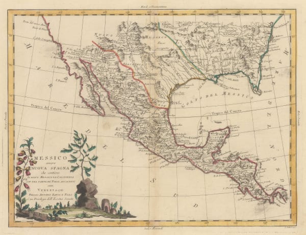
Antonio Zatta, Southern US, Mexico and Central America, 1785£ 795.00
-
Capt. James Cook, Hawaii, 1785£ 1,850.00
-
Rigobert Bonne, South eastern United States , 1785 c£ 275.00
-
William Guthrie, Newly-independent United States, 1785 c.£ 945.00
-
Tardieu, Eastern United States, 1785 c.£ 745.00
-
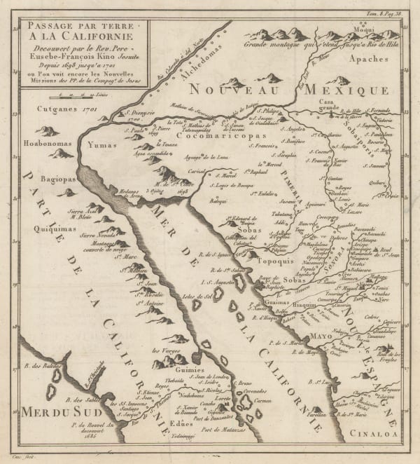
Eusebio Francisco Kino, Late French rendition of the important map by Eusebio Kino, 1785 c.£ 885.00
-
-
-
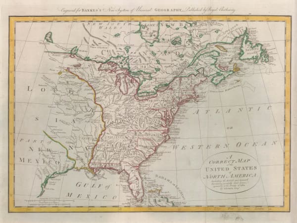
Thomas Bowen, Very early map of the newly formed United States, 1787£ 985.00
-
Georges-Louis Le Rouge, Eastern coast of North America and the Mississippi river, 1787£ 1,500.00
-
Tardieu, Carte de L'Ile de Nantucket, 1787£ 2,250.00
-
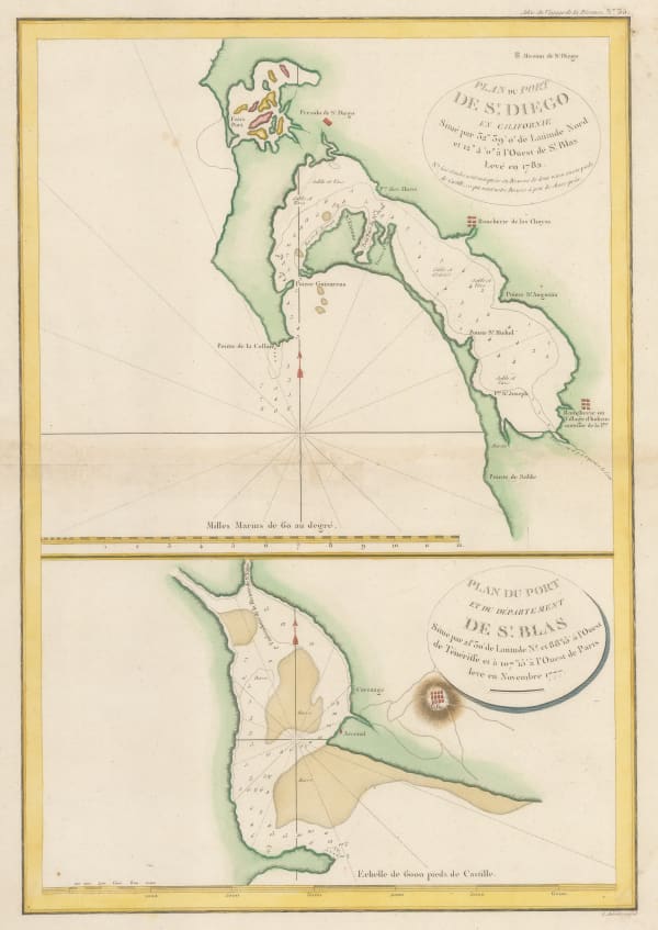
Jean Francois de La Perouse, San Diego and San Blas, 1787£ 885.00
-
Joseph Purcell, A Map of the States of Virginia, North Carolina, South Carolina and Georgia, 1788£ 1,925.00
-
William Gordon, Revolutionary War map of New Jersey, 1788£ 645.00
-
David Ramsay, Plan of the Siege of Charleston, 1789£ 695.00
-
John Harrison, Eastern North America, 1790£ 1,750.00
-
Thomas Conder, Captain Cook's Map of Hawaii , 1790 c.£ 945.00
-
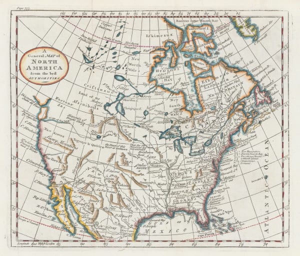
William Guthrie, A General Map of North America from the best Authorities, 1792£ 295.00
-
Antoine de Sartine, Important map of the east coast of the United States and Canada, 1792 (c.)£ 3,250.00
-
Charles Stedman, A Plan of the Operations of the King's Army under the Command of Sir William Howe in New York and East New Jersey, 1793£ 2,750.00
-
Charles Stedman, Plan of the Attack of the Forts Clinton & Montgomery, upon Hudsons River, 1793£ 2,450.00
-
Charles Stedman, Plan of the Position which the Army under Burgoine took at Saratoga, 1793£ 1,950.00
-
Charles Stedman, Sketch of General Grants Position on Long Island, 1793£ 1,250.00
-
Laurie & Whittle, A New and General Map of the Southern Dominions Belonging to The United States of America, 1794£ 3,500.00
-
Laurie & Whittle, Chart of the Entrance of Hudson's River, 1794£ 3,750.00
-
John Russell, Map of the Middle States of America, 1794£ 675.00
-
Laurie & Whittle, The United States of America, 1794£ 3,000.00
-
Charles Stedman, Revolutionary War- Battle of the Capes, 1794£ 495.00
-
Osgood Carleton, A Map of Pensylvania, 1795£ 495.00
-
John Russell, Map of the Northern, or, New England States of America, 1795£ 525.00
-
John Russell, Miniature map of the Eastern United States, 1795£ 155.00
-
Jacques-Nicolas Bellin, North Pacific, Alaska & the Bering Strait, 1795 c£ 3,450.00
-
Bowles & Carver, Bowles's New One-Sheet Map of New England, 1795 c.£ 4,250.00
-
John Meares, The North Pacific Ocean, 1795 c.£ 675.00
-
John Reid, A Map of the Tennassee Government formerly Part of North Carolina, 1796£ 1,450.00
-
John Reid, Georgia from the Latest Authorities, 1796£ 1,550.00
-
John Reid, The State of Massachusetts from the Best Information, 1796£ 1,550.00
-
John Reid, The State of New Hampshire Compiled chiefly from Actual Surveys, 1796£ 950.00
-
John Reid, The State of New Jersey compiled from the Most Accurate Surveys, 1796£ 745.00
-
John Reid, The State of New York, compiled from the Most Authentic Information, 1796£ 750.00
-
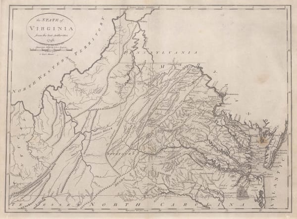
John Reid, The State of Virginia from the best Authorities, 1796£ 1,750.00
-
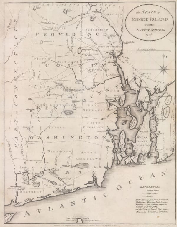
John Reid, The State of Rhode Island from the Latest Surveys, 1796£ 1,250.00
-
John Reid, The State of South Carolina from the Best Authorities, 1796£ 1,750.00
-
John Reid, Vermont from the Latest Authorities, 1796£ 1,250.00
-
Amos Doolittle, A Correct Map of Connecticut from an Actual Survey, 1797£ 985.00
-
Jedediah Morse, A Correct Map of the Georgia Western Territory, 1797£ 745.00
-
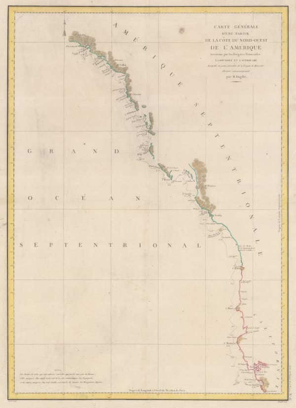
Jean Francois de La Perouse, Comte de la Perouse's voyage, western coast of North America, 1797£ 675.00
-
Abraham Bradley, Map of the Southern United States of America, 1797£ 850.00
-


Page
3
of 15