-
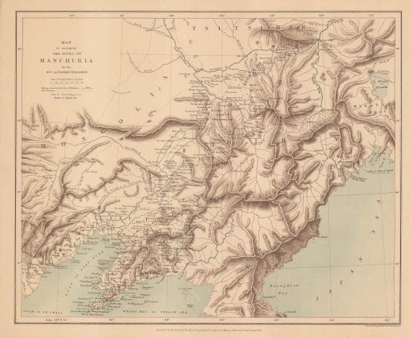
 Royal Geographical Society (RGS), Map to Accompany the Notes on Manchuria, 1870£ 175.00
 -
Royal Geographical Society (RGS), Sketch Map Showing the Mineral & Silk Districts of the Province of Shan-Tung (China), 1870£ 265.00
-
Royal Geographical Society (RGS), Map of Part of Nipon Island, 1871£ 145.00
-
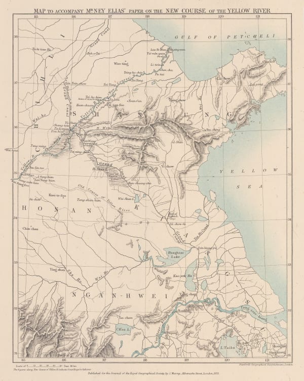
Royal Geographical Society (RGS), Map to accompany Mr Ney Elias' paper on the New Course of the Yellow River, 1871£ 165.00
-
Royal Geographical Society (RGS), Sketch map of Hokkaido, 1872£ 185.00
-
Royal Geographical Society (RGS), Kyoto to Tokyo route map, 1873£ 165.00
-
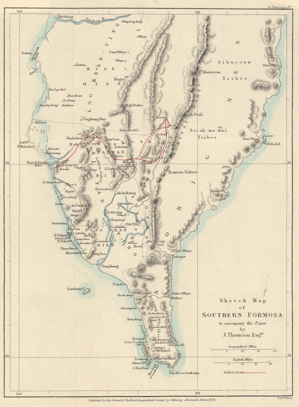
Royal Geographical Society (RGS), Southern Taiwan (Formosa), 1873£ 275.00
-
James Wyld, Map of the Empire of China and Japan, 1874£ 175.00
-
Royal Geographical Society (RGS), Route Map of Journey Through North China and Inner Mongolia, 1874£ 110.00
-
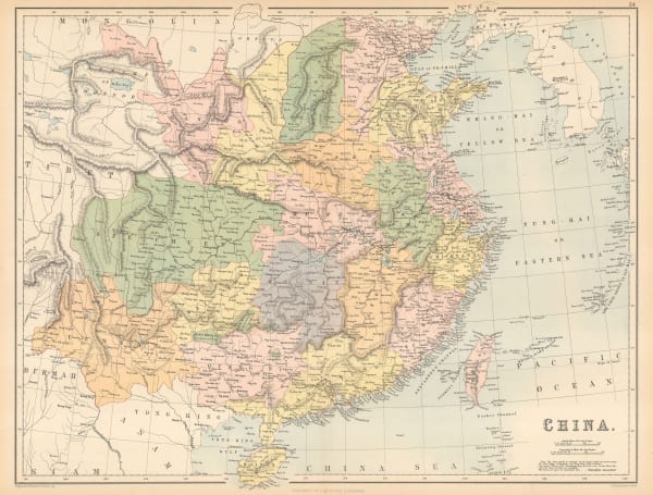
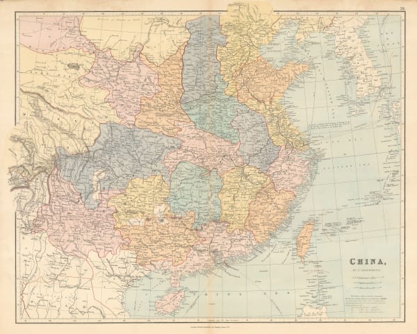
Society for the Diffusion of Useful Knowledge (SDUK), China, 1875£ 275.00
-
Society for the Diffusion of Useful Knowledge (SDUK), Empire of Japan, 1875£ 545.00
-
Royal Geographical Society (RGS), Map Showing Routes of Native Explorers in Tibet and Nepal, 1875£ 745.00
-
Royal Geographical Society (RGS), Map Illustrating the Journey of the Pundit Nain Singh through Great Tibet, 1877£ 395.00
-
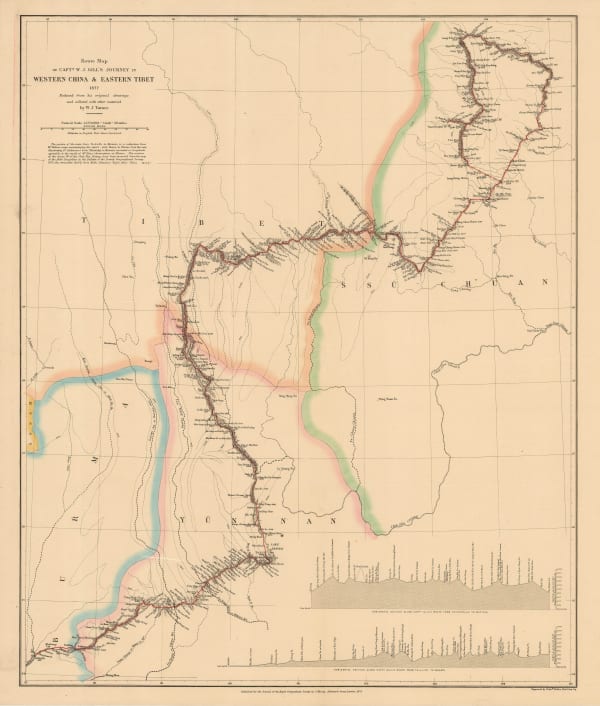
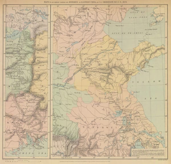
Royal Geographical Society (RGS), Route Map of Capt. W. J. Gill's Journey in Western China & Eastern Tibet, 1878£ 255.00
-
Justus Perthes, The Province of Canton, 1878£ 450.00
-
Justus Perthes, Hydrographic sketch map of Tokyo, 1879£ 82.00
-
Justus Perthes, Tokyo and Mount Fuji, 1879£ 245.00
-
Royal Geographical Society (RGS), Eastern China, 1880£ 275.00
-
-
A. & C. Black, China, 1880 c.£ 225.00
-
John Dower, China and Japan, 1880 c.£ 165.00
-
Royal Geographical Society (RGS), Map of Southern China, 1882£ 165.00
-
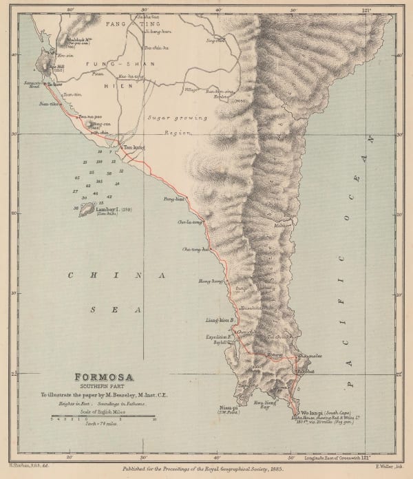
Royal Geographical Society (RGS), Southern Taiwan, 1885£ 225.00
-
George W. Bacon, Japan, 1885 (c.)£ 145.00
-
Royal Geographical Society (RGS), Sketch Map of South Western China, 1886£ 345.00
-
Royal Geographical Society (RGS), Map of Manchuria, 1887£ 275.00
-
-
Arbuckle Brothers Company, [Chinese Empire], 1889£ 145.00
-
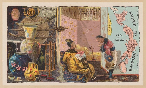
Arbuckle Brothers Company, Empire of Japan, 1889£ 225.00
-
Anonymous, Kyoto, 1890 c.£ 1,550.00
-
G. & J. Bartholomew, Port Arthur - Shanghai, 1890 c.£ 125.00
-
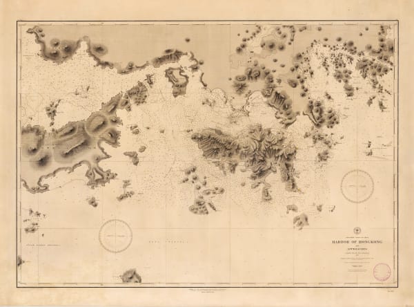
Anonymous, Sketch map of Victoria, Hong Kong, 1890 c.£ 425.00
-
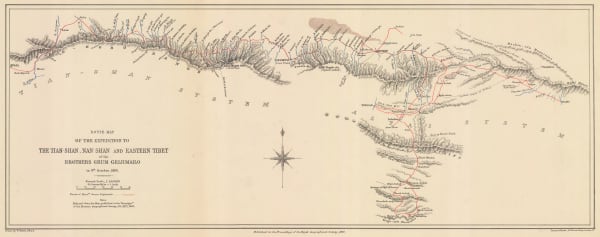
Royal Geographical Society (RGS), Tianshan Mountains, 1891£ 150.00
-
Royal Geographical Society (RGS), Northern Korea, 1892£ 145.00
-
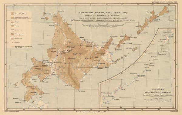
Royal Geographical Society (RGS), Geological map of Hokkaido, 1893£ 185.00
-
F.A. Brockhaus, Macao, Canton (Guangzhou) and the Pearl River, 1893£ 62.00
-
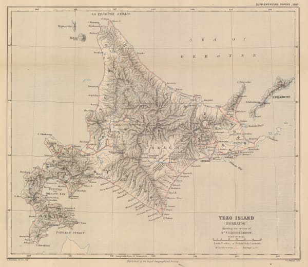
Royal Geographical Society (RGS), Yezo Island (Hokkaido) showing the routes of Mr A. H. Savage Landor, 1893£ 185.00
-
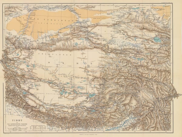
Royal Geographical Society (RGS), Tibet and the Surrounding Regions, 1894£ 795.00
-
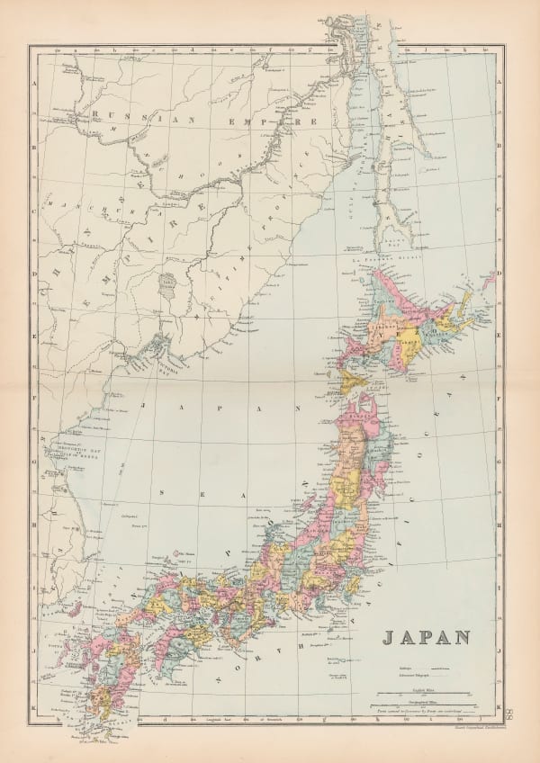
Edward Stanford, Japan, 1896£ 155.00
-
Edward Stanford, China, 1896£ 95.00
-
Inoma Shozaburo, Korea, 1897£ 1,750.00
-
Edward Stanford, China, 1898£ 165.00
-
Royal Geographical Society (RGS), Sketch Map of Central China showing the basin of the Yang-tse-chiang., 1898£ 225.00
-
Royal Geographical Society (RGS), Sketch Map of China and Adjoining Regions, 1898£ 985.00
-
Royal Geographical Society (RGS), Central and Southern Manchuria, 1899£ 395.00
-
Edward Stanford, China, 1899£ 795.00
-
Royal Geographical Society (RGS), Part of Tibet and Sin-Chiang, 1900£ 545.00
-
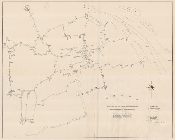
Thomas Ferguson, Waterways near Shanghai, 1900£ 4,500.00
-
War Office, Early 20th century plan of Beijing (Peking), 1900 c.£ 4,500.00
-
Edward Stanford, Map of China prepared for The China Inland Mission, 1903£ 3,500.00
-
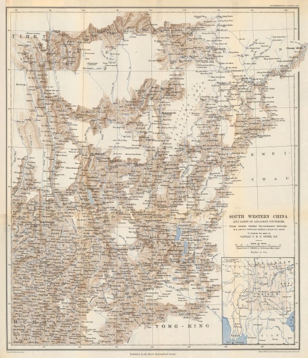
Royal Geographical Society (RGS), South Western China, 1903£ 195.00
-
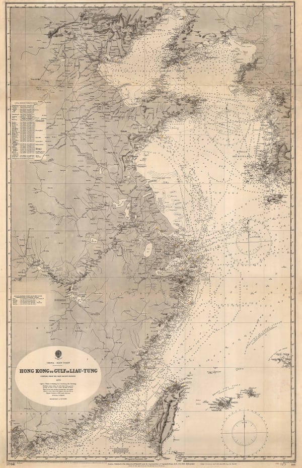
British Admiralty, Hong Kong to Gulf of Liau-Tung, 1904£ 595.00
-
Edward Stanford, Map of the Seat of War in the Far East 1904, 1904£ 1,450.00
-
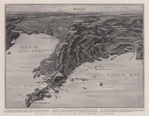
The Graphic Magazine, The Seat of War: Bird's-Eye View of the Theatre of Operations, 1904£ 325.00
-
Royal Geographical Society (RGS), Tibet, Map showing Explorations by Major C. H. D. Ryder RE DSO and Captains H. Wood RE & H. W. Cowie RE of the Tibet Frontier Commission 1904, 1905£ 375.00
-
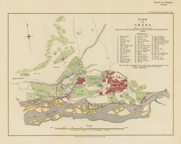
Royal Geographical Society (RGS), Plan of Lhasa, 1905£ 295.00
-
Royal Geographical Society (RGS), The Southern Japanese Alps, 1906£ 245.00
-
Royal Geographical Society (RGS), Central Asia - Leh to Peking, 1907£ 445.00
-
Royal Geographical Society (RGS), China - Routes and Rivers in An-Hui, 1907£ 225.00
-
-
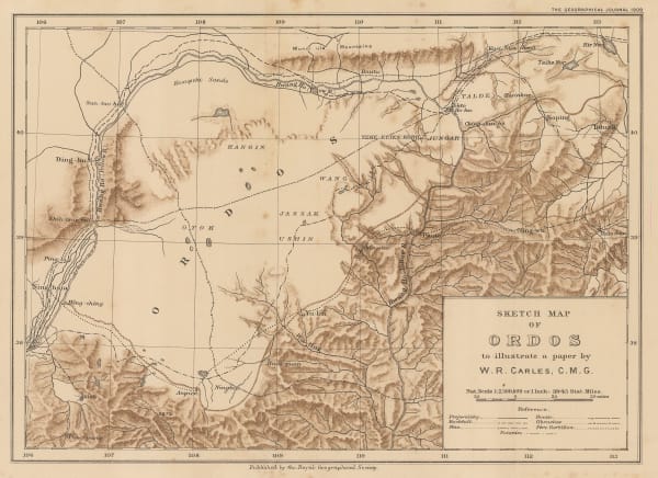
Royal Geographical Society (RGS), Sketch Map of Ordos to illustrate a paper by W. R. Carles. C. M. G., 1909£ 185.00
-
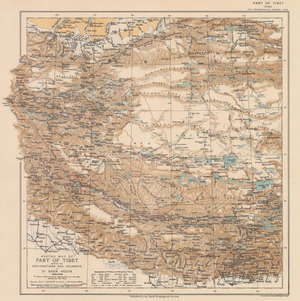
Royal Geographical Society (RGS), Sketch Map of Tibet, 1909£ 325.00
-
G. De Kelsch, Russian schematic map of the Ussuriysk, Manchurian, and Korean Railroads, 1910 c.£ 525.00
-
George Philip & Son Ltd., China, Korea and Japan Industries & Communications, 1910 c.£ 165.00
-
Edward Stanford, A Map of China prepared for the China Inland Mission, 1911£ 1,450.00
-
Y Koshiba, Mineral Distribution of Japanese Empire, 1911£ 1,850.00
-
Torakichi Kinoshita, Meiji-era map of the city of Osaka , 1911£ 285.00
-
Joseph Meyer, Macao, 1912£ 125.00
-
Royal Geographical Society (RGS), Part of the North-Eastern Frontier and Tibet showing the routes of Captains Morshead and Bailey 1913, 1914£ 285.00
-
John Bartholomew, Japan, 1915 c£ 185.00
-
Anonymous, Eastern District of Victoria City, 1920 c.£ 445.00
-
Anonymous, Western District of Victoria City, 1920 c.£ 445.00
-
Carl Crow, Plan of Hong Kong, City of Victoria, 1921£ 495.00
-
Kinosuke Inouye, Map of Applied Geology - Japan - Copper, 1922£ 495.00
-
British Admiralty, Kue Shan Is. to the Yang Tse Kiang including the Chusan Archipelago, 1922£ 1,450.00
-
Royal Geographical Society (RGS), Preliminary Map to Illustrate the Route of the Mount Everest Expedition, 1922£ 675.00
-
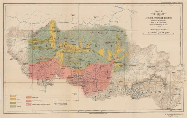
Royal Geographical Society (RGS), The Geology of the Mount Everest Region, 1922£ 675.00
-
Royal Geographical Society (RGS), The Route of the Mount Everest Expedition 1922, Chumbi to Mt. Everest from the maps of the 1921 Expedition, 1922£ 675.00
-
E. W. Gregory, Beijing, 1922£ 1,550.00
-


![Arbuckle Brothers Company, [Chinese Empire], 1889](https://artlogic-res.cloudinary.com/w_600,c_limit,f_auto,fl_lossy,q_auto/artlogicstorage/themaphouse/images/view/cfce919992a86f044f4cb6e0f401cf82j/themaphouse-arbuckle-brothers-company-chinese-empire-1889.jpg)


Page
3
of 5