-
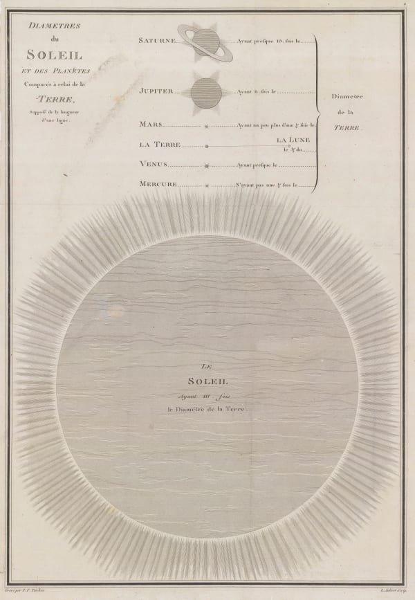
 Pierre Tardieu, Diametres du Soleil et des Planetes comparés à celiu de la Terre, 1785£ 275.00
 -
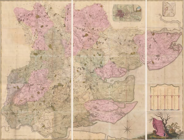
John Chapman & Peter André, Monumental Wall Map of Essex, 1785£ 4,500.00
-
Capt. James Cook, Hawaii, 1785£ 1,850.00
-
William Faden, A Plan of the Cities of London and Westminster, The Borough of Southwark and their Suburbs, 1785£ 2,750.00
-
Pierre Tardieu, South America divided into Spanish provinces, 1785£ 85.00
-
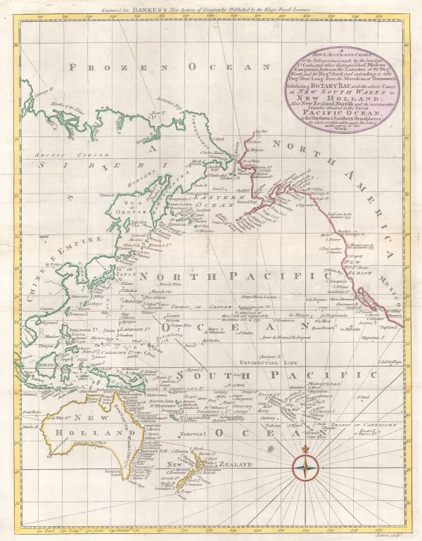
William Guthrie, Chart of the World, 1785 c£ 275.00
-
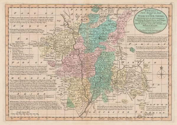
Bowles & Carver, Worcestershire, 1785 c£ 195.00
-
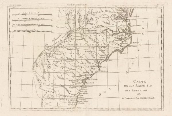
Rigobert Bonne, South eastern United States , 1785 c£ 275.00
-
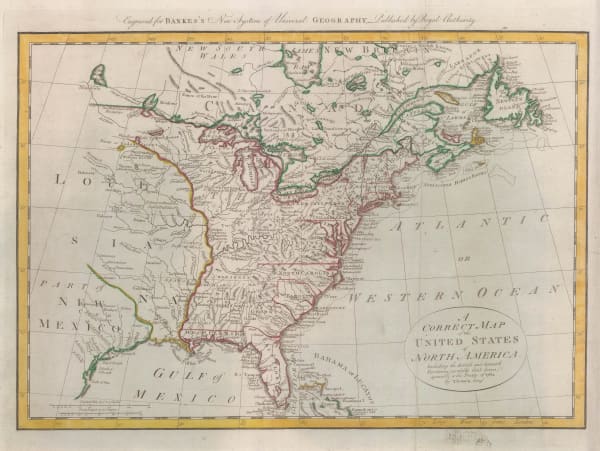
William Guthrie, Newly-independent United States, 1785 c.£ 945.00
-
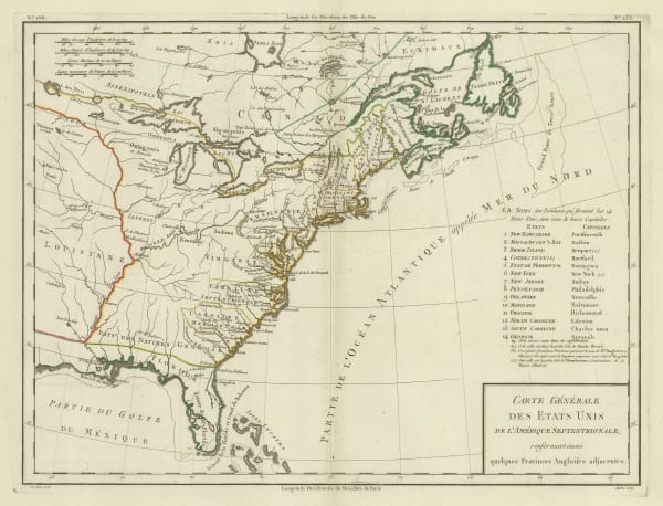
Tardieu, Eastern United States, 1785 c.£ 745.00
-
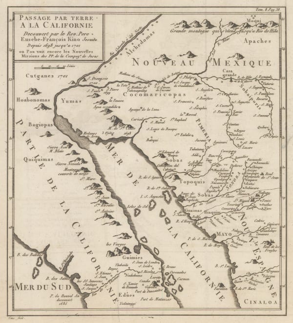
Eusebio Francisco Kino, Late French rendition of the important map by Eusebio Kino, 1785 c.£ 885.00
-
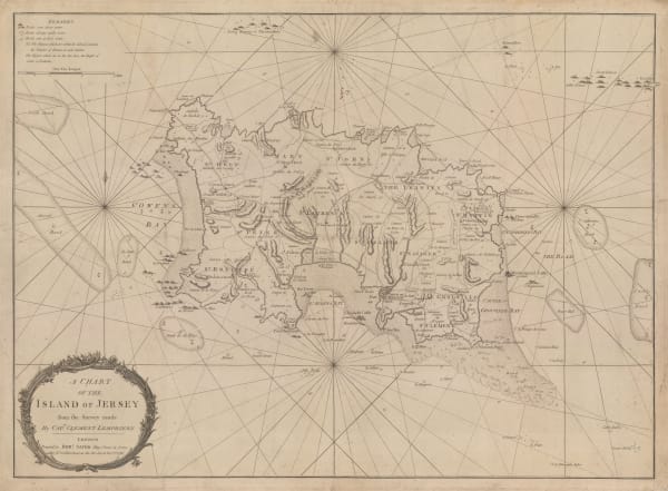
Robert Sayer, A Chart of the Island of Jersey, 1786£ 1,850.00
-
Robert Sayer, A New Hydrographic Sketch of the North, South and Middle Channels, 1786£ 495.00
-
-
-
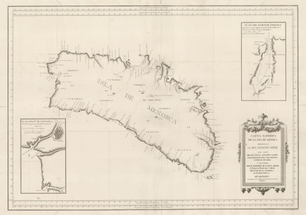
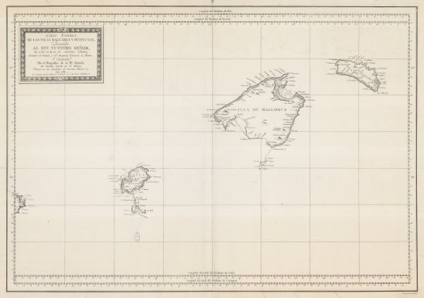
Vicente Maria Tofino, Rare Spanish Sea Chart of Mallorca, Menorca & Ibiza, 1786£ 3,450.00
-
Jacques-Nicolas Bellin, Chart of the North Atlantic Ocean, 1786£ 1,200.00
-
Franz Anton Schraembl, Wall map of South America, 1786£ 985.00
-
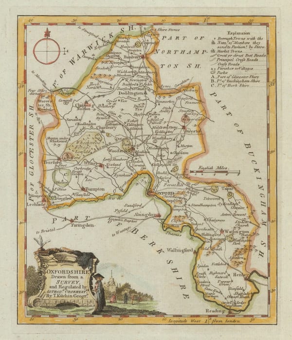
Thomas Kitchin, Oxfordshire, 1786£ 82.00
-
Vicente Maria Tofino, Rare Spanish Chart of Gibraltar, 1786£ 1,450.00
-
-
Vicente Maria Tofino, Rare Spanish Sea Chart of Ibiza & Formentera, 1786£ 3,450.00
-
Thomas Bowen, Very early map of the newly formed United States, 1787£ 985.00
-
-
John Seller, Berkshire, 1787£ 95.00
-
Georges-Louis Le Rouge, Eastern coast of North America and the Mississippi river, 1787£ 1,500.00
-
Tardieu, Carte de L'Ile de Nantucket, 1787£ 2,250.00
-
Jacques-Nicolas Bellin, Chart of Turks and Caicos, 1787£ 1,275.00
-
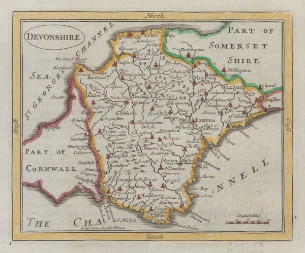
John Seller, Devon, 1787£ 125.00
-
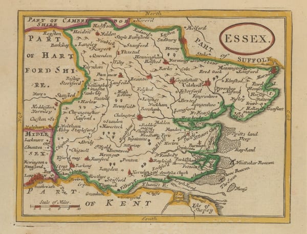
John Seller, Essex, 1787£ 62.00
-
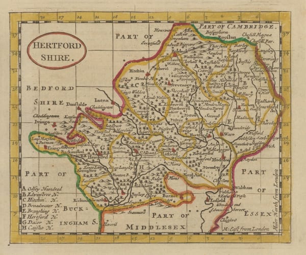
John Seller, Hertfordshire, 1787£ 55.00
-
Franz Anton Schraembl, Karte von Scotland, 1787£ 575.00
-
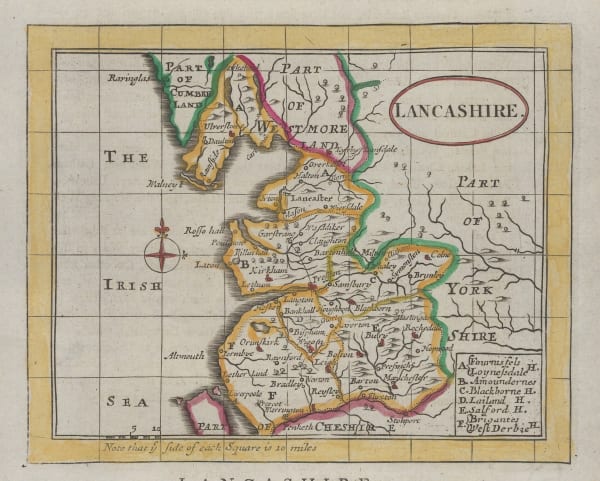
John Seller, Lancashire, 1787£ 85.00
-
John Seller, Lincolnshire, 1787£ 80.00
-
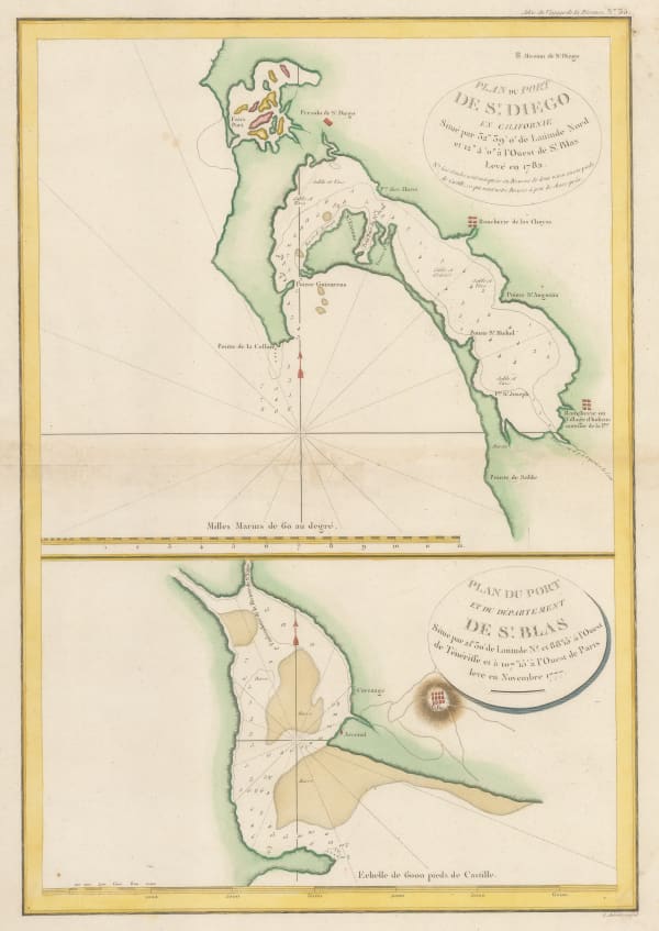
Jean Francois de La Perouse, San Diego and San Blas, 1787£ 885.00
-
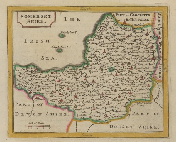
Jeremiah Seller, Somersetshire, 1787£ 82.00
-
John Harrison, South America, 1787£ 225.00
-
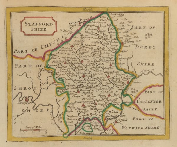
John Seller, Staffordshire, 1787£ 58.00
-
John Seller, Wiltshire, 1787£ 62.00
-
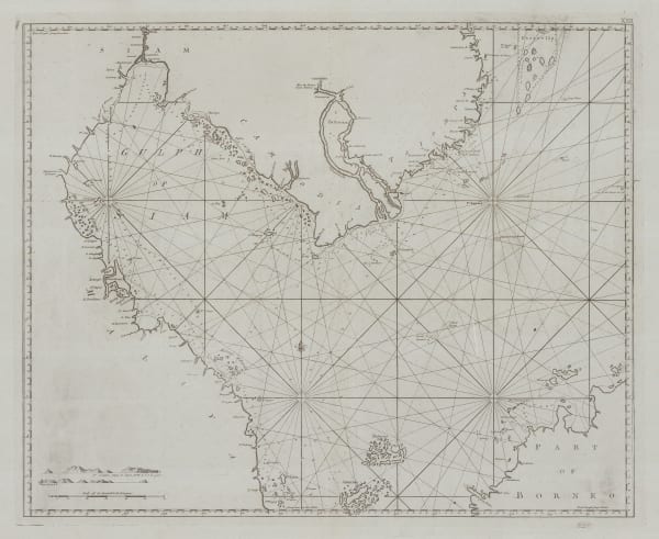
Henry Gregory, Sea Chart of the Gulf of Thailand (Siam), 1787£ 895.00
-
-
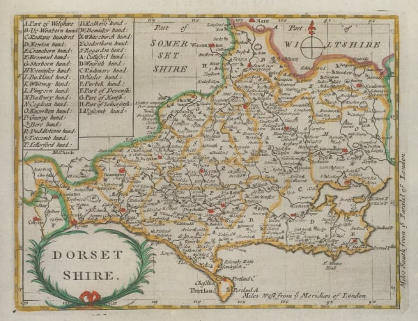
John Seller, Dorsetshire, 1787£ 95.00
-
Joseph Purcell, A Map of the States of Virginia, North Carolina, South Carolina and Georgia, 1788£ 1,925.00
-
Hieronymus Benedicti, Chart of the Dniprovs'ka Gulf, 1788£ 545.00
-
John Harrison, Egypt and the course of the Nile, 1788£ 145.00
-
Giovanni Maria Cassini, Africa, 1788£ 675.00
-
Giovanni Maria Cassini, L'America secondo le ultime osservazioni, 1788£ 875.00
-
Giovanni Maria Cassini, Asian continent, 1788£ 575.00
-
John Harrison, Chart of the Persian Gulf, 1788£ 775.00
-
Jean-Dominique Cassini, Réduction de la grande Carte de la Lune de J. Dom. Cassini, 1788£ 4,500.00
-
Antonio Zatta, The Black Sea coast, 1788£ 4,750.00
-
William Gordon, Revolutionary War map of New Jersey, 1788£ 645.00
-
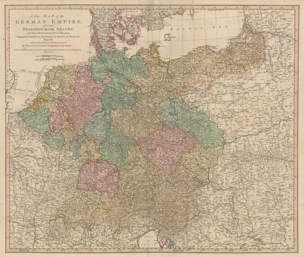
William Faden, Germany and the Holy Roman Empire, 1788£ 195.00
-
John Stockdale, First cartographic record of Lord Howe Island, Tasman Sea, 1789£ 345.00
-
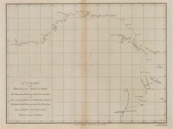
John Stockdale, Store ship Alexander's voyage from Port Jackson to Batavia, 1789£ 195.00
-
John Stockdale, Chart of the Track of the Scarborough from Port Jackson to Guam, 1789£ 245.00
-
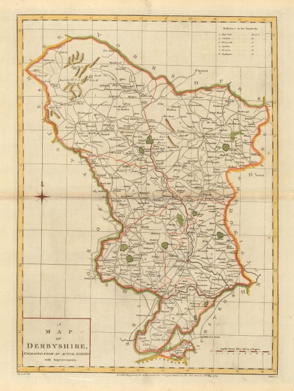
John Harrison, A Map of Derbyshire, 1789£ 125.00
-
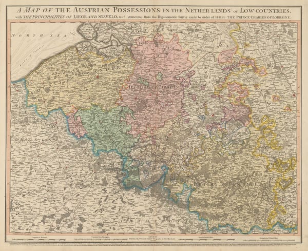
William Faden, Belgium, 1789£ 275.00
-
Franz Von Reilly, Das Furstenthum Wales, 1789£ 185.00
-
David Ramsay, Plan of the Siege of Charleston, 1789£ 695.00
-
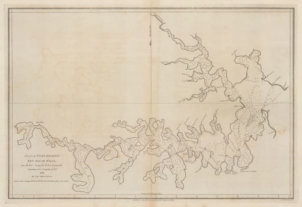
John Stockdale, Plan of Port Jackson, New South Wales, 1789£ 1,250.00
-
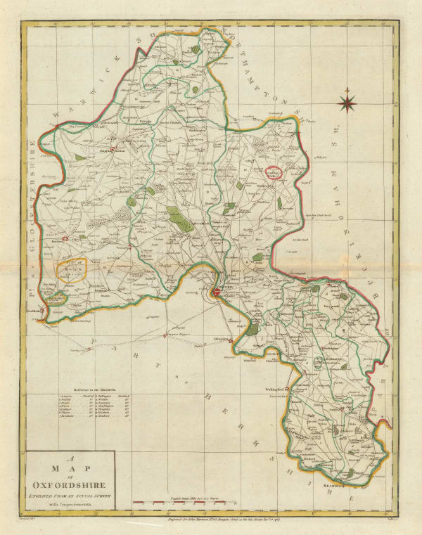
John Harrison, A Map of Oxfordshire, 1790£ 175.00
-
Robert Sayer, Italy, Sicily, Sardinia & Corsica, 1790£ 295.00
-
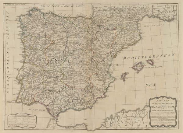
Robert Sayer, Kingdoms of Spain and Portugal, 1790£ 195.00
-
Robert Sayer, Scandinavia, 1790£ 385.00
-
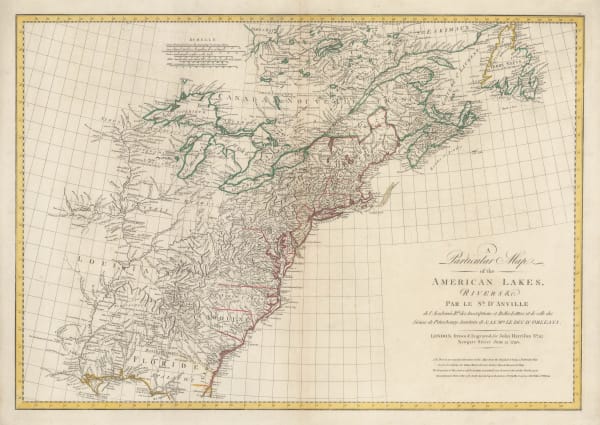
John Harrison, Eastern North America, 1790£ 1,750.00
-
John Cary, Cambridgeshire, 1790£ 35.00
-
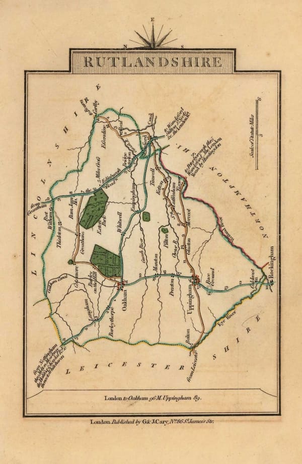
John Cary, Rutlandshire, 1790£ 30.00
-
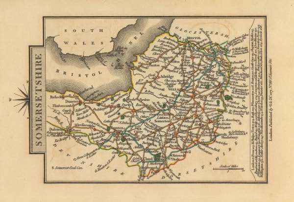
John Cary, Somersetshire, 1790£ 25.00
-
Robert Sayer, Russian Empire, 1790£ 495.00
-
Thomas Bowen, A New and Complete Chart of the World, 1790£ 750.00
-
Emanuel Bowen, Chart of the Pacific Ocean with voyages of Captain James Cook, 1790 c.£ 895.00
-
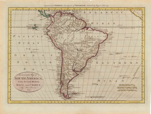
Rigobert Bonne, South America, 1790 c.£ 80.00
-
Thomas Bowen, South America, 1790 c.£ 225.00
-
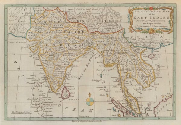
Charles Theodore Middleton, India and the East Indies, 1790 c.£ 325.00
-
Rigobert Bonne, Asia, 1790 c.£ 85.00
-
J.M. Wauthier, Battlefields. A Graphical Guide to the Places described in the History of England, 1790 c.£ 495.00
-
Capt. James Cook, Carte de L'Hemisphere Austral Montrant les Routes des Navigateurs les plus Célebres Par le Captaine Jacques Cook, 1790 c.£ 2,500.00
-
Capt. James Cook, Cook's survey of Tahiti, 1790 c.£ 575.00
-
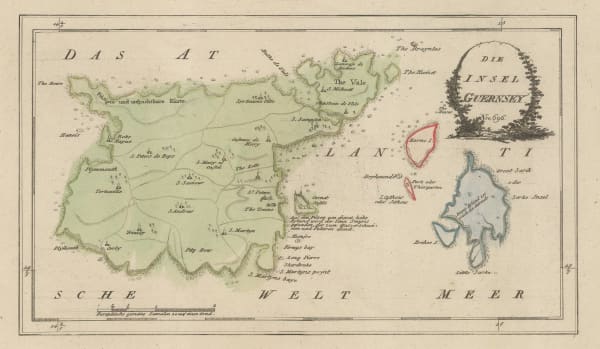
Franz Von Reilly, Guernsey, 1790 c.£ 345.00


Page
46
of 130