-
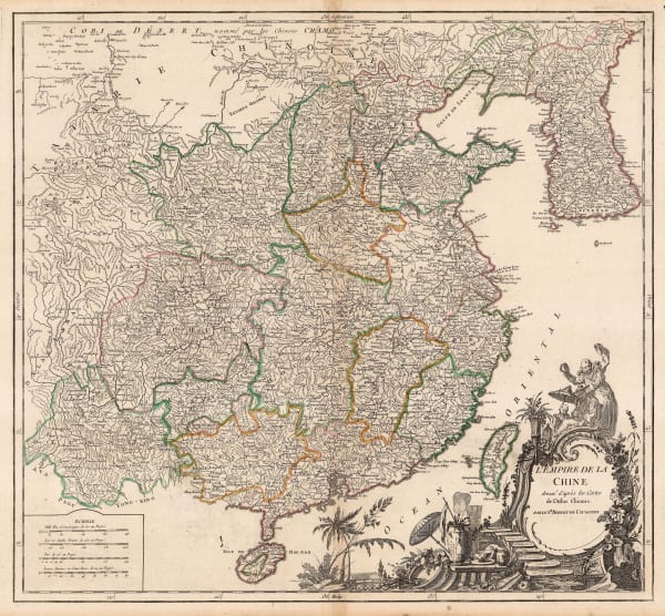
 Robert de Vaugondy, Chinese Empire, 1790 c.£ 425.00
 -
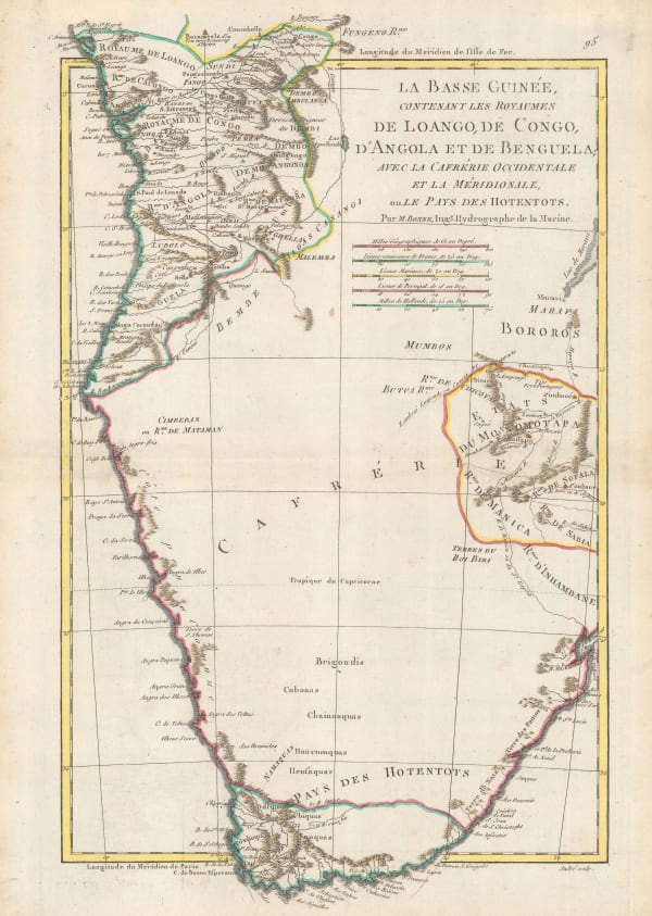
Rigobert Bonne, Southern Africa, 1790 c.£ 150.00
-
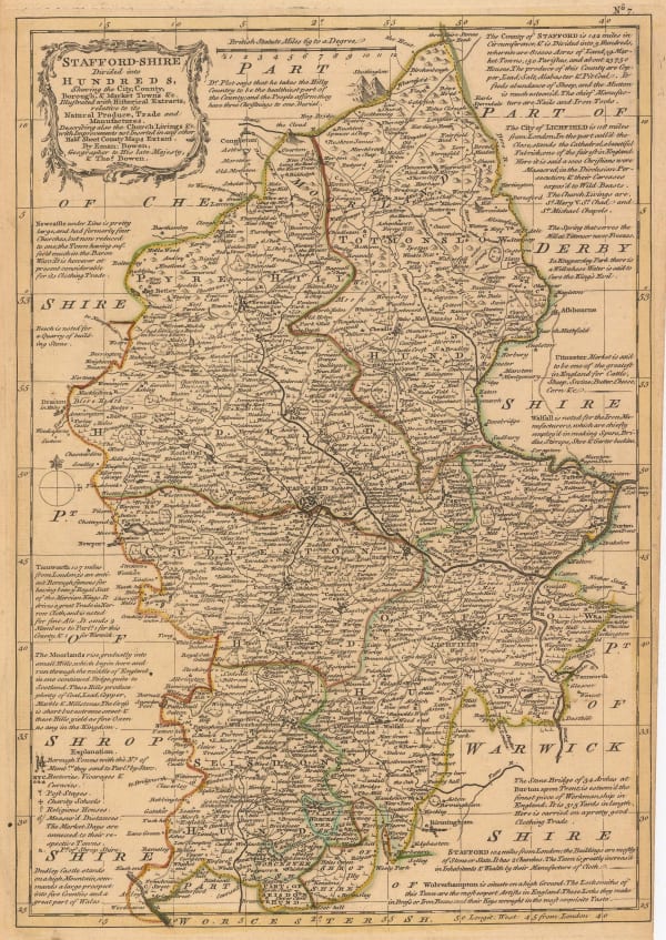
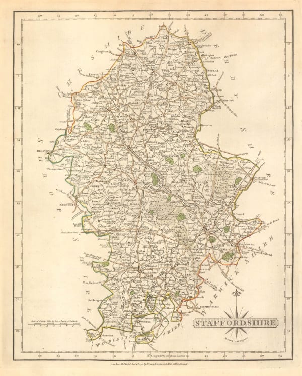
T. & E. Bowen, Staffordshire Divided into Hundreds, 1790 c.£ 185.00
-
Thomas Conder, Captain Cook's Map of Hawaii , 1790 c.£ 945.00
-
Charles Cooke, The World including the Discoveries made by Captain Cook, 1790 c.£ 895.00
-
Robert Wilkinson, A Map of Spain & Portugal, 1791£ 125.00
-
William Faden, Greece and part of Anatolia, 1791£ 1,185.00
-
William Faden, Plan of the Road to Funchal, 1791£ 785.00
-
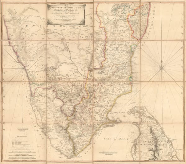
William Faden, The Southern Countries of India from Madrass to Cape Comorin, 1791£ 3,950.00
-
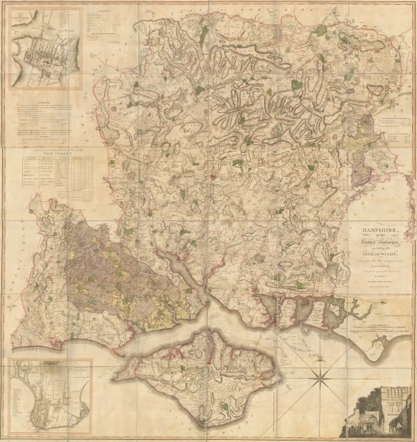
William Faden, Hampshire, or the County of Southampton, 1791£ 4,500.00
-
William Faden, France, Divided into Metropolitan Circles, Departments & Districts, 1792£ 485.00
-
William Guthrie, Africa from the best Authorities, 1792£ 155.00
-
William Guthrie, Ireland, 1792£ 145.00
-
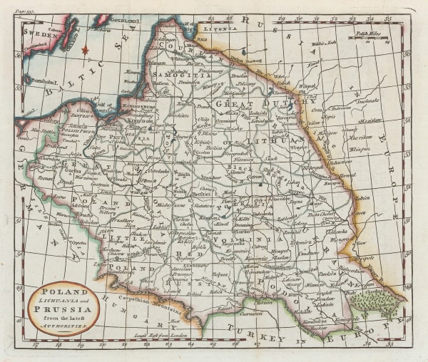
William Guthrie, Poland, 1792£ 125.00
-
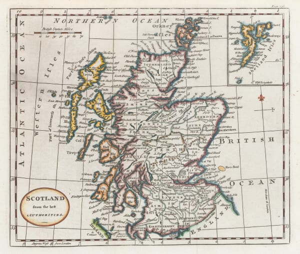
William Guthrie, Scotland from the best Authorities, 1792£ 115.00
-
William Guthrie, Italy from the best Authorities, 1792£ 125.00
-
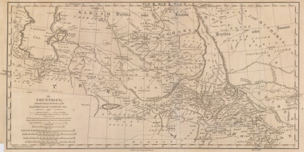
James Rennell, Afghanistan, Pakistan, India and Turkestan, 1792£ 445.00
-
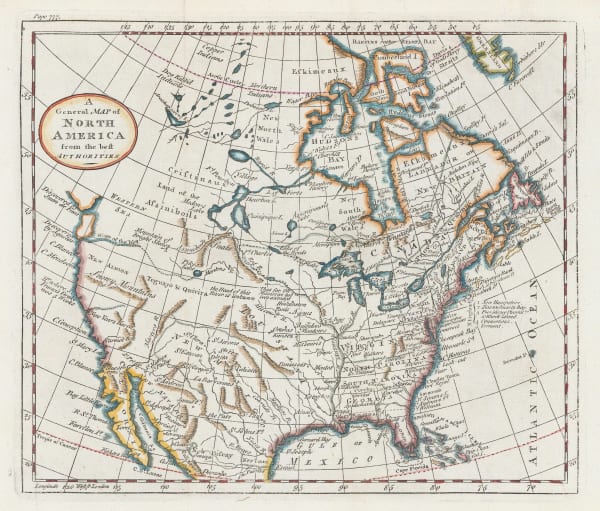
William Guthrie, A General Map of North America from the best Authorities, 1792£ 295.00
-
William Guthrie, Europe from the best Authorities, 1792£ 85.00
-
William Guthrie, East Indies from the best Authorities, 1792£ 145.00
-
William Guthrie, Double Hemisphere World Map, 1792£ 295.00
-
Antoine de Sartine, Important map of the east coast of the United States and Canada, 1792 (c.)£ 3,250.00
-
Charles Cooke, North America with Captain Cook's discoveries, 1792 c.£ 695.00
-
Charles Stedman, A Plan of the Operations of the King's Army under the Command of Sir William Howe in New York and East New Jersey, 1793£ 2,750.00
-
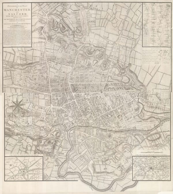
John Stockdale, Manchester, 1793£ 775.00
-
Jean Lattre, South America, 1793£ 165.00
-
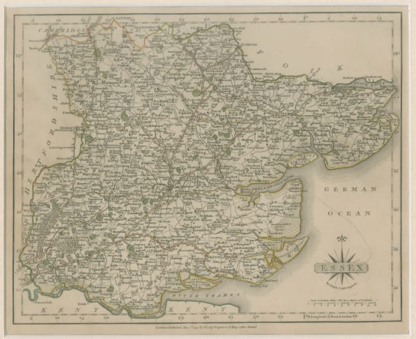
John Cary, Essex, 1793£ 115.00
-
John Cary, Kent, 1793£ 115.00
-
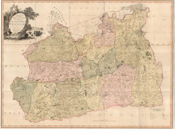
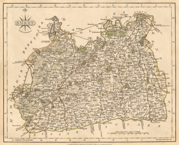
J. Lindley and W. Crosley, Map of the County of Surrey, 1793£ 4,450.00
-
Charles Stedman, Plan of the Attack of the Forts Clinton & Montgomery, upon Hudsons River, 1793£ 2,450.00
-
Charles Stedman, Plan of the Position which the Army under Burgoine took at Saratoga, 1793£ 1,950.00
-
John Cary, Staffordshire, 1793£ 72.00
-
John Cary, Surrey, 1793£ 195.00
-
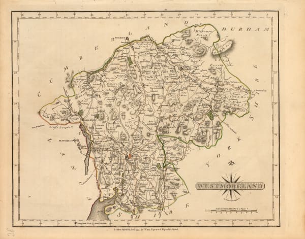
John Cary, Westmoreland, 1793£ 72.00
-
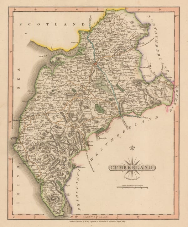
John Cary, Cumberland, 1793£ 88.00
-
Charles Stedman, Sketch of General Grants Position on Long Island, 1793£ 1,250.00
-
Laurie & Whittle, A Chart of the Coast of India, from Goa to Cape Comorin, 1794£ 1,250.00
-
Laurie & Whittle, Madeira & the Canary Islands, 1794£ 925.00
-
Laurie & Whittle, A Chart of the Mahe and Amirantes Islands, 1794£ 2,450.00
-
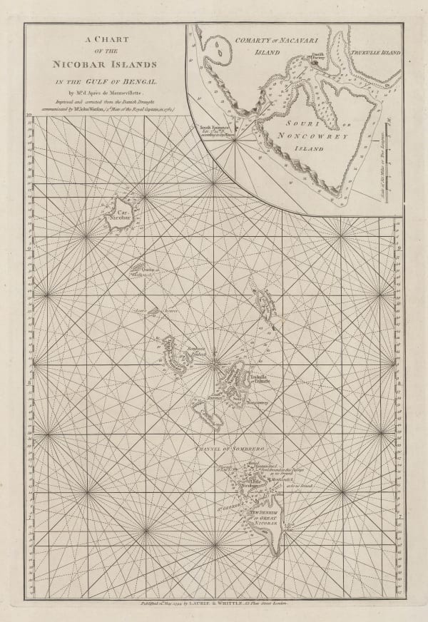
Laurie & Whittle, A Chart of the Nicobar Islands in the Gulf of Bengal, 1794£ 750.00
-
Laurie & Whittle, Chart of the East China Sea, 1794£ 2,450.00
-
Laurie & Whittle, A Chart of the Northern Part of the Indian Ocean, 1794£ 2,850.00
-
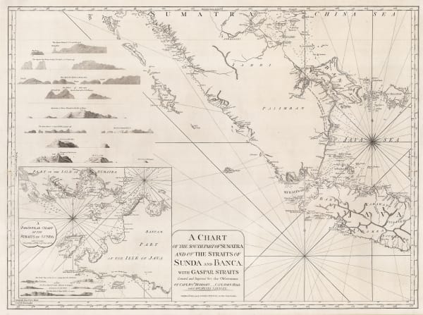
Laurie & Whittle, A Chart of the Southern Part of Sumatra and of the Straits of Sunda and Banca, 1794£ 925.00
-
John Armstrong, Menorca, 1794£ 2,750.00
-
Laurie & Whittle, Wall map of South America, 1794£ 4,950.00
-
Laurie & Whittle, Uttar Pradesh, 1794£ 450.00
-
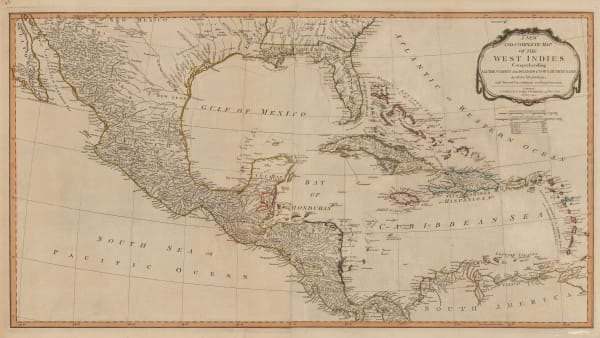
Laurie & Whittle, Central America and the West Indies, 1794£ 985.00
-
Laurie & Whittle, A New and General Map of the Southern Dominions Belonging to The United States of America, 1794£ 3,500.00
-
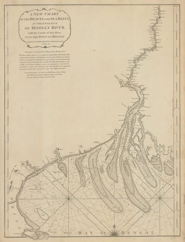
Laurie & Whittle, Chart of entrance to the Hooghly River, 1794£ 1,650.00
-
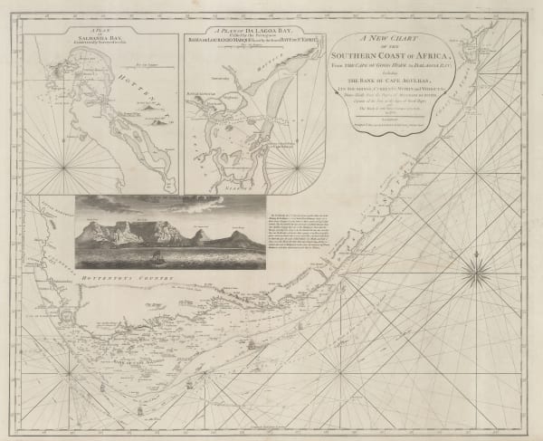
Laurie & Whittle, A New Chart of the Southern Coast of Africa, 1794£ 3,250.00
-
Laurie & Whittle, Chart of the South Atlantic, 1794£ 750.00
-
Laurie & Whittle, A New Chart of the World with The Tracks & Discoveries of the Latest Circumnavigators, 1794£ 1,150.00
-
Robert Wilkinson, Miniature map of South America, 1794£ 155.00
-
Laurie & Whittle, Switzerland, 1794£ 200.00
-
Robert Wilkinson, Kingdom of Sardinia, 1794£ 125.00
-
Laurie & Whittle, The Kingdom of France, 1794£ 375.00
-
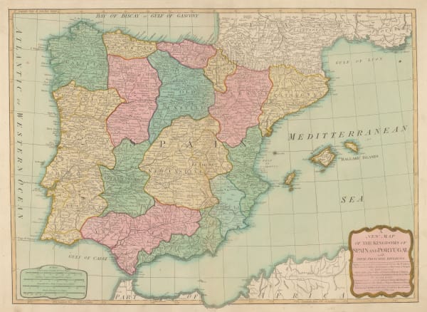
Laurie & Whittle, Spain, Portugal and the Balearic Islands, 1794£ 445.00
-
Laurie & Whittle, Belgium, 1794£ 225.00
-
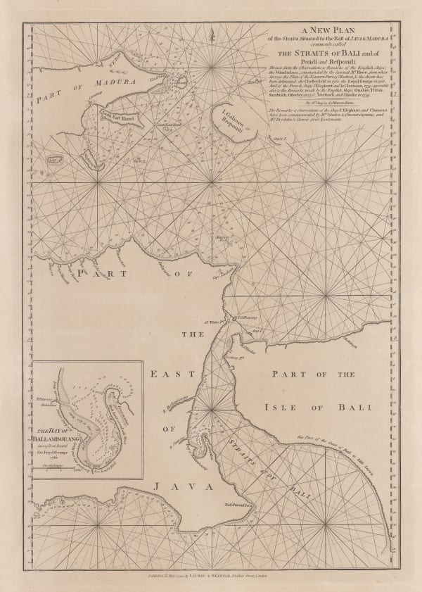
Laurie & Whittle, Bali Strait, 1794£ 395.00
-
Laurie & Whittle, A Plan of Table Bay with the Road of the Cape of Good Hope, 1794£ 2,950.00
-
Laurie & Whittle, Rare chart of the Pearl River, 1794£ 4,250.00
-
Laurie & Whittle, America North and South and the West Indies, 1794£ 525.00
-
Laurie & Whittle, Bay of Biscay, 1794£ 1,250.00
-
Robert Wilkinson, The West Indies, 1794£ 195.00
-
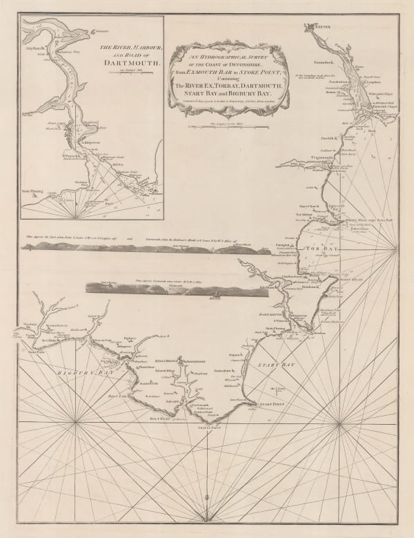
Laurie & Whittle, Sea Chart of the Devon Coast from Exmouth Bar to Stoke Point, 1794£ 650.00
-
Laurie & Whittle, Chart of the Entrance of Hudson's River, 1794£ 3,750.00
-
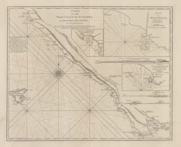
Laurie & Whittle, Chart of the west Coast of Sumatra, 1794£ 495.00
-
Laurie & Whittle, Egypt and the Nile, 1794£ 275.00
-
Francois Bohn, Anthropomorphic map of Europe, 1794£ 950.00
-
Capt. James Cook, Coast of New Caledonia, 1794£ 185.00
-
Charles Francois Delamarche, French map of Asia, 1794£ 225.00
-
Bryan Edwards, Dominica, 1794£ 225.00
-
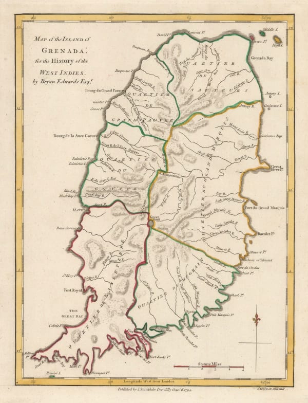
Bryan Edwards, Grenada divided into quartiers, 1794£ 195.00
-
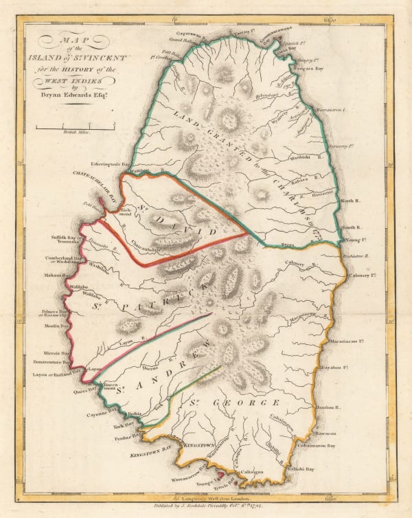
Bryan Edwards, Map of the Island of St. Vincent, 1794£ 225.00
-
John Russell, Map of the Middle States of America, 1794£ 675.00
-
Bryan Edwards, Map of the Virgin Islands for The History of the West Indies, 1794£ 895.00
-
Capt. James Cook, Botany Bay and mouth of the Endeavour River, 1794£ 185.00
-
Capt. James Cook, Easter Island or Rapa Nui, 1794£ 125.00
-
-
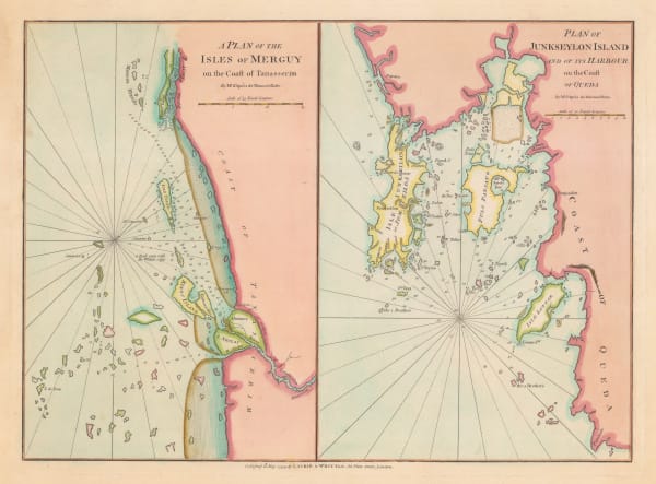
Laurie & Whittle, Phuket and the Mergui Archipelago, 1794£ 795.00


Page
47
of 130