-
 Petrus Bertius, Early miniature map of north eastern United States, 1616£ 445.00
 -
Henri Justel, Important map of the East coast of the United States , 1674£ 1,950.00
-
Johann Ulrich Muller, [Virginia], 1692£ 525.00
-
Robert Morden, Rare miniature map of eastern North America, 1693£ 985.00
-
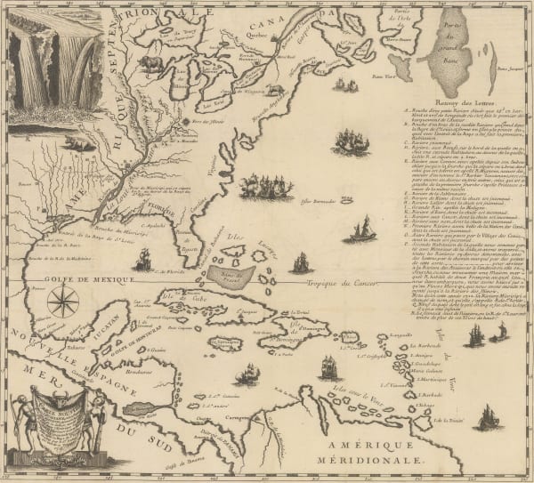
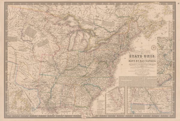
Pierre Mortier, Scarce map of Canada and Eastern seaboard, 1700£ 3,000.00
-
-
Johann Baptist Homann, Virginia, Maryland and Carolina, 1714 c.£ 3,250.00
-
-
Henri Chatelain, North America, Mexico, Central America and the Caribbean, 1719£ 1,250.00
-
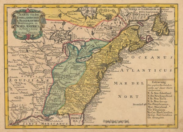
Johann Georg Schreiber, Eastern United States and Louisiana, 1720 c.£ 565.00
-
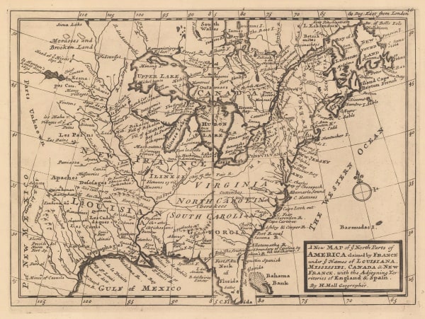
Herman Moll, The English Empire in America, Newfound-land, Canada, Hudson's Bay, 1723£ 945.00
-
Covens (Jean) & Mortier (Cornelius), Louisiana and the Mississippi River, 1730 (c.)£ 3,450.00
-
-
Jacques Benard, Le Cours du Fleuve Missisipi, 1730 c.£ 2,750.00
-
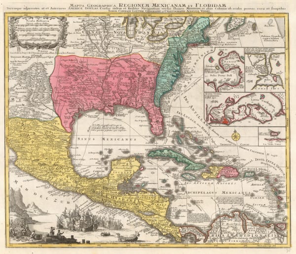
Covens (Jean) & Mortier (Cornelius), Tabula Geographica Mexicae et Floridae &c., 1730 c.£ 2,750.00
-
-
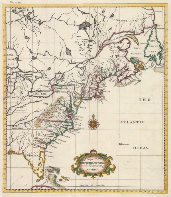
Thomas Salmon, East Coast showing British plantations, 1739£ 945.00
-
Jacques-Nicolas Bellin, Carte de La Louisiane Cours Du Mississipi et Pais Voisins, 1744£ 2,200.00
-
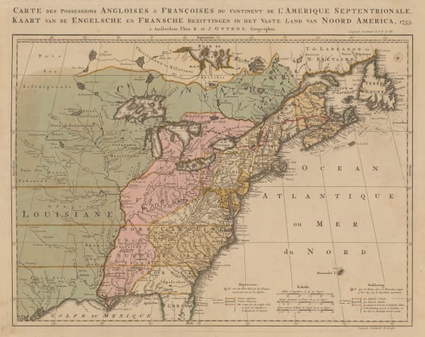
Josua & Reinier Ottens, French and Indian War, 1755£ 4,850.00
-
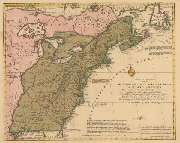
Isaac Tirion, East coast showing British claims, 1755£ 1,125.00
-
Thomas Bowen, British and French Settlements in America, 1755£ 4,500.00
-
Herman Moll, United States and Canada, 1755 c.£ 1,250.00
-
Covens (Jean) & Mortier (Cornelius), L'Amerique Septenrionale, 1757£ 4,200.00
-
Tobias Conrad Lotter, Southern USA, Mexico, Central America & the Caribbean, 1760 c.£ 3,450.00
-
-
Malachy Postlethwayt, North America, 1766£ 3,850.00
-
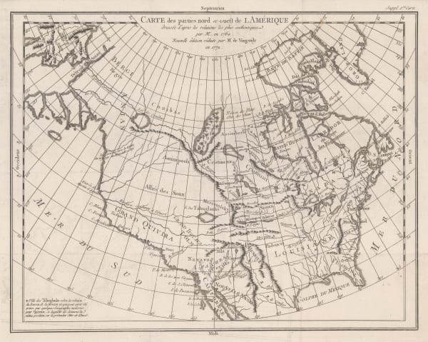
Robert de Vaugondy, Carte des Parties Nord et Ouest de l'Amerique, 1772£ 695.00
-
Rigobert Bonne, Eastern North America, 1772£ 1,250.00
-
Francois Santini, Carte Generale du Canada, de la Louisiane, de la Floride, de la Caroline, de la Virginie, de la Nouvelle Angleterre etc., 1776£ 700.00
-
Louis Joseph Mondhare, Scarce Revolutionary War map, 1777£ 3,250.00
-
Antonio Zatta, Eastern North America, 1778£ 985.00
-
-
Charles Francois Delamarche, Canada, Louisiana, États-Unis, 1778£ 525.00
-
John Obadiah Justamond, Eastern United States, 1780 c.£ 1,750.00
-
Rigobert Bonne, Etats Unis de L'Amerique, 1780 c.£ 375.00
-
Rigobert Bonne, Eastern United States, 1780 c.£ 375.00
-
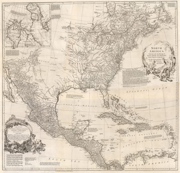
Guillaume De L'Isle, Carte du Mexique et des Etats Unis D'Amerique, partie Meridionale, 1783£ 3,500.00
-
Hendrik Klockhoff, One of the earliest maps to recognize the newly-independent United States, 1785£ 2,450.00
-
Charles Francois Delamarche, Scarce early map of the newly-independent USA, 1785£ 1,850.00
-
William Guthrie, Newly-independent United States, 1785 c.£ 945.00
-
Tardieu, Eastern United States, 1785 c.£ 745.00
-
-
-
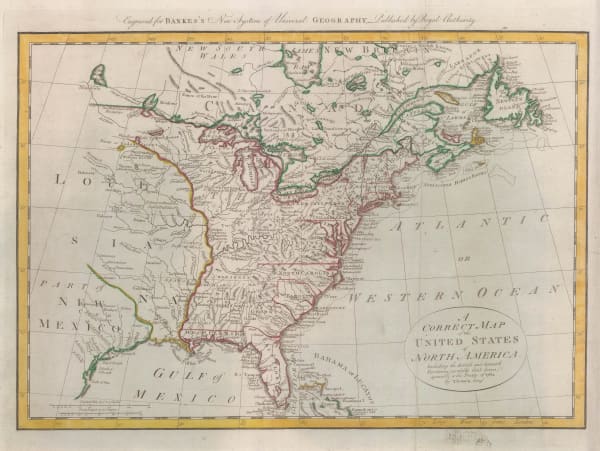
Thomas Bowen, Very early map of the newly formed United States, 1787£ 985.00
-
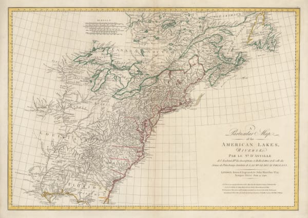
Georges-Louis Le Rouge, Eastern coast of North America and the Mississippi river, 1787£ 1,500.00
-
John Harrison, Eastern North America, 1790£ 1,750.00
-
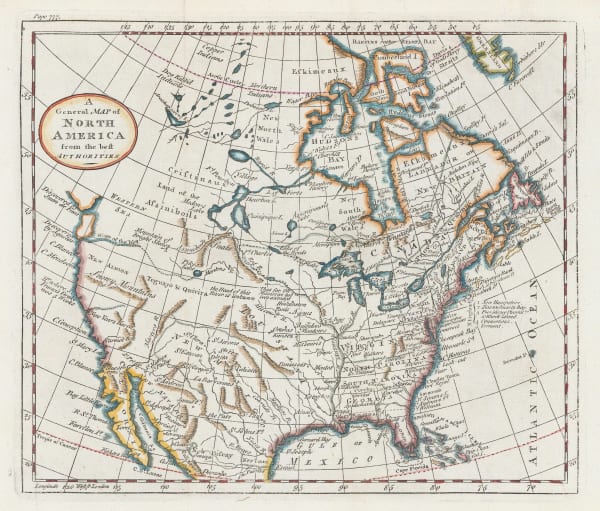
William Guthrie, A General Map of North America from the best Authorities, 1792£ 295.00
-
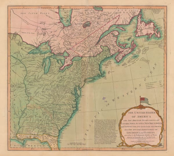
Laurie & Whittle, The United States of America, 1794£ 3,000.00
-
John Russell, Miniature map of the Eastern United States, 1795£ 155.00
-
Aaron Arrowsmith, United States, 1805£ 375.00
-
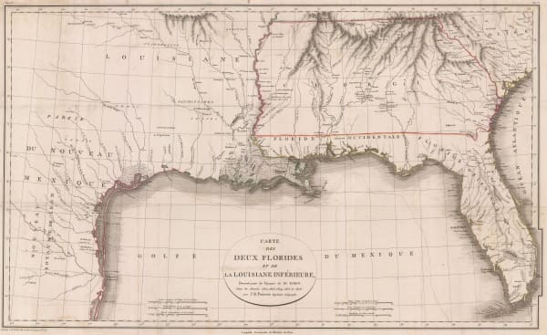
Jean-Baptiste Poirson, Texas, Louisiana, Alabama, Mississippi, Florida and Georgia, 1807£ 2,500.00
-
-
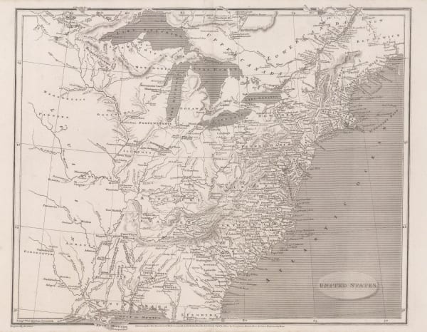
John Wilkes, North America, 1815 c£ 445.00
-
Edward Baines, United States and Canada during the War of 1812, 1816£ 295.00
-
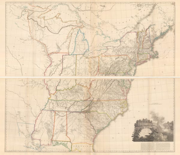
Matthew Carey, Map of the United States of America, 1818£ 1,650.00
-
Pierre Tardieu, Eastern United States and West Indies., 1820 c.£ 175.00
-
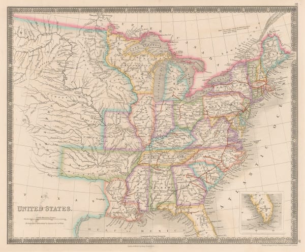
Daniel & William Lizars, United States, 1820 c.£ 365.00
-
-
John Cary, Eastern United States, 1825£ 1,475.00
-
I.T. Hinton, Map of the United States of America and Nova Scotia, 1832£ 285.00
-
Charles Smith, United States, 1834£ 295.00
-
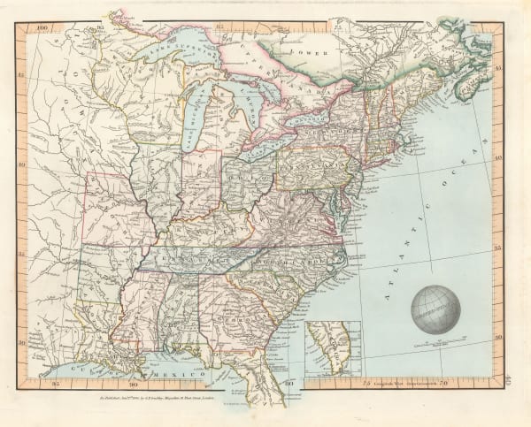
Samuel Augustus Mitchell, United States, 1835£ 1,850.00
-
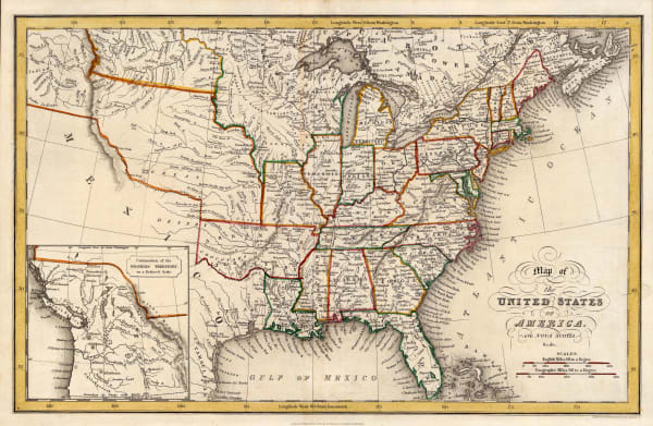
Adrien Brue, United States showing westward expansion, 1836£ 895.00
-
Carl Flemming, United States of North America, 1840 (c.)£ 885.00
-
James Wyld, The United States of North America with the British Territories, 1841£ 1,850.00
-
Thomas Tegg, United States, 1843£ 55.00
-
Samuel Augustus Mitchell, National Map of the American Republic, 1843£ 1,450.00
-
Samuel Augustus Mitchell, US Cities and Statistics, 1843£ 1,150.00
-
George Frederick Cruchley, North America, 1845£ 120.00
-
George Frederick Cruchley, United States, 1845£ 140.00
-
Joseph Meyer, Illinois, 1845£ 325.00
-
-
Henry Teesdale, United States, 1847£ 345.00
-
Samuel Augustus Mitchell, Map of the United States, 1847 (c.)£ 625.00
-
Selina Hall, United States, 1850 c.£ 275.00
-
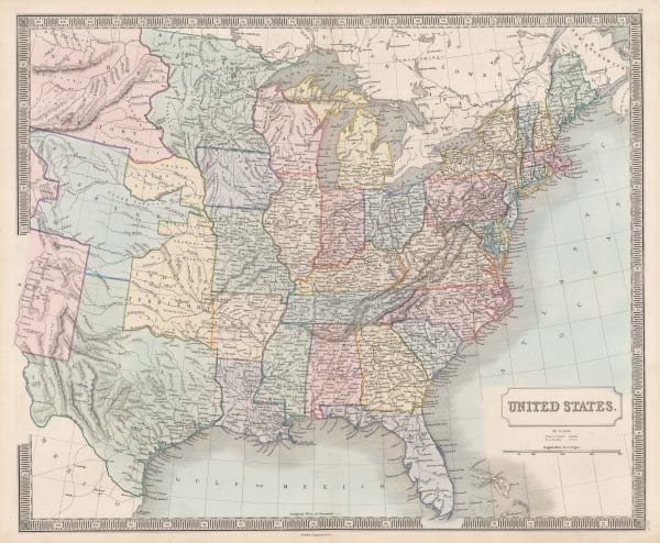
John Tallis, United States, 1851£ 495.00
-
Edward Hitchcock, A Geological Map of the United States and Canada, 1853£ 985.00
-
Charles V. Monin, United States, 1853£ 82.00
-
-


![Johann Ulrich Muller, [Virginia], 1692](https://artlogic-res.cloudinary.com/w_600,c_limit,f_auto,fl_lossy,q_auto/artlogicstorage/themaphouse/images/view/4daa878413391787ca44f4a3e03c1df3j/themaphouse-johann-ulrich-muller-virginia-1692.jpg)


Page
1
of 2