-
 James Wyld, Plan of London and Westminster, 1841£ 2,000.00
 -
Edward Wallis, Wallis's Guide for Strangers through London, 1843£ 1,350.00
-
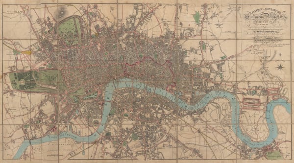
Edward Mogg, London in Miniature with Surrounding Villages, 1844£ 1,850.00
-
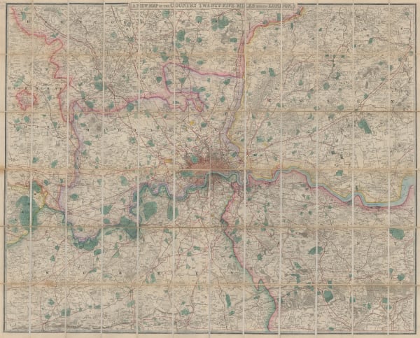
James Wyld, A New Topographical Map of the Country in the vicinity of London, 1845£ 2,250.00
-
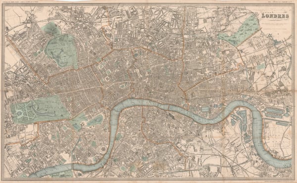
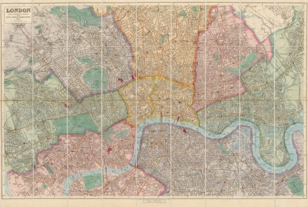
Edward Mogg, Modern London and its Environs, 1845£ 1,250.00
-
William Tombleson, Panoramic Map of the Thames and Medway, 1845 c.£ 2,250.00
-
Edward Mogg, Mogg's New Plan of London, 1845 c.£ 1,650.00
-
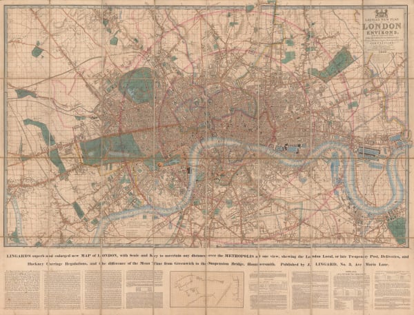
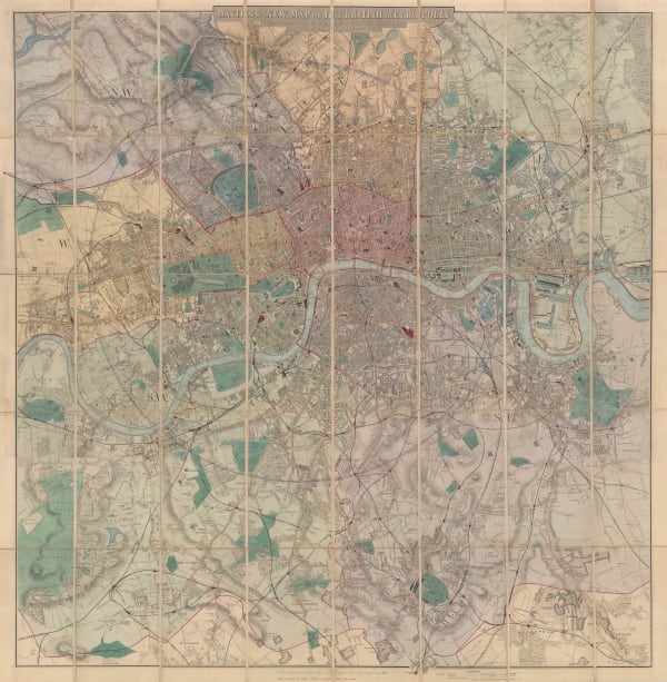
Richard Holmes Laurie, Laurie's New Plan of London and its Environs, with an improved Scale for Ascertaining Distances, the Fares of Hackney Coaches, Porterage of Parcels, &c., 1846£ 3,450.00
-
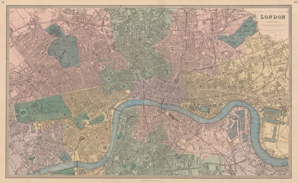
Benjamin Rees Davies, London and its Environs, 1847£ 1,450.00
-
Joseph Cross, London Guide, 1850 c.£ 1,500.00
-
Johann Georg Heck, Neuester Plan von London, 1851£ 1,850.00
-
Henry George Collins, Plan of London, 1851£ 795.00
-
-
James Wyld, New Plan of London, 1851£ 1,850.00
-
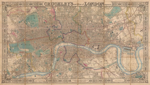
George Frederick Cruchley, New Plan of London Improved, 1851 c.£ 3,250.00
-
-
Society for the Diffusion of Useful Knowledge (SDUK), London, 1855 c£ 1,250.00
-
William Mogg, Twenty Four Miles Round London, 1855 c.£ 1,200.00
-
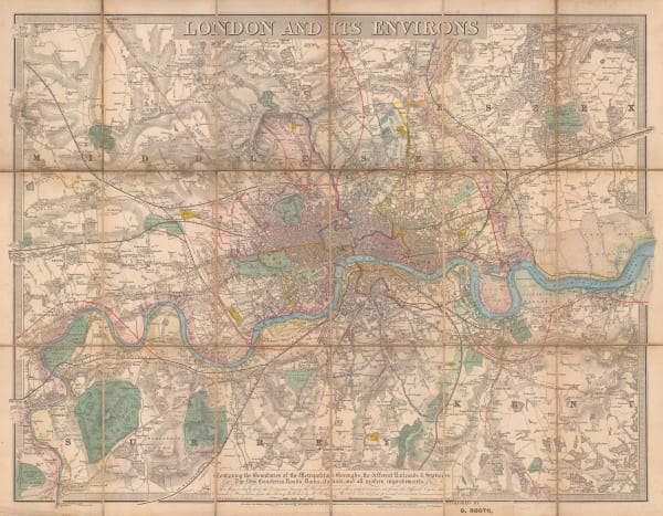
Letts & Son, London and its Environs, 1857£ 925.00
-
Robert William Mylne, Geological and Topographical Map of London & its Environs, 1858£ 2,500.00
-
Benjamin Rees Davies, Davies's New Map of London and its Environs, 1862£ 1,750.00
-
Edward Weller, The 'Landmarks' of London, 1863 c.£ 695.00
-
Benjamin Rees Davies, Davies's New Map of the British Metropolis, 1865£ 1,850.00
-
-
James Wyld, Wyld's New Plan of London & Its Vicinity, 1869£ 2,950.00
-
Benjamin Rees Davies, Davies's New Map of London, 1870£ 2,250.00
-
W.H. Smith & Son, Environs of London, 1870 c£ 295.00
-
W.H. Smith & Son, New Plan of London, 1870 c£ 395.00
-
James Wyld, A New Map of the Country Twenty-Five Miles Round London, 1870 c.£ 2,250.00
-
Society for the Diffusion of Useful Knowledge (SDUK), London, 1875£ 1,350.00
-
John Bartholomew, Clue Plan for Collins' Illustrated Guide to London, 1875£ 195.00
-
James Wyld, Map of the Superficial Geology of London and its Environs, 1878 c.£ 825.00
-
Gall & Inglis, Cruchley's Handy Map of London, 1880 c£ 545.00
-
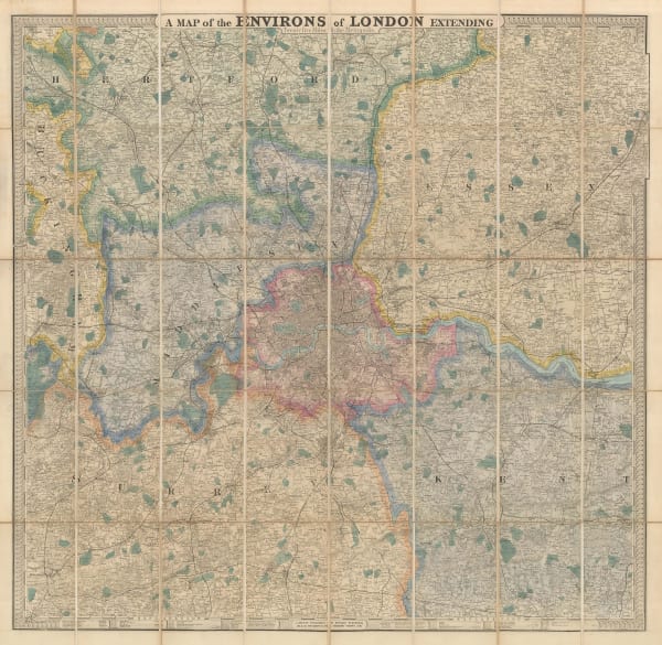
Edward Stanford, A Map of the Environs of London Extending Twenty Five Miles fr. the Metropolis, 1880 c.£ 825.00
-
Henry George Collins, Collins' Standard Map of London, 1880 c.£ 785.00
-
-
Gall & Inglis, Reduced Ordnance Map of London, 1880 c.£ 945.00
-
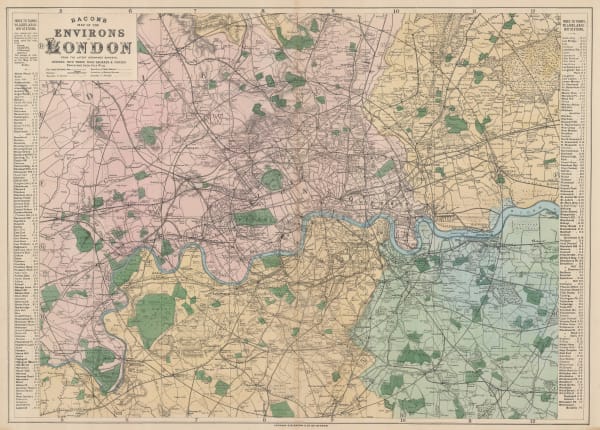
George W. Bacon, Bacon's Map of the Environs of London, 1880 c.£ 445.00
-
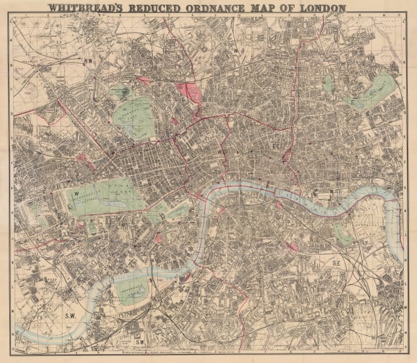
Josiah Whitbread, Whitbread's Reduced Ordnance Map of London, 1883£ 775.00
-
George W. Bacon, London, 1885 c£ 1,250.00
-
George W. Bacon, Bacon's New Map of London, 1885 c.£ 850.00
-
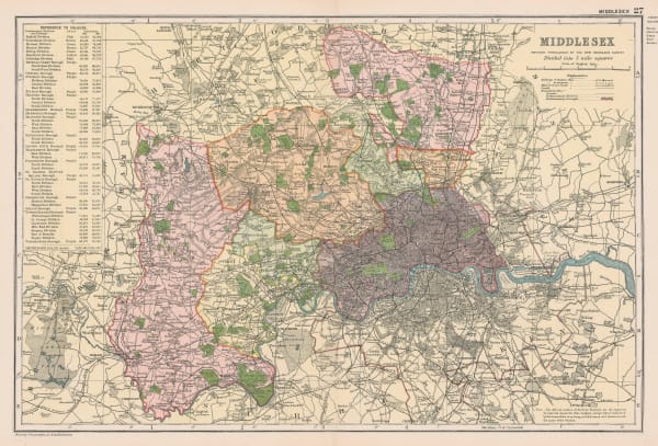
George W. Bacon, Middlesex, 1886£ 68.00
-
James Wyld, Wyld's New Plan of London and its Vicinity, 1888£ 1,750.00
-
John Bartholomew & Co., Postal Districts, 1889£ 48.00
-
John Bartholomew & Co., Environs of London, 1889£ 48.00
-
George W. Bacon, London, 1890 (c.)£ 395.00
-
Gall & Inglis, Gall and Inglis' Reduced Ordnance Map of London, 1890 c.£ 795.00
-
Benjamin Rees Davies, Davies's Map of the Environs of London, 1891£ 645.00
-
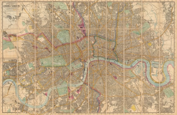
Post Office Directory, London, 1893£ 595.00
-
James Reynolds, New Map of London and its Suburbs, 1893£ 1,350.00
-
Benjamin Rees Davies, Davies' New Map of London and its Environs, 1894£ 1,950.00
-
W. & A.K. Johnston, London (Central), 1895 c£ 155.00
-
George Philip & Son Ltd., New Large Print Map of the County of London, 1895 c.£ 2,000.00
-
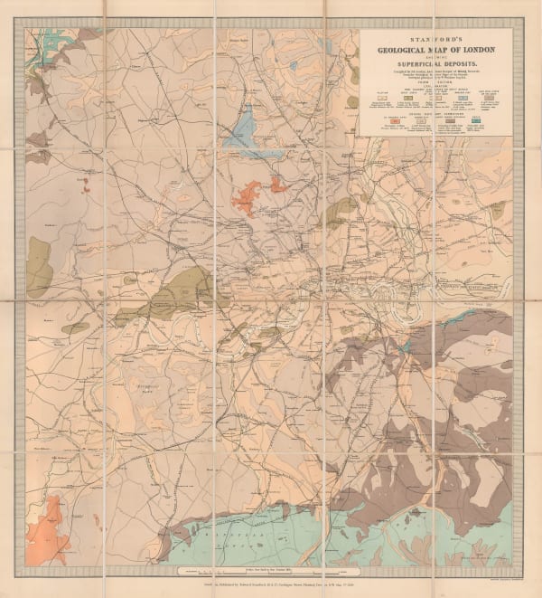
Edward Stanford, Stanford's Geological Map of London Shewing Superficial Deposits, 1899£ 425.00
-
Charles Booth, Map Showing Places of Religious Worship, Public Elementary Schools, and Houses Licensed for the Sale of Intoxicating Drinks, 1900£ 2,950.00
-
George Philip & Son Ltd., New Plan of London, 1900 c£ 950.00
-
Cassell & Company, London and Environs, 1900 c.£ 125.00
-
-
Geological Survey, Geological Map of London, 1904£ 725.00
-
George Philip & Son Ltd., Kew Gardens & London Zoo, 1904£ 58.00
-
George Philip & Son Ltd., The Thames from London to Oxford, 1904£ 68.00
-
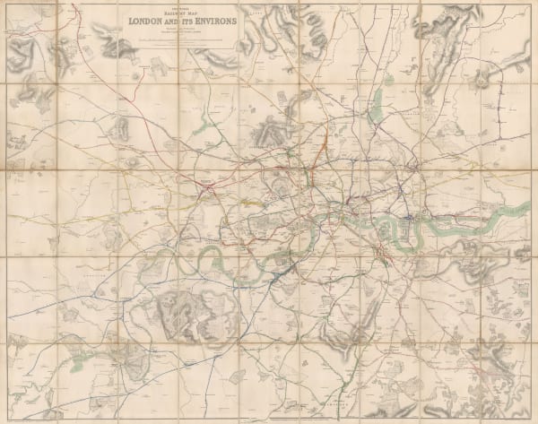
Railway Clearing House, Official Railway Map of London and its Environs, 1907£ 550.00
-
George W. Bacon, Map of the Golf Courses around London, 1907 c.£ 1,350.00
-
The Graphic Magazine, What Will Be the End of London?, 1910£ 650.00
-
Chas. Baker & Co., London & Environs, 1910 (c.)£ 185.00
-
George W. Bacon, Bacon's Map of London, 1910 (c.)£ 295.00
-
G. & J. Bartholomew, The Environs of London, 1910 c£ 195.00
-
J.F. Bennet, Bennet's Map of the River Thames from Oxford to Gravesend, 1910 c.£ 1,350.00
-
George W. Bacon, Bacon's Large-Print Map of London and Suburbs, 1910 c.£ 575.00
-
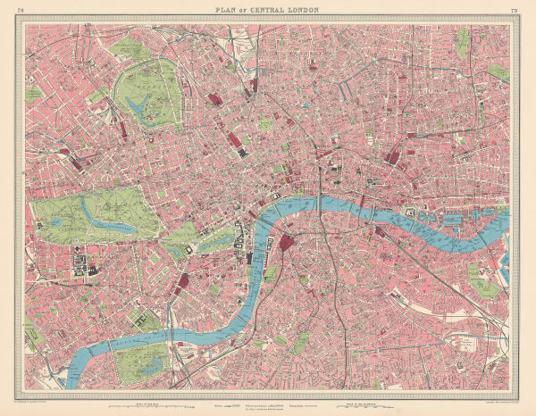
John Bartholomew, Plan of Central London, 1910 c.£ 395.00
-
Chas. Baker & Co., London - A Bird's-Eye View, 1912£ 1,150.00
-
Thomas Kelly, London, 1915£ 545.00
-
Pharus, London, 1920 c.£ 950.00
-
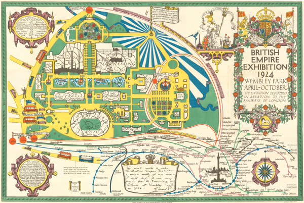
Kennedy North, British Empire Exhibition 1924, 1923£ 650.00
-
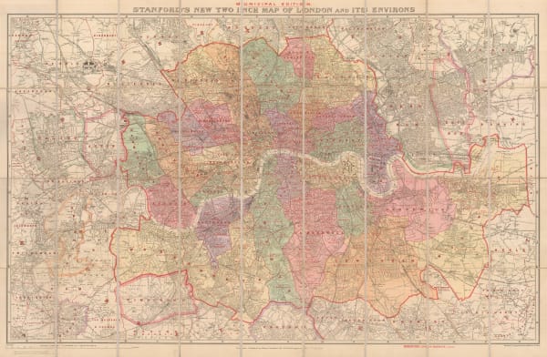
Edward Stanford, Stanford's New Two Inch Map of London and its Environs - Municipal Edition, 1924£ 845.00
-
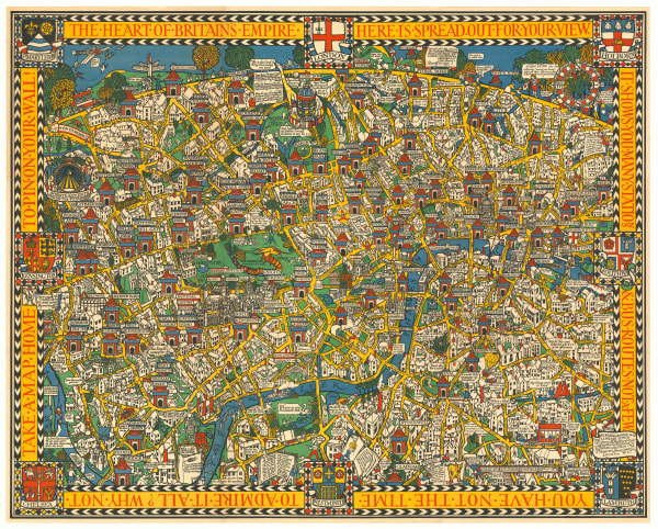
Macdonald Gill, The Wonderground Map of London, 1924 c.£ 4,800 (framed)
-
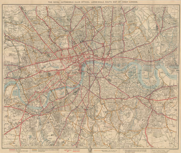
George Philip & Son Ltd., The Royal Automobile Club Official Large Scale Route Map of Inner London, 1925£ 575.00
-
George W. Bacon, Bacon's New Map of London, Divided into Half-Mile Squares and Circles from Charing Cross, 1925 c.£ 775.00
-
-
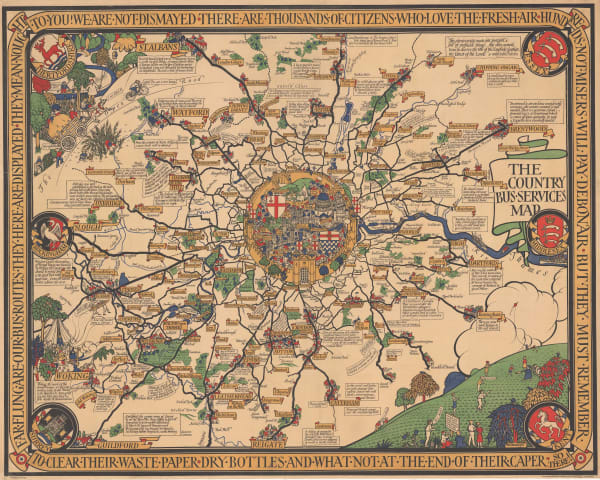
London General Omnibus Co., General Omnibus Map of London, 1929£ 195.00


Page
2
of 3