This International Women’s Day, it seems only right that we are celebrate women in cartography, highlight their achievements and put them on the map. Here are a selection from The Map House collection;
ANNE SEILE
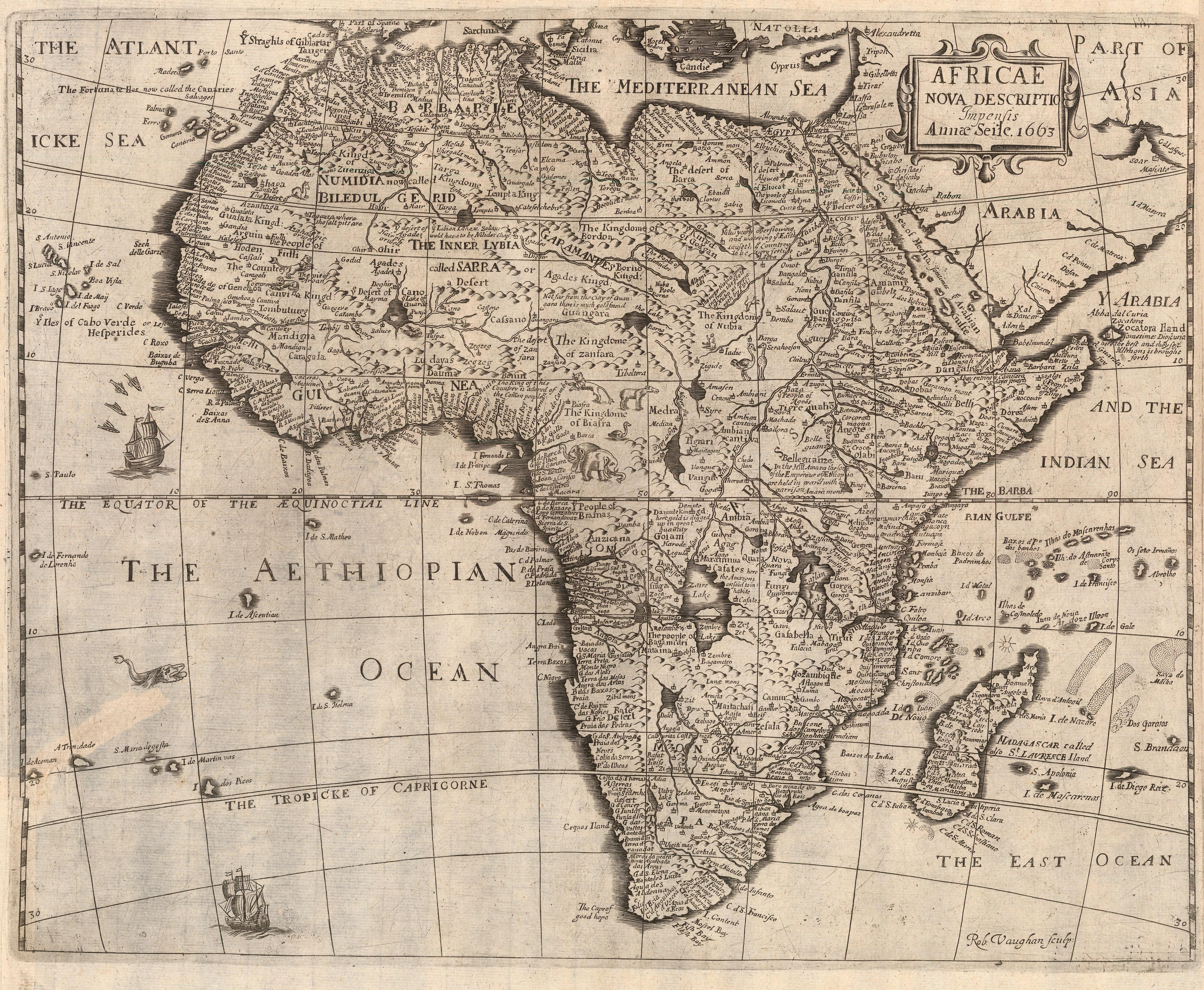
Anne Seile was a publisher working in London. Following the death of her husband, Henry in 1662, she continued his work, publishing a variety of titles – from poetry and proverbs, to history and politics. Anne Seile employed Robert Vaughan to engrave this map only a year after her husband’s death. Henry Seile had previously engraved and published a set of continent maps for Peter Heylin’s “Cosmographie” in 1652. In a third edition, published in 1663, these continent maps were included. Unusually for the period, Seile did not inherit her late husband’s copperplates, and had to instruct Vaughan to re-engrave them to the same specification.
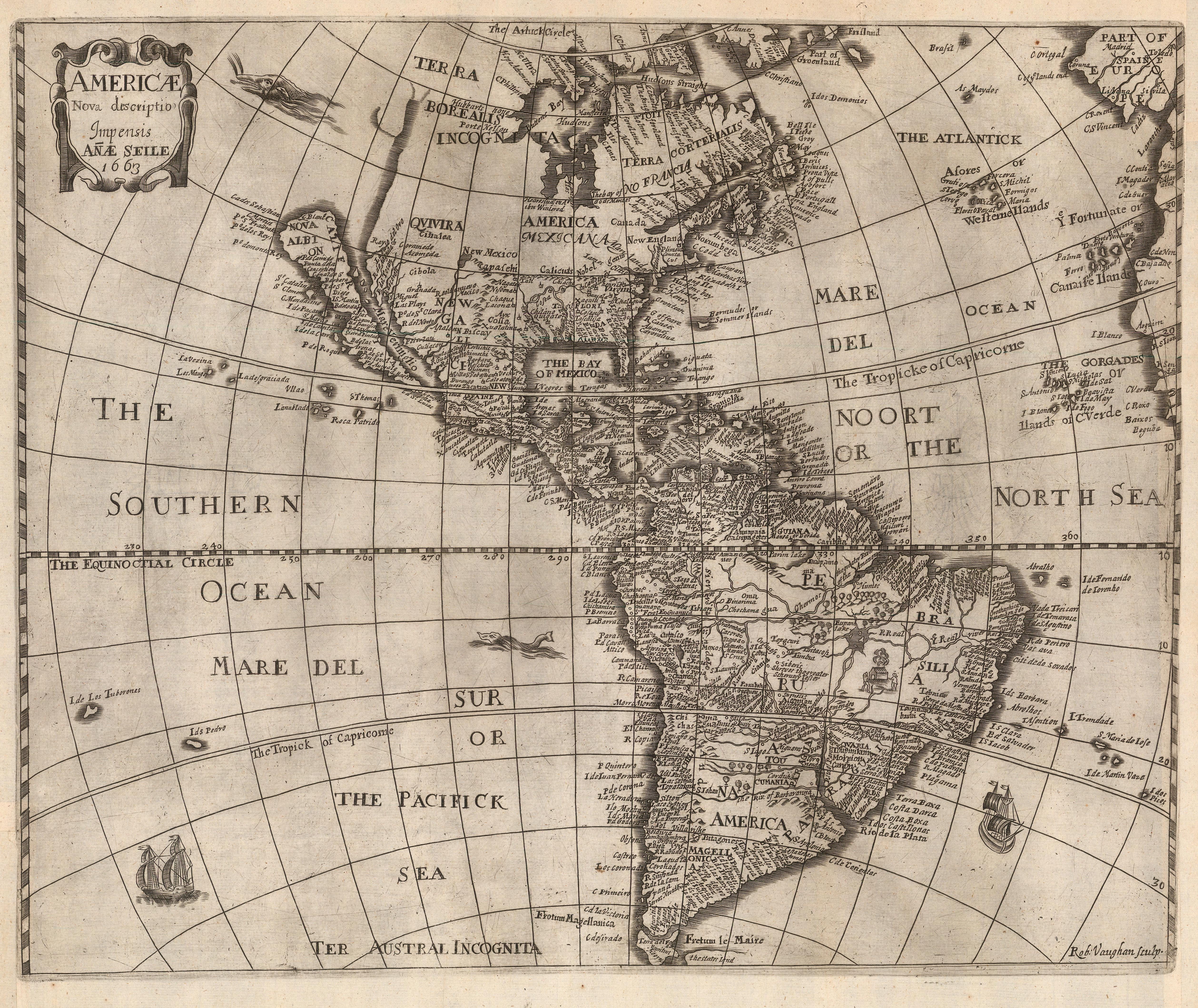
These are the earliest maps of Africa [AFR5665] and the Americas [AMER2272] attributed to a female cartographer, published in London in 1663. The geography of these maps is similar to Henry Seile’s earlier version, though some minor decorative elements were reworked for Anne’s edition. Both are considered archetypal 17th Century maps of the continent. Each map is embellished with sea monsters and ships, and has a menagerie of miniature animals roaming the interior.
MARIE ANGÉLIQUE DUVAL
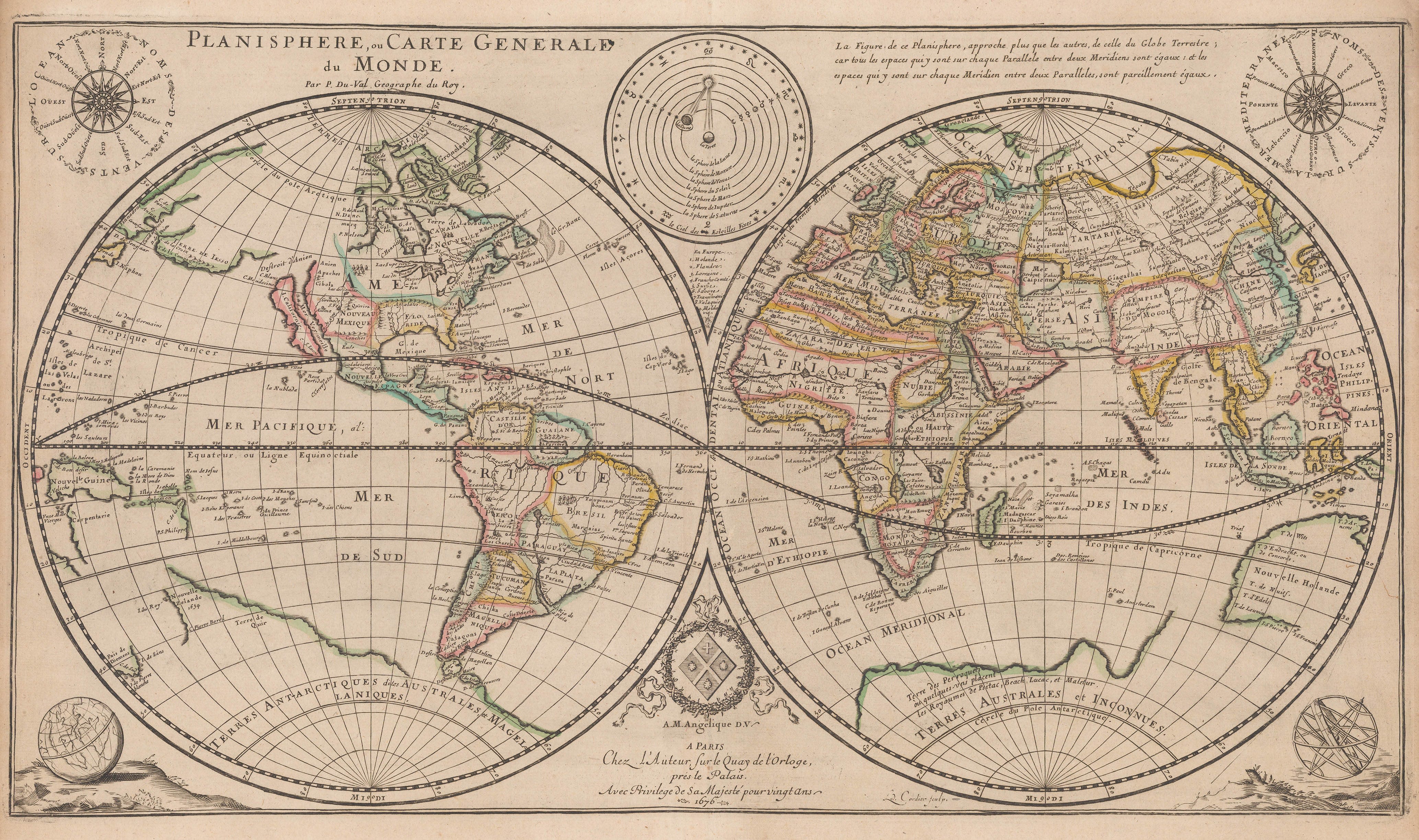
After Pierre Duval’s death in 1683, the business passed to his widow and their two daughters, Marie-Angélique and Michelle. One or both of the daughters continued to publish maps until at least 1707 from Chez Mlle. Duval at their father’s former address. Marie-Angélique Duval then married Guillaume De L’Isle, often considered the first scientific geographer, and one of France’s great cartographers. After De L’Isle’s death in 1726, Marie-Angélique again took over the business, publishing her late-husband’s atlas until the firm could be passed to De L’Isle’s nephew, Philippe Buache. One of the maps in the atlas, the map of Senegal and West Africa, bears the imprint ‘La Veuve Delisle’ (the widow Delisle), the only reminder of Marie-Angélique’s extraordinary role in early French map publishing.
This beautiful copper-engraved double-hemisphere world map was first published by Pierre Duval in 1676. This example was reissued by Duval’s daughter, Marie Angélique, in 1684 from a new copper-plate. Unusually, Marie Angélique Duval’s imprint appears on the map itself in place of her father’s, a real rarity for female mapmakers of this period. [WLD4522]
The map’s geography was already slightly outdated when it was first issued in 1676: the shape of Australia, in particular, is quite old-fashioned. The large southern continent had also begun to disappear from some maps of the period, though it stubbornly remains on Duval’s map. Typically for the period, the map shows California as an island following Sanson’s model.
Above the map are two finely-engraved wind roses (one naming the winds at sea and one naming the winds in the Mediterranean) and an astronomical diagram depicting the geocentric model of the Solar System. In the lower corners are a globe and an armillary sphere.
SELINA HALL
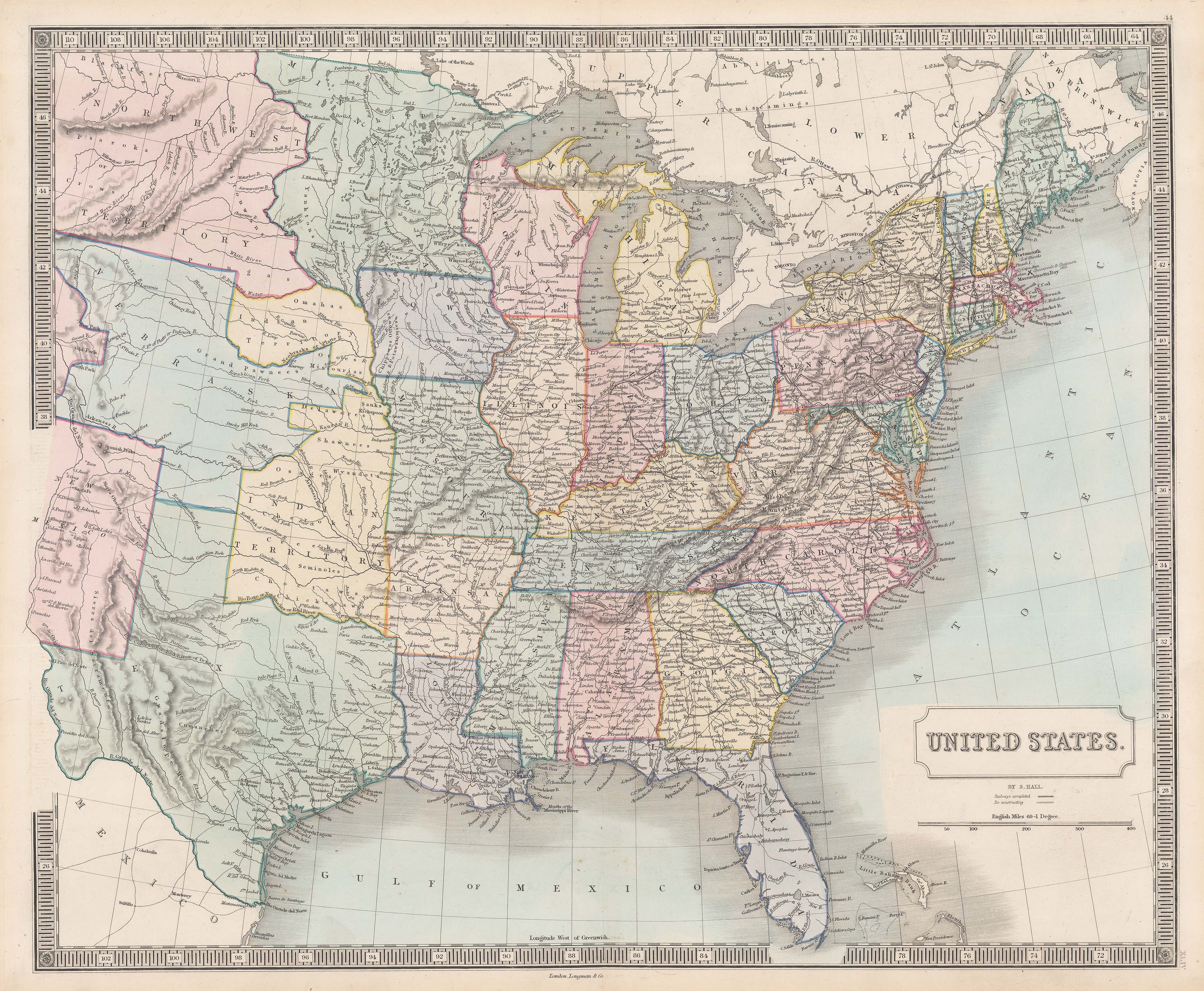
Selina Hall, one of many largely-uncredited women who took over cartographic firms after their husbands’ deaths. Confusingly, Selina signed her maps ‘S. Hall’, which has meant that her work is often confused with her husband Sidney Hall’s. We can be quite certain in our attribution here as Sidney died in 1831 while Wisconsin did not gain statehood until 1848, and Texas was not annexed by the United States until 1845.
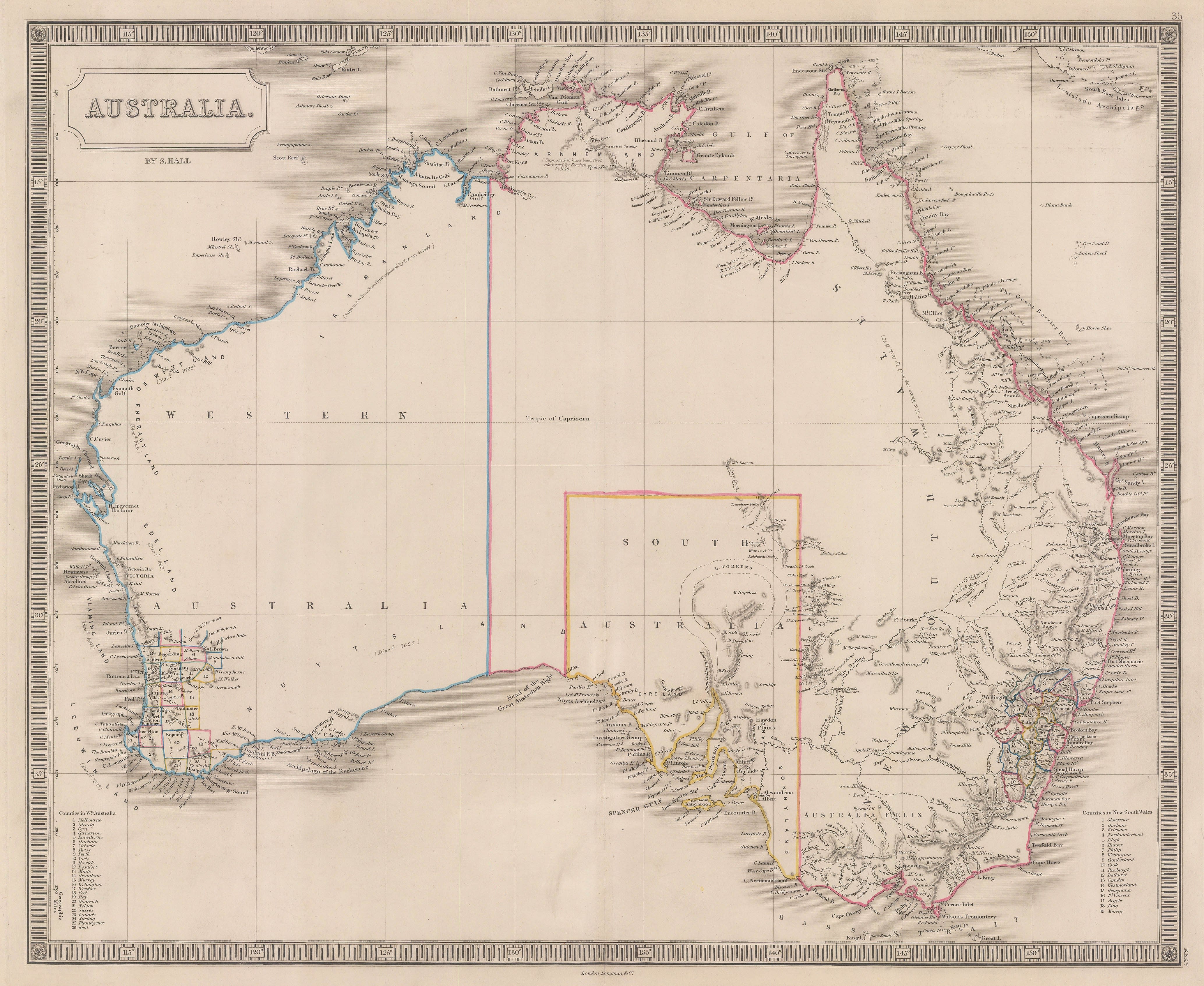
These maps of North America [USA9145] and Australia [AUNZ2836] attributed to Selina. and would have been published within Sidney Hall’s “New General Atlas” was published in multiple editions between 1830 and around 1860 by various iterations of the Longman firm of publishers. Editions after Sidney’s death in 1831 were often updated by Selina Hall to show contemporary developments.
LILLIAN LANCASTER
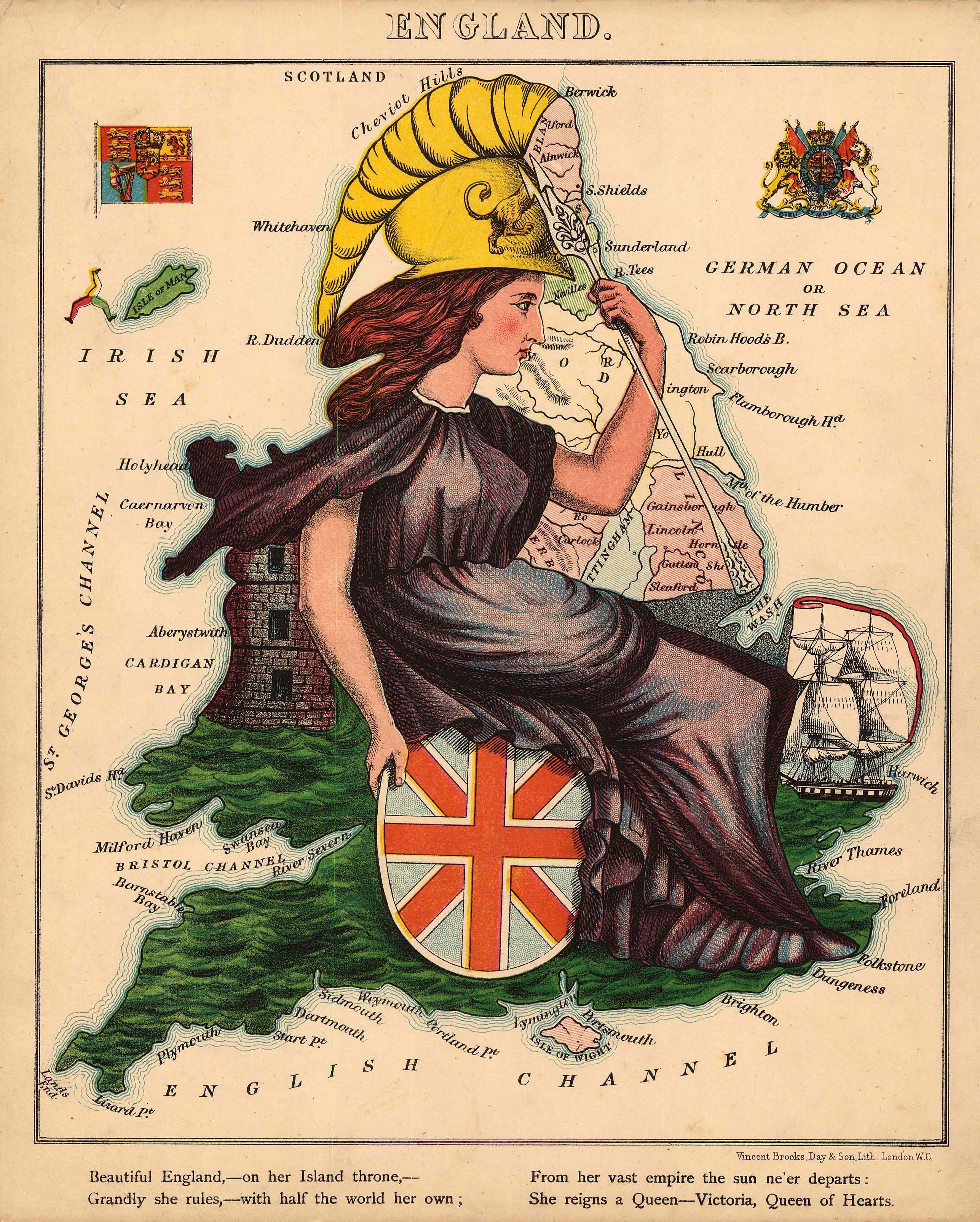
Lilian Lancaster (1852-1939) was a well-known English stage performer and artist. When she was a teenager, trying to amuse her sick brother, she created a series of playful, educational anthropomorphic pictorial maps of 12 European countries. Each illustration inspired by historical events, popular folklore and often stereotypes from each country.
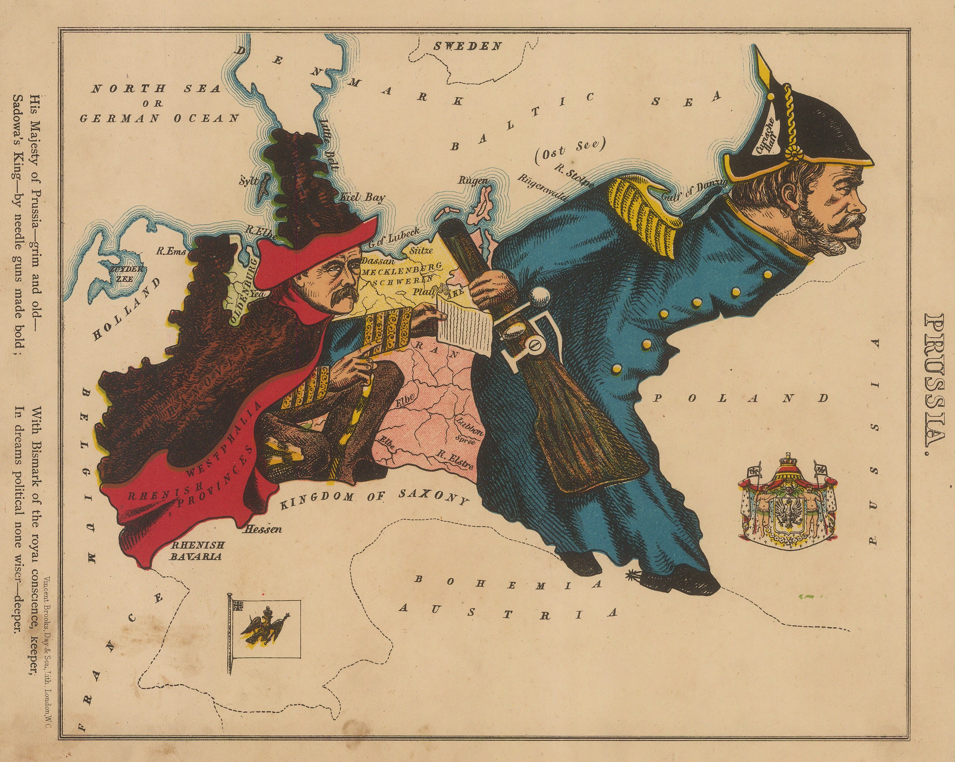
Her collection of maps were adapted and presented in “Geographical Fun, Humourous Outlines of Various Countries” published under the name of Aleph, the pseudonym for London journalist and antiquary, Dr. William Harvey (1796-1873). Released just in time for Christmas in 1868, the book was a great success – and still collectable to this day! Here you can see Britannia, an allegory for England [GB1858], and map of Kingdom of Prussia [POL1018].
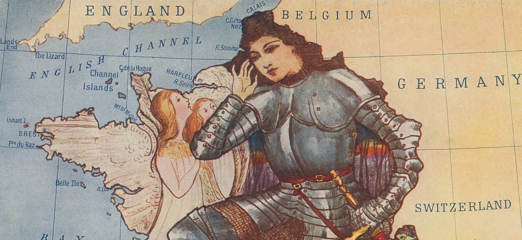
In 1912, Lilian, whom had by this time married and taken the name Tennant, illustrated a collection of popular folk tales compiled by Elizabeth Louisa Hoskyn, published by Adam and Charles Black. A scene of the historical or mythological tales filled the outlines of the country they originated from – the heroic Joan of Arc in France [FR3221], the voyages of discovery in Iceland of Leif Erikson and Erik the Red [SCAN2467], and Tsaritsa Natalya protecting her son Peter (the Great) from an attacking Cossack [RUS2523].
ELIZABETH SHURTLEFF
Shurtleff was a painter and illustrator who attended the Boston School of art in the early 20th Century. A mention must also be made of the distinctive Art Deco border featuring fish and sea life around the map, designed by Elizabeth McMillin, niece of Helen McMillin, who is given credit as co-creator of the map on a cartouche on the upper centre of the Bermuda map.
Shurtleff’s map of Bermuda is often cited as one of the great archetypes of the Golden Age of pictorial maps in the 1920s and 30s. Her map of Bermuda was heavily influenced by Olsen and Clark’s pictorial maps of Washington, Boston and Philadelphia for the publishers Houghton and Mifflin and they in turn had looked to Macdonald Gill in London for their inspiration. Although Bermuda is not Elizabeth’s first map, (New Hampshire in 1926) it is probably her most memorable. [WIND4175]
The gloriously illustrated Art-Deco pictorial celestial map dated circa 1935 includes instructions for use and how to identify constellations in the night sky again displays her bold, graphic style and striking use of colour. [CELEST1182]
There are many, many names to add to this cartographic timeline of female mapmakers, publishers, engravers and map innovators throughout history. We look forward to learning about more of these inspiring women, their stories and contributions to cartography, and acquiring their work in The Map House collection.
If you have any questions about any of the maps listed in this article, please contact maps@themaphouse.com.
