-
 Claudius Ptolemy & Laurent Fries, Ptolemaic Map of France, 1541£ 1,750.00
 -
-
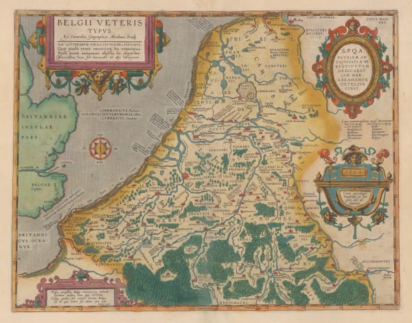
Abraham Ortelius, Ancient Belgium, 1592£ 945.00
-
Abraham Ortelius, Germaniae Veteris Typus, 1592£ 495.00
-
Abraham Ortelius, Illyricvm, 1592£ 925.00
-
Samuel Purchas, Tabula Cananaeae, 1625£ 395.00
-
John Speed, A New Mappe of the Romane Empire, 1627£ 3,950.00
-
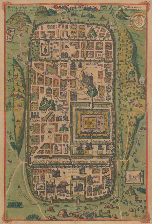
Benito Arias Montanus, Antiquae Jerusalem Vera Icnographiae ad Sacrae Lectionis Praecipve et Aliarvm de Illa Vrbe Historiar. Explicationem ex Collatione Authorum cum Ruinarum Vestigiis, ac Situ Ipso, 1640 c.£ 575.00
-
Jan Jansson, Thraciae Veteris Typus, 1640 c.£ 625.00
-
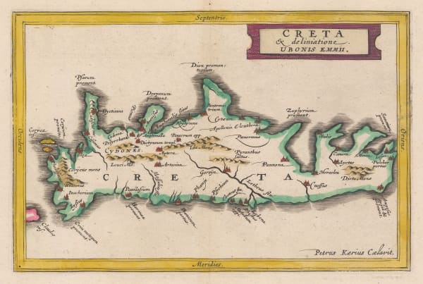
Jan Jansson, Ancient Crete, 1661£ 245.00
-
Jan Jansson, Ancient Greece, 1661£ 325.00
-
Jan Jansson, Northern Italy, or Cisalpine Gaul, 1661£ 195.00
-
Jan Jansson, Ancient Thrace, 1661£ 175.00
-
Jan Jansson, Tuscany during the Roman Period, 1661£ 285.00
-
Giovanni Giacomo Rossi, La Grecia Vniversale Antica, 1683£ 850.00
-
Herman Moll, The Roman Roads of England, 1723£ 245.00
-
Herman Moll, Historical Map of the Roman Empire, 1730 c£ 2,450.00
-
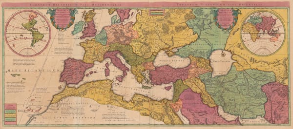
Covens (Jean) & Mortier (Cornelius), Theatrum Historicum pars Occidentalis and Theatrum Historicum pars Orientalis, 1730 c.£ 2,450.00
-
Robert Sayer, Orbis Romani Pars Orientalis, 1780£ 195.00
-
Thomas Conder, A Correct Plan of the Antient City of Jerusalem, and Parts Adjacent, 1780 c.£ 225.00
-
Robert Sayer, Aegyptus Antiqua, 1780 c.£ 195.00
-
J.M. Wauthier, Battlefields. A Graphical Guide to the Places described in the History of England, 1790 c.£ 495.00
-
Robert Wilkinson, Belli Trojana, 1798£ 295.00
-
Robert Wilkinson, Saxon England, 1800£ 75.00
-
Robert Wilkinson, Siciliae Antiquae Tabula, 1800£ 95.00
-
Robert Wilkinson, Alexandri Magni Itinera in Expeditione inter Macedoniam, Libyam, et Indiam, 1807£ 125.00
-
C.V. Lavoisne, Geographical and Historical Map of Greece, 1813£ 245.00
-
J. Vincent, Pass of Thermopylae, 1828£ 68.00
-
J. Vincent, Scythia Illustrative of Herodotus, 1828£ 64.00
-
Society for the Diffusion of Useful Knowledge (SDUK), Ancient Egypt, 1831£ 120.00
-
Royal Geographical Society (RGS), Minoa and Nisea in the Gulf of Aegina, 1837£ 58.00
-
Royal Geographical Society (RGS), Map to illustrate Major Rawlinson's route from Zohab to Khuzistan, 1839£ 145.00
-
Clark, A Map of Gallia Cisalpina Liguria and the Neighbouring Countries, 1840 c.£ 100.00
-
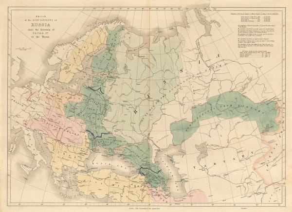
John Arrowsmith, Sketch of the Acquisitions of Russia since the Accession of Peter 1st to the Throne, 1842£ 495.00
-
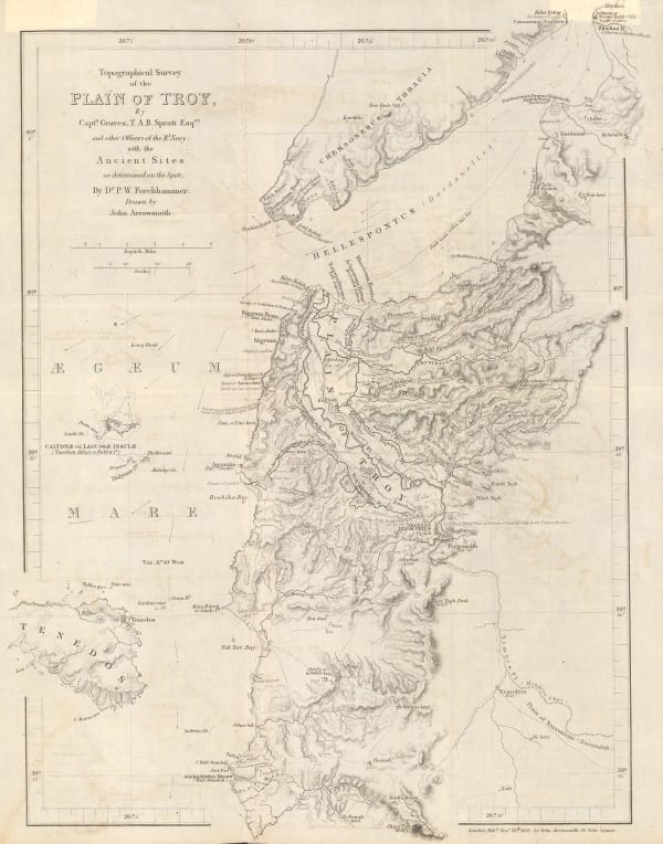
Royal Geographical Society (RGS), Topographical Survey of the Plain of Troy with the Ancient Sites, 1842£ 380.00
-
Royal Geographical Society (RGS), Ruins of Ancient Milos, 1852£ 88.00
-
-
Edward Quin, A.D. 1660. At the Restoration of the Stuarts, 1856£ 385.00
-
Edward Quin, A.D, 476. The Dissolution of the Western Empire, 1856 c.£ 125.00
-
Royal Geographical Society (RGS), Sketch of the Battle of Marathon, 1857£ 82.00
-
Edward Quin, A.D. 1783. Independence of the United States, 1865 c.£ 495.00
-
Edward Quin, A.D. 395, The Division of the Roman Empire, 1865 c.£ 175.00
-
Edward Quin, B.C. 1491. The Exodus of the Israelites, 1865 c.£ 95.00
-
Royal Geographical Society (RGS), Plan of the Principal Group of Ruins at Copan, 1886£ 250.00
-
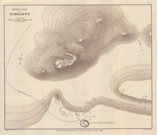
Royal Geographical Society (RGS), General Plan of Zimbabwe, 1892£ 175.00
-
Karl Baedeker, Carthage, 1911£ 44.00
-
Royal Geographical Society (RGS), Air Mosaic of Petra, 1924£ 225.00
-
Ceylon Survey Department, Plan of Anuradhapura and Environs shewing Ancient Ruins, 1926£ 645.00
-
Royal Geographical Society (RGS), Map to illustrate the Historical Geography of the March Lands of Georgia, 1929£ 72.00
-
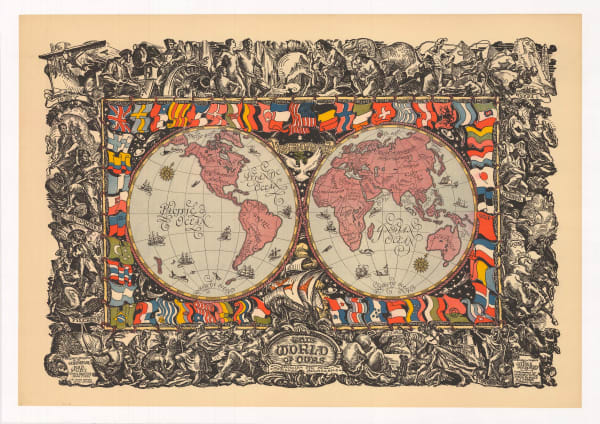
James Daugherty, This World of Ours, 1929 c.£ 2,500.00
-
Royal Geographical Society (RGS), Petra, 1930£ 225.00
-
Service géographique de l'Indochine, Carte Archaeologique de la Region d'Angkor, 1939£ 3,250.00
-
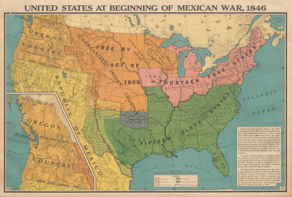
Franklin Scott, Territorial Expansion to 1848: The Mexican War, 1954£ 345.00
-
Franklin Scott, The European Background - The Medieval World, 1954£ 385.00
Close
Search Inventory
Our entire inventory of over 10,000 antique and vintage maps is now available to browse by region, date, cartographer, and subject


Join our mailing list
* denotes required fields
We will process the personal data you have supplied to communicate with you in accordance with our Privacy Policy. You can unsubscribe or change your preferences at any time by clicking the link in our emails.
![]()