-
 Capt. James Cook, James Cook's Map of New South Wales & Queensland, 1774£ 1,250.00
 -
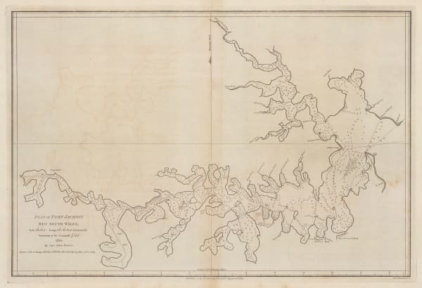
John Stockdale, Plan of Port Jackson, New South Wales, 1789£ 1,250.00
-
Capt. James Cook, Mond van de Endeavour Rivier in Nieuw Zuid Wales - Botanie Baai in Nieuw Zuid Wales, 1794£ 185.00
-
Franz Anton Schraembl, Karte aller Theile von Neu Sud-Wallis, 1795£ 825.00
-
Louis-Claude de Freycinet, Plan du Port Jackson/Plan du Comte de Cumberland, 1811£ 4,950.00
-
-
-
Philippe Vandermaelen, Partie de la Nlle. Galles du Sud., 1827£ 985.00
-
Justus Perthes, Neu-Sud-Wales, 1828£ 395.00
-
John Thomson, A Chart of New South Wales, Van Diemen's Land &c., 1828£ 1,250.00
-
Royal Geographical Society (RGS), Map of the South East portion of Australia, 1832£ 795.00
-
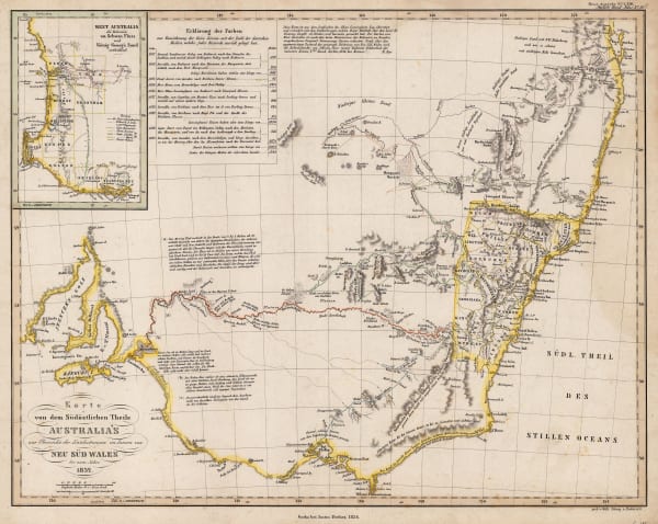
Justus Perthes, Karte von dem Sudostlichen Theile Australia's, 1834£ 375.00
-
Rest Fenner, Colony of New South Wales, 1836£ 125.00
-
Royal Geographical Society (RGS), Sketch of New England, Beardy Plains, the Clarence & Richmond Rivers New South Wales, 1844£ 145.00
-
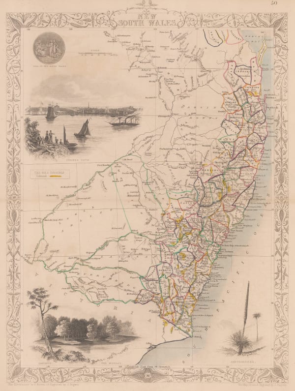
John Tallis, New South Wales, 1851£ 385.00
-
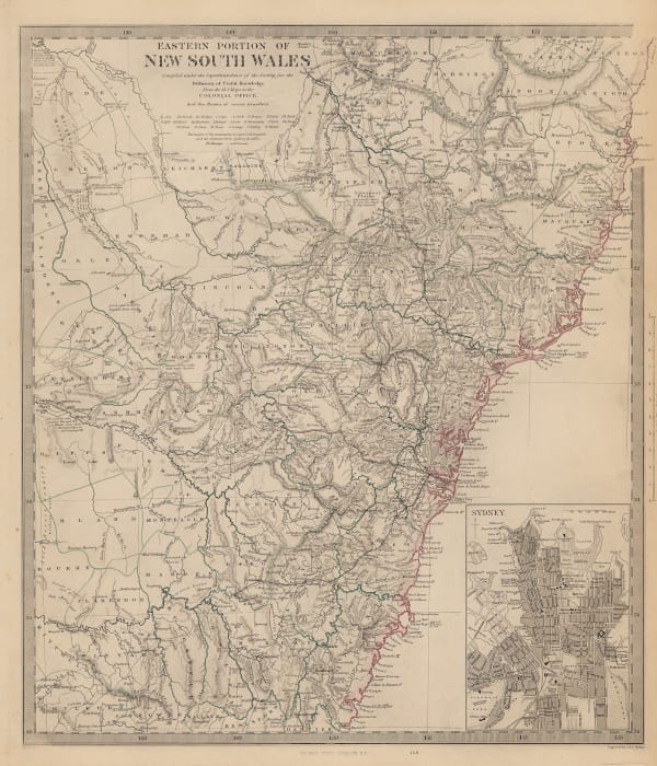
John Arrowsmith, The South Eastern Portion of Australia compiled from Colonial Surveys, 1853£ 2,250.00
-
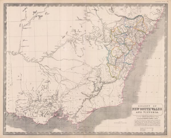
Alexander Keith Johnston, New South Wales and Victoria, 1858 c.£ 495.00
-
Royal Geographical Society (RGS), Expeditions in Search of Burke and Wills, 1863£ 1,250.00
-
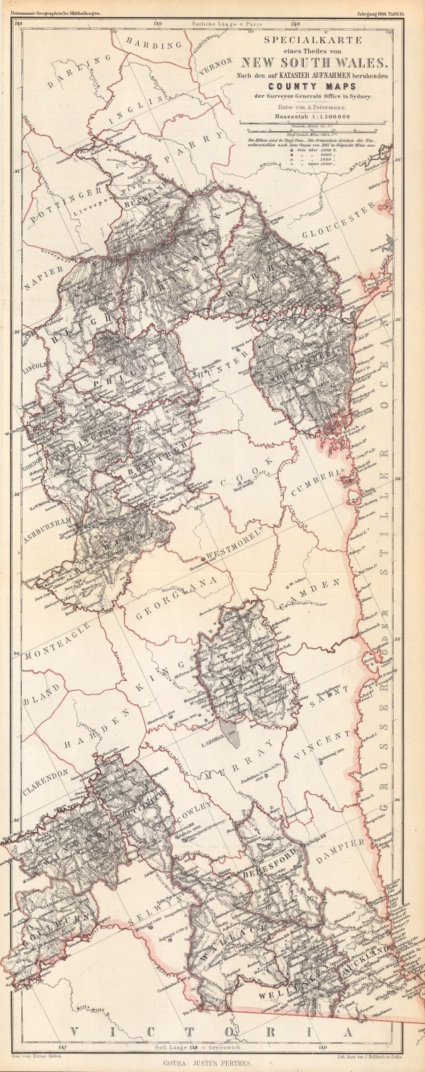
Justus Perthes, New South Wales, 1867£ 88.00
-
Thomas Richards, Sketch Map of New South Wales, 1876£ 885.00
-
Society for the Diffusion of Useful Knowledge (SDUK), New South Wales, 1879£ 345.00
-
W. & A.K. Johnston, South Australia, New South Wales and Victoria, 1890 c.£ 95.00
-
Letts & Son, Northern New South Wales & Southern Queensland, 1892£ 66.00
-
Joseph Pearson, Road Map of 50 Miles around Sydney, 1910 c.£ 295.00
-
Edward Fisher Pittman, Geological Map of New South Wales, 1914£ 1,450.00
-
Dept. of Lands, Map of the South Eastern Tourist District, 1932£ 425.00
-
Dept. of Lands, Map of the North Eastern Tourist District, 1938£ 325.00
-
Dept. of Lands, Map of the Central Northern Tourist District, 1939£ 225.00
-
Dept. of Lands, Map of the Central Southern Tourist District including Riverina, 1940£ 295.00
Close
Search Inventory
Our entire inventory of over 10,000 antique and vintage maps is now available to browse by region, date, cartographer, and subject


Join our mailing list
* denotes required fields
We will process the personal data you have supplied to communicate with you in accordance with our Privacy Policy. You can unsubscribe or change your preferences at any time by clicking the link in our emails.
![]()