-

-
Robert Morden, A New Map of New Jarsey and Pensilvania, 1688£ 885.00
-
Matthaus Seutter, Pensylvania, Nova Jersey et Nova York, 1745 c.£ 3,450.00
-
Homann Heirs, Partie Occidentale de la Nouvelle France ou du Canada, 1755£ 3,650.00
-
London Magazine, A Map of the Eastern part of the Province of New York with part of New Jersey, 1756£ 525.00
-
London Magazine, A Map of the Province of Pennsylvania, 1756£ 495.00
-
John Gibson, A Plan of the City of Philadelphia with the Country Adjacent., 1761£ 245.00
-
Andrea Scacciati, Carta rappresentante i cinque Laghi del Canada, 1763£ 675.00
-
Jacques-Nicolas Bellin, Plan de Philadelphia et Environs, 1764£ 695.00
-
Antoine de Sartine, Carte de la Baye et Riviere de Delaware, 1778£ 1,350.00
-
Antonio Zatta, La Pensilvania La Nuova York, Il Jersey Settentriole, Con La Parte Occidentale Del Connecticut, Massachusset-S-Bay E L'Irochesia, 1779£ 825.00
-
John Bew, New York and part of the Jerseys, New England and Canada, 1780£ 1,495.00
-
Osgood Carleton, A Map of Pensylvania, 1795£ 495.00
-
Morris Birkbeck, Map of part of the United States of North America with the Territory of Illinois on the Ohio particularly designed to illustrate Birkbeck's Journey, 1818£ 1,250.00
-
Carey & Lea, Geographical, Statistical and Historical Map of Pennsylvania, 1822£ 1,550.00
-
I.T. Hinton, Map of the States of Pennsylvania and New Jersey, 1832£ 240.00
-
Joseph Meyer, Neueste Karte von Pennsylvania, 1845£ 275.00
-
Joseph Meyer, Philadelphia, 1845 c.£ 345.00
-
Samuel Augustus Mitchell, A New Map of Pennsylvania with its Canals, Rail-Roads & c., 1846£ 275.00
-
Samuel Augustus Mitchell, Philadelphia, 1846£ 295.00
-
Joseph Hutchins Colton, Pennsylvania, 1855£ 185.00
-
Joseph Hutchins Colton, The Cities of Pittsburgh and Allegheny - The City of Cincinnati, 1855£ 88.00
-
Samuel Augustus Mitchell, Plan of Philadelphia, 1860£ 225.00
-
Johnson & Ward, Johnson's Pennsylvania and New Jersey, 1864£ 195.00
-
Frank Arnold Gray, Pennsylvania, 1878 c.£ 140.00
-
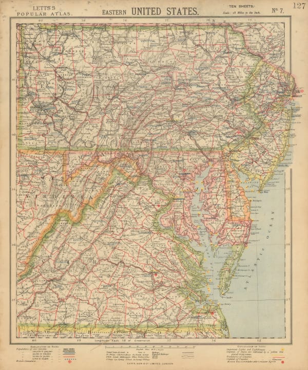
Letts & Son, Eastern United States, 1883£ 68.00
-
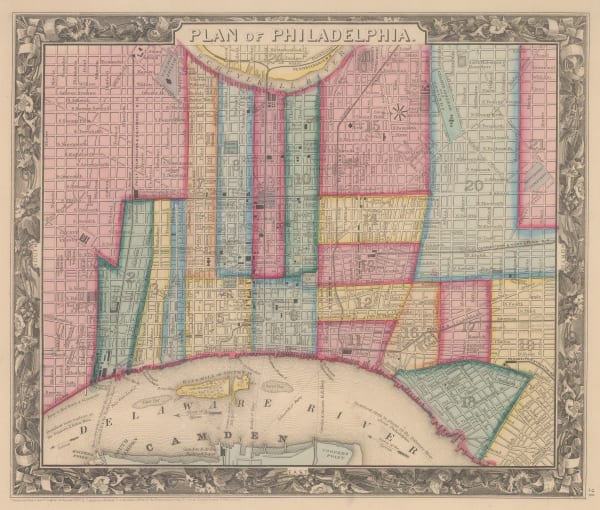
Samuel Augustus Mitchell, Plan of the City of Philadelphia and Camden, 1884£ 165.00
-
Arbuckle Brothers Company, [Pennsylvania], 1889£ 115.00
-
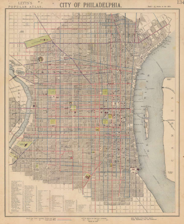
Letts & Son, City of Philadelphia, 1892£ 225.00
-
American Civil War, Route Map of Gettysburg Campaign, 1894£ 675.00
-
George Cram, Pennsylvania, 1897£ 165.00
-
Karl Baedeker, Gettysburg, 1909£ 52.00
-
Karl Baedeker, Philadelphia, 1909£ 78.00
-
National Map Company, National Street Map of the Pittsburgh Area, 1930£ 1,750.00
-
George W. Buohl, Buohl's Illustrated Map and Guide to Tour The Gettysburg Battlefield, 1936£ 250.00
Close
Search Inventory
Our entire inventory of over 10,000 antique and vintage maps is now available to browse by region, date, cartographer, and subject


![Arbuckle Brothers Company, [Pennsylvania], 1889](https://artlogic-res.cloudinary.com/w_600,c_limit,f_auto,fl_lossy,q_auto/artlogicstorage/themaphouse/images/view/22099416ce7b47ac0a4a1b2292eb3ceej/themaphouse-arbuckle-brothers-company-pennsylvania-1889.jpg)


Join our mailing list
* denotes required fields
We will process the personal data you have supplied to communicate with you in accordance with our Privacy Policy. You can unsubscribe or change your preferences at any time by clicking the link in our emails.
![]()