-
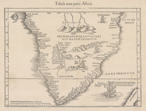
 Martin Waldseemüller & Laurent Fries, The Second Printed Map of Southern Africa, 1541£ 4,950.00
 -
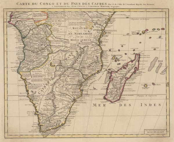
Covens (Jean) & Mortier (Cornelius), Southern & Central Africa, 1730 c.£ 1,250.00
-
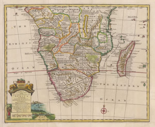
Emanuel Bowen, A New & Accurate Map of the Southern Parts of Africa, 1747£ 695.00
-
Herman Moll, Southern & Central Africa, 1755 c.£ 345.00
-
Charles Francois Delamarche, Southern & Central Africa, 1795£ 325.00
-
Charles Smith, South & Central Africa, 1828£ 285.00
-
Adrien Brue, Southern Africa & the Cape Colony, 1828 c.£ 250.00
-
Justus Perthes, Skizze einer Karte eines Theils von Ost u Central Afrika, 1856£ 595.00
-
Royal Geographical Society (RGS), East Africa Expedition - Pangani to Fuga, 1859£ 195.00
-
Justus Perthes, Mt Kilimanjaro, 1864£ 78.00
-
Royal Geographical Society (RGS), A Map of The Albert N'Yanza, 1866£ 645.00
-
Royal Geographical Society (RGS), A Map Showing the Routes of Some Native Caravans from the Coast into the Interior of Eastern Africa, 1870£ 725.00
-
Justus Perthes, Exploration of Zambia, Malawi & Tanzania, 1870£ 78.00
-
Royal Geographical Society (RGS), Slave Caravan Route, 1874£ 195.00
-
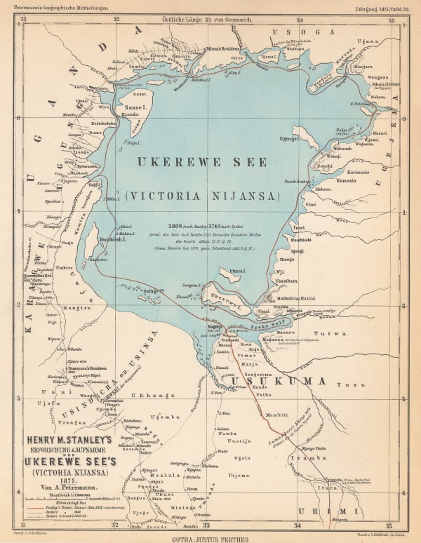
Justus Perthes, Lake Victoria according to Stanley, Speke & Grant, 1875£ 125.00
-
Royal Geographical Society (RGS), Map of Lake Tanganyika from Ujiji to its Southern Extremity, 1875£ 325.00
-
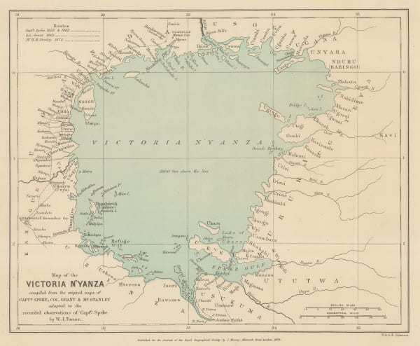
Royal Geographical Society (RGS), Lake Victoria according to Stanley, Speke & Grant, 1876£ 225.00
-
Royal Geographical Society (RGS), Lake Victoria according to Stanley, Speke & Grant, 1876£ 295.00
-
Royal Geographical Society (RGS), Sketch Map of Native Routes from Dar Es Salaam Towards the Head of Lake Nyassa, 1879£ 125.00
-
Royal Geographical Society (RGS), Map of the Route of the R.G.S. East African Expedition to Lakes Nyassa & Tanganyika, 1880£ 165.00
-
Royal Geographical Society (RGS), Route Survey Between Lakes Nyassa & Tanganyika, 1880£ 125.00
-
Royal Geographical Society (RGS), Mt Kilimanjaro, 1885£ 675.00
-
Scottish Geographical Society (SGS), Stanley's Emin Pasha Expedition, 1886£ 395.00
-
G. & J. Bartholomew, Central Africa, 1887£ 42.00
-
Royal Geographical Society (RGS), East Africa, 1887£ 485.00
-
Royal Geographical Society (RGS), Mr. C.S.Smiths Journeys near Mombasa and from Kilwa to the Rovuma, 1887£ 88.00
-
Scottish Geographical Society (SGS), The Stevenson Road from Lake Malawi to Lake Tanganyika, 1890£ 275.00
-
Scottish Geographical Society (SGS), Stanley's Emin Pasha Expedition, 1890£ 775.00
-
Royal Geographical Society (RGS), Sketch Map of the Route of the Emin Pasha Relief Expedition, 1890£ 325.00
-
Royal Geographical Society (RGS), A Sketch Map of Ibea, 1892£ 545.00
-
Justus Perthes, Karte der Berliner-Missions-Expedition im Norden des Nyassa, 1892£ 68.00
-
Justus Perthes, Spezialkarte der Kilima-Ndscharo und Meru-Gebietes, 1893£ 2,450.00
-
War Office, Map of Part of British and German East Africa including the British Protectorate of Uganda, 1894£ 1,650.00
-
Jean Jacques Élisée Reclus, Sources of the Nile and Nyanza Plateau, 1894£ 75.00
-
Royal Geographical Society (RGS), Map of Part of East Africa, 1895£ 190.00
-
Royal Geographical Society (RGS), Nyasa Tanganyika Plateau, 1899£ 295.00
-
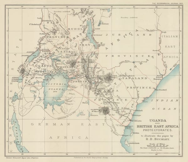
Royal Geographical Society (RGS), Uganda and British East Africa Protectorates, 1903£ 425.00
-
Geographical Section, General Staff (GSGS), Kilimanjaro, 1905£ 895.00
-
Royal Geographical Society (RGS), Victoria Nyanza to Mt. Kilimanjaro, 1907£ 445.00
-
Royal Geographical Society (RGS), The Jubilee of Speke's Discovery of Victoria Nyanza, 1909£ 425.00
-
S. Africa Newspaper, Central and South Africa, 1916£ 975.00
-
War Office, Lake Victoria, 1917£ 595.00
-
Royal Geographical Society (RGS), East Africa, 1918£ 525.00
-
Royal Geographical Society (RGS), Boundaries in East Africa, 1926£ 115.00
-
Geographical Section, General Staff (GSGS), Kenya Colony, 1927£ 875.00
-
George Philip & Son Ltd., Philips' New Wall Map of East Africa, 1930 c.£ 1,250.00
-
George Philip & Son Ltd., Map of Tanganyika Territory, 1933£ 875.00
-
Geographical Section, General Staff (GSGS), Tanganyika, 1943£ 445.00
-
Tanganyika Survey, Lindi, 1947£ 385.00
-
Leo Vernon, East Africa, 1948£ 1,250.00
-
Dennis Owen Matthews, East Africa Land of Sunshine, 1954£ 495.00
Close
Search Inventory
Our entire inventory of over 10,000 antique and vintage maps is now available to browse by region, date, cartographer, and subject


Join our mailing list
* denotes required fields
We will process the personal data you have supplied to communicate with you in accordance with our Privacy Policy. You can unsubscribe or change your preferences at any time by clicking the link in our emails.
![]()