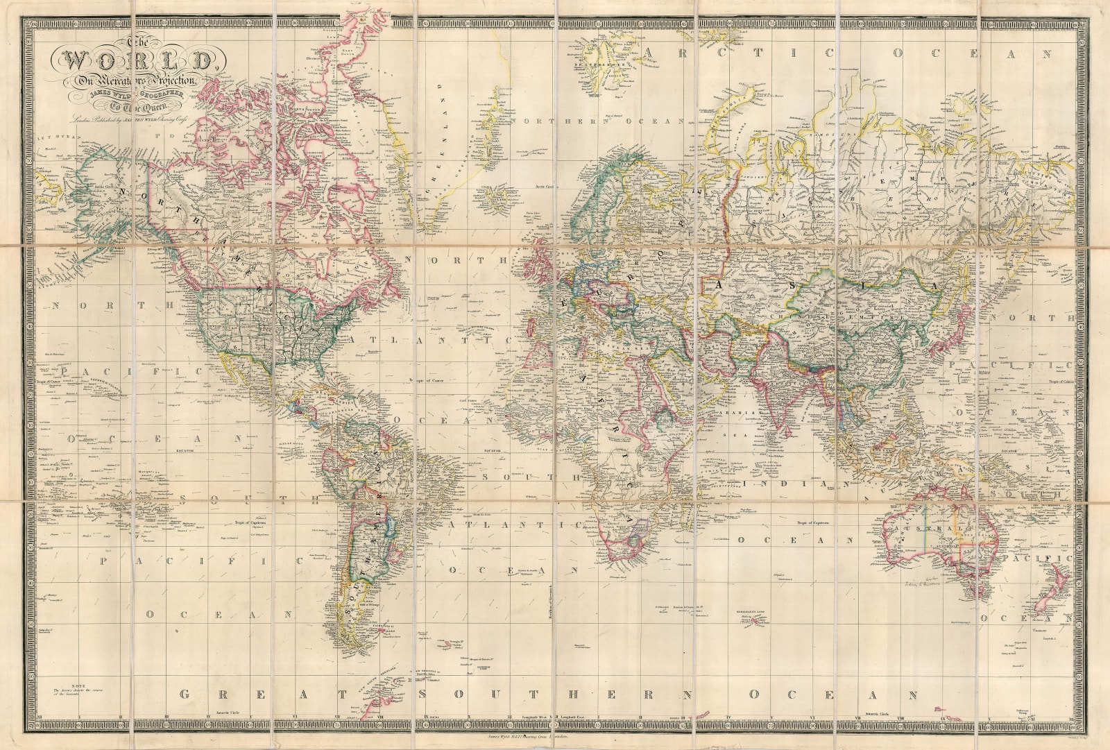
James Wyld
64 x 94 cm
This example was issued very late in the annals of the Wyld firm, probably just before the death of James Wyld the Younger (1812-87), who had been in charge of the firm since 1836 and had taken it to the very top of its sector in Victorian England. As is not uncommon, there is no date on this map but due to Wyld's punctiliousness in updating it geo-politically, it is possible to trace the date to a reasonable accuracy.
This was a time when major world powers where jockeying for position and claiming territory, with Wyld's map a superb indicator of existing and new developments. One of the main changes shown on this map is the portrayal of the Balkans; the Ottomans had suffered a devastating defeat during the Russo-Turkish Wars of 1877-8 which led to the Congress of Berlin in the latter year. The western European powers managed to curb Russia's major demands, such as the creation of an enormous Principality of Bulgaria throughout most of the Balkans, which would also allow a garrison of Russian troops within its borders. Instead, it established the new independence of several countries including Bulgaria and Rumania. Russia did gain the key strategic fortress of Kars in the Caucasus and Rumania had to cede Southern Bessarabia immediately to the Russian Empire. Greece gained territory to its north and Great Britain gained the island of Cyprus, a much needed naval base in the eastern Mediterranean.
This the geo-political activity was not only confined to Europe. In North America, the United States purchased Russian America now Alaska from the Russian Empire in 1867, thus securing a strategically important border. The exact border of what they had purchased was now in dispute with Great Britain through the claims of Canada. In South America, there is another indicator of the date of the issue of this map, with Bolivia shown with a coastline on the Pacific Ocean. They lost access to the Ocean in 1884 after losing the War of the Pacific meaning that the map would have been issued between 1878-84.
The Scramble for Africa was in its very early stages with Great Britain gaining Cape Colony during the Napoleonic Wars and having established multiple small trading stations on the West African coast. The French were far more energetic in obtaining territory in the same region and in Algeria as well as a great deal of influence in Morocco. However, the new rising power on the continent was Egypt under the extraordinary leadership of Mehmet Ali Pasha, who conquered the east coast of Arabia, moved into the Levant and established control in a large part of Sudan and central Africa as far south as modern Uganda, as clearly marked on the map. Mehmet Ali is credited as the father of the modern Egyptian State.
In Asia, power is divided between the British in India, China with their enormous territory in the east, with their Empire stretching from the eastern coast of Asia to modern Kashmir, Afghanistan and the Himalayan States, including Tibet; the Empire also encompasses Mongolia. The final great power as portrayed on the map is Russia with its vast holdings in Siberia, its treaties with China and its continual successes against the weakening Ottoman Empire in the Caucasus.
It is often said that looking at a map is the equivalent of reading multiple history books and this is particularly illustrated by this example.
Original colour. SL. [WLD3984]


