Johannes Cloppenburg
19 x 26 cm
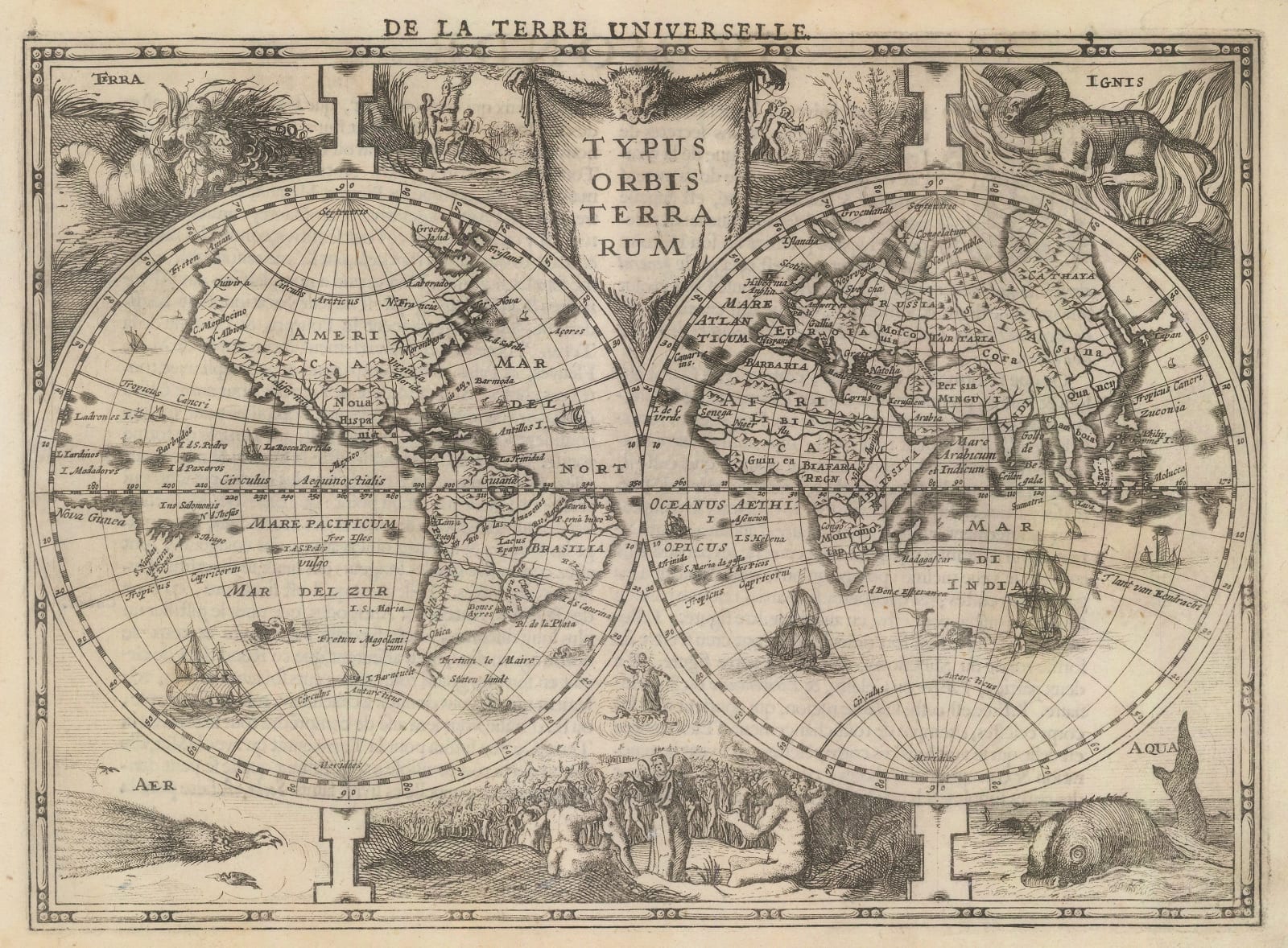
A double-hemisphere map of the world, with alchemical and biblical imagery illustrated along its borders. Issued with the new edition of the ‘Atlas Minor’ in 1630.
A double-hemisphere map of the world, with alchemical and biblical imagery illustrated along its borders. This map was commissioned in Amsterdam by Jan Cloppenburg, a Dutch publisher and bookseller, to be issued with the new edition of his ‘Atlas Minor’ in 1630.
The constrained size of the map has resulted in some crude limitations of its geographical precision. However, it should be observed that Korea is depicted as a peninsula; this is a notable evolution of cartographical accuracy in comparison to most world maps that preceded this one, where Korea was usually depicted as an island. Contrary to the belief of the period, California is also shown as a peninsula; on most world maps, it was erroneously shown as separated from the North American mainland.
The most important feature of the map’s geography is a small stretch of coast in the lower-right area of the eastern hemisphere, labelled as ‘T’lant van Eendracht’. This portion of coastline is the very first reference to Australia found in any atlas map. The inclusion of this coastline was due to the discovery of the Dutch sailor and explorer Dirk Hartog, who charted part of Australia’s west coast aboard his ship, the Eendracht, in 1616. Originally setting out as part of a fleet heading to the Dutch East Indies, the Eendracht was blown off course and became isolated. On the 25th of October, Hartog and his crew stumbled upon “various islands, which were, however, found uninhabited”. They made landfall at an island off the coast of Shark Bay, Western Australia, which is now called Dirk Hartog Island after him. This initial coastal reference was further developed in later versions of the map, such as in the 1673 version by Jansson’s heirs, which showed a much more advanced depiction of Australia.T
The corners of the map are illustrated with alchemical images depicting the four elements. On the upper left, earth is labelled as ‘Terra’ and is symbolised by a cornucopia. The upper right shows fire as ‘Ignis’, symbolised by a salamander. On the lower left, air is ‘Aer’ and is symbolised by a bird of paradise. On the lower right, water is ‘Aqua’, symbolised by a sea monster. The upper centre and lower centre of the map are illustrated with biblical imagery depicting the Temptation in the Garden of Eden and the Last Judgement, respectively.
This beautifully illustrated map is perfect for those who are fascinated by the unique style of the Golden Age of Dutch Cartography (c.1590-1720), and would be especially precious for collectors of Australiana and those interested in Australian history.
French text on reverse. Image available of reverse. [Shirley 334] [WLD4763]


