Letts & Son
62 x 80 cm
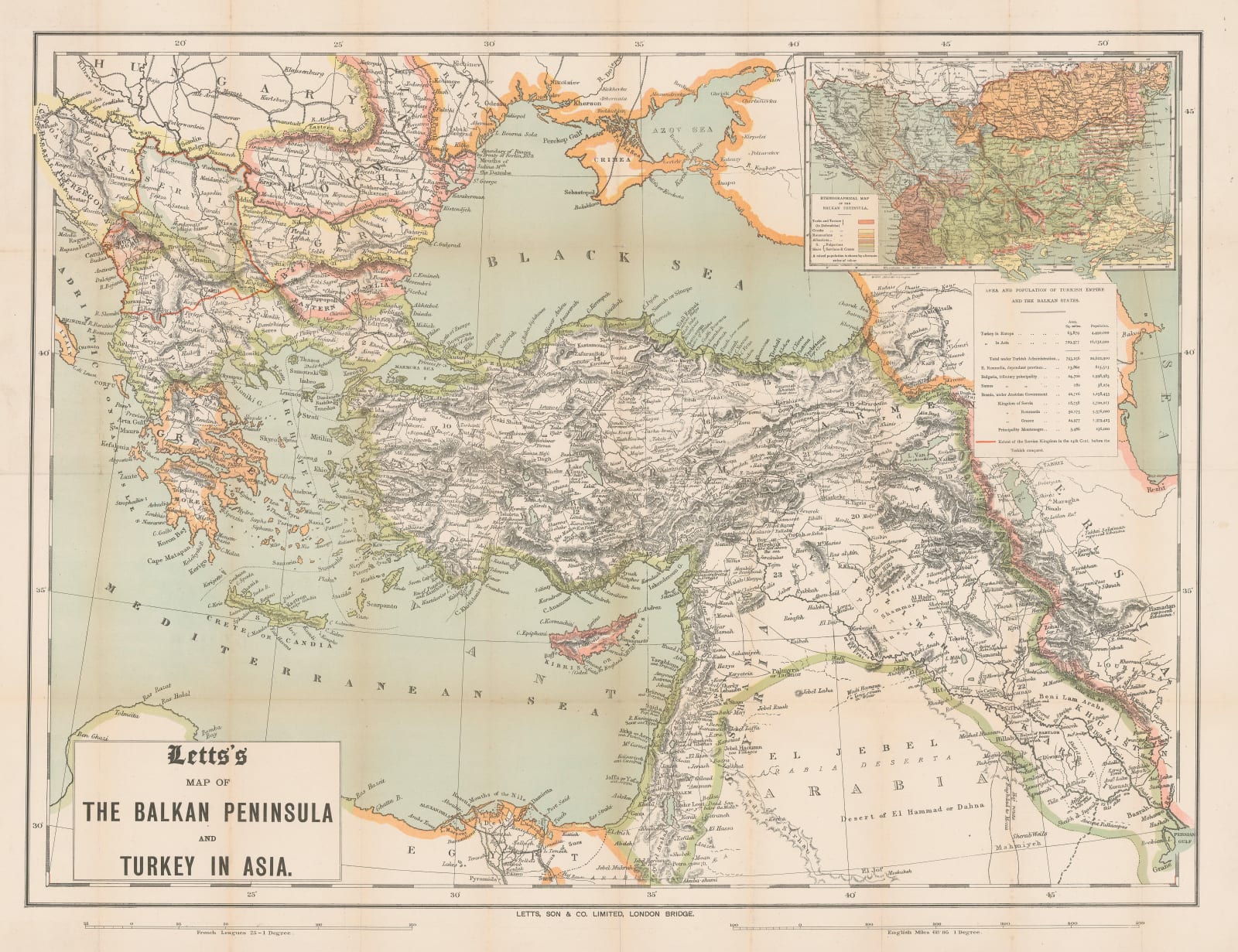
A large inset map in the upper-right corner provides an ethnographic breakdown of the region, with Turkish, Greek, Romanian, Albanian, and Slavic populations distinguished. This is most likely based on the German geographer Heinrich Kiepert's much larger and more detailed ethnographic map of the Balkans, also published in 1878. A table lists the sizes and populations of the nations of the region. A thick red line shows the 14th century historical borders of the Kingdom of Serbia before it was conquered and dismembered by the Ottomans.
This map was almost certainly published to take advantage of public interest in the Balkan question during the Treaty of Berlin negotiations. Britain's involvement in the conference was largely aimed at curbing further Russian advances into Turkey or the Balkans, the same desire which ultimately led to the period of tension between Britain and Russia known as the 'Great Game'.
Printed colour. [MEAST4582]


