US Air Force
Seoul Road Map, 1959
25 x 35 in
64 x 89 cm
64 x 89 cm
SEAS5347
Separately issued map of Seoul, capital of South Korea first surveyed by the U. S. Air Force. This map was most likely to have been first surveyed by the Air...
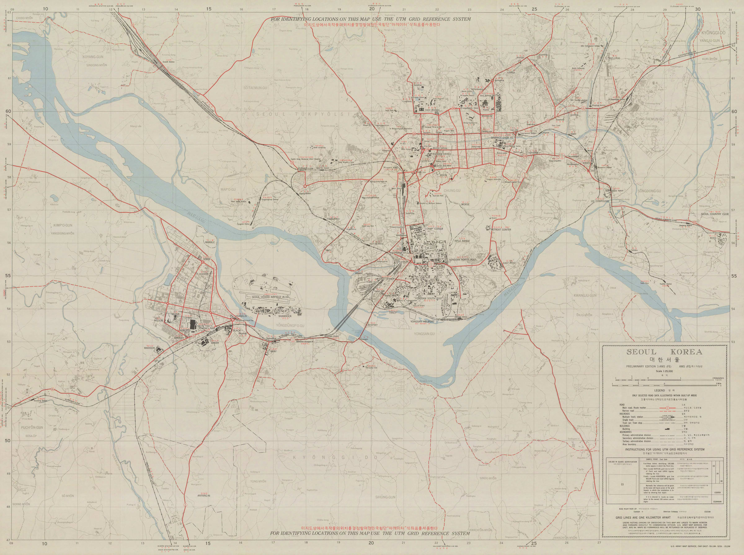
Separately issued map of Seoul, capital of South Korea first surveyed by the U. S. Air Force.
This map was most likely to have been first surveyed by the Air Force during the Korean War of 1950-53 but now it has been adapted for civilian use.
The main face of the map remains functional for the Air Force, retaining the UTM Grid System (Universal Transverse Mercator) which was in use by the United States military. Major roads are marked together with important buildings and features. The map is bilingual in English and Korean.
The reverse shows three maps which focus on specific areas including the downtown area of the city as well as showing a pictorial title panel most likely added after the release of this map for civilian use.
Image available upon request. Original colour. [SEAS5347]