Gregario Hombrados Oñativia
66 x 96 cm
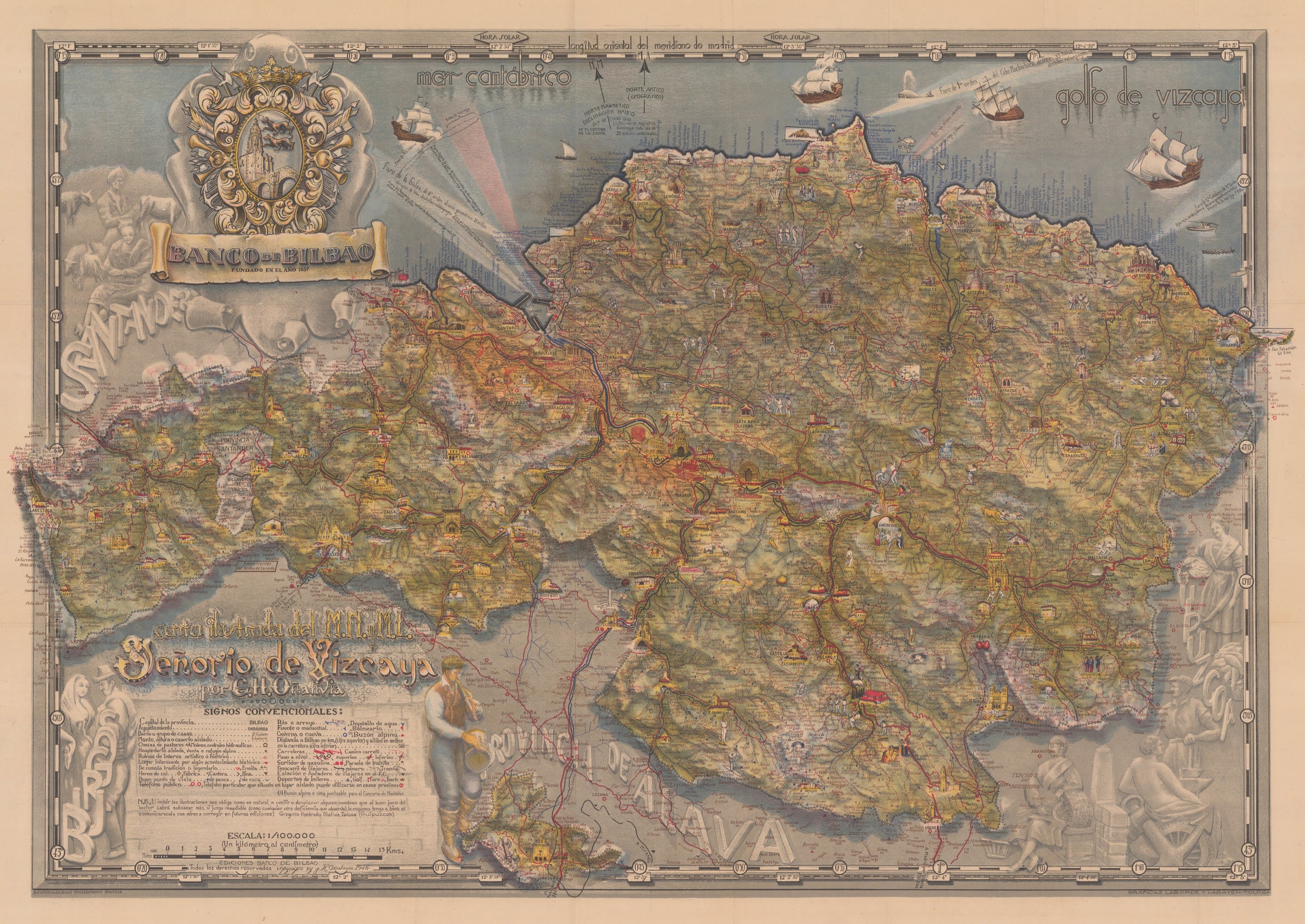
This pictorial map of the Biscay province of Spain was designed by Gregario Hombrados Oñativia (1902-1978) and printed by Laborde y Labayen. It was published in Tolosa by the Banco de Bilbao, one of the largest Spanish banks of the time.
The map is centred on the city of Bilbao. It also includes numerous cities and towns, railways and roads, industrial and public services, recreational activities, historical and geographical features, and many other details of the region. Its colourful palette gives a vibrant energy to the map.
In addition to its lush illustration, this map also features ornate textual elements, with vignettes of the Basque people and their culture throughout the map and its borders with provinces Álava and Guipúzcoa. Small depictions of local churches and other significant buildings are present throughout the geography. A large decorative title reads, ‘Carta ilustrasa del M[uy] N[oble] y M[uy] L[Leal], Señorio de Vizcaya [Historic Lordship of Biscay].’ Despite its extensive homage to the Basque community, all of the text on the map is in Spanish.
[SP2177]