Trento Tourism Dept.
The Dolomites, 1950 c
18 x 26 in
46 x 66 cm
46 x 66 cm
IT3529
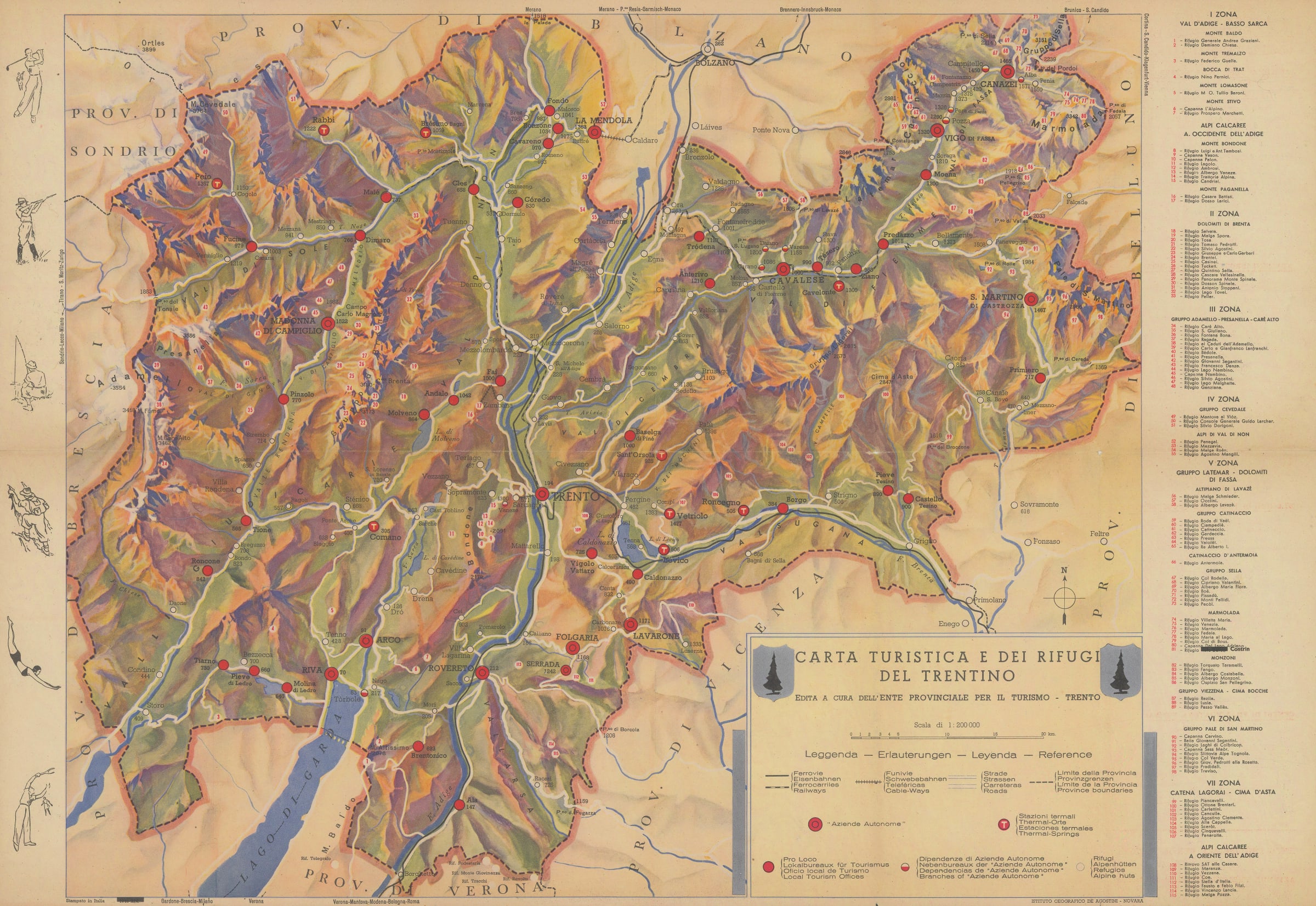
Pictorial map of the Dolomites advertising the attractions of the mountains and the area. The map focuses on the mountains as well as the waystations dotted around the area. A...
Pictorial map of the Dolomites advertising the attractions of the mountains and the area.
The map focuses on the mountains as well as the waystations dotted around the area. A blacked out date of 1941 is present on the lower left border suggesting this map was re-used, probably just after World War II when the area began trying to attract travellers and tourists to the region. Period photographs and further information are present on the reverse.
Image available upon request. Original colour. [IT3529]