J.P. Sayer
St James's Park, 1947
8 x 10 in
20 x 26 cm
20 x 26 cm
LDN7304
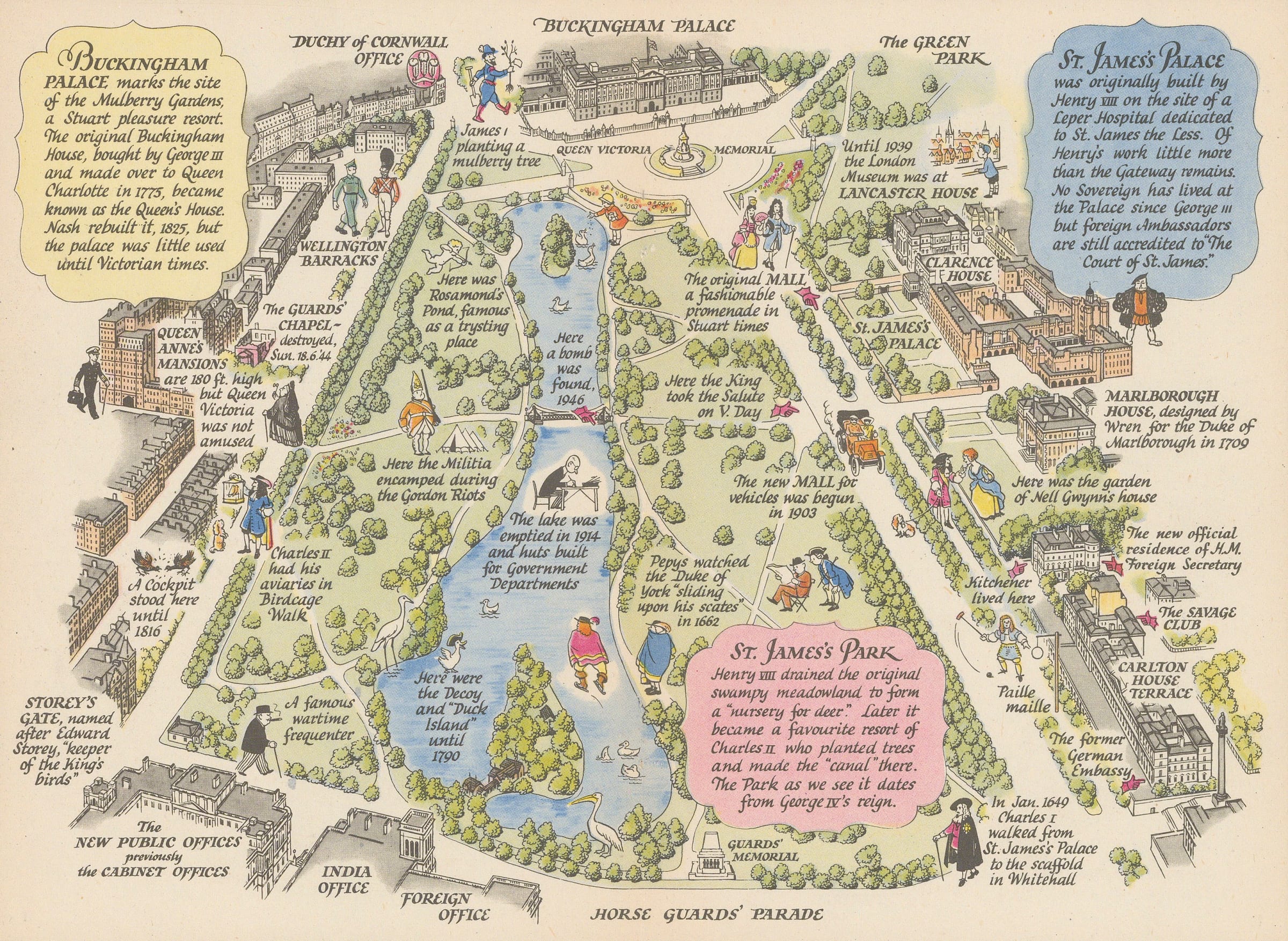
A Prospect of St James's Park Charming pictorial map of the St James's Park, Palace and The Mall and its immediate environs, including Buckingham Palace and the institutional and...
A Prospect of St James's Park
Charming pictorial map of the St James's Park, Palace and The Mall and its immediate environs, including Buckingham Palace and the institutional and military buildings at Horse Guard's Road and Birdcage Walk, alongside illustrations and notes about key historical figures and events. Noteworthy persons and events mentioned include the execution of King Charles I, Sir Winston Churchill, Nell Gwynn and Samuel Pepys. Institutions of note include the Foreign Office, the New Public Offices and Wellington Barracks. Also illustrated are Marlborough House, Carlton House Terrace and Lancaster House.
This map is one a of a series of maps of London neighbourhoods, designed by J.P. Sayer and published monthly in the Strand Magazine from 1946-48. The maps are playful and accessible to an ordinary reader, but also contain a surprising amount of history and detail to explore.
Printed colour. [LDN7304]