James Wyld
London, 1849
16 x 31 in
41 x 79 cm
41 x 79 cm
LDN7013
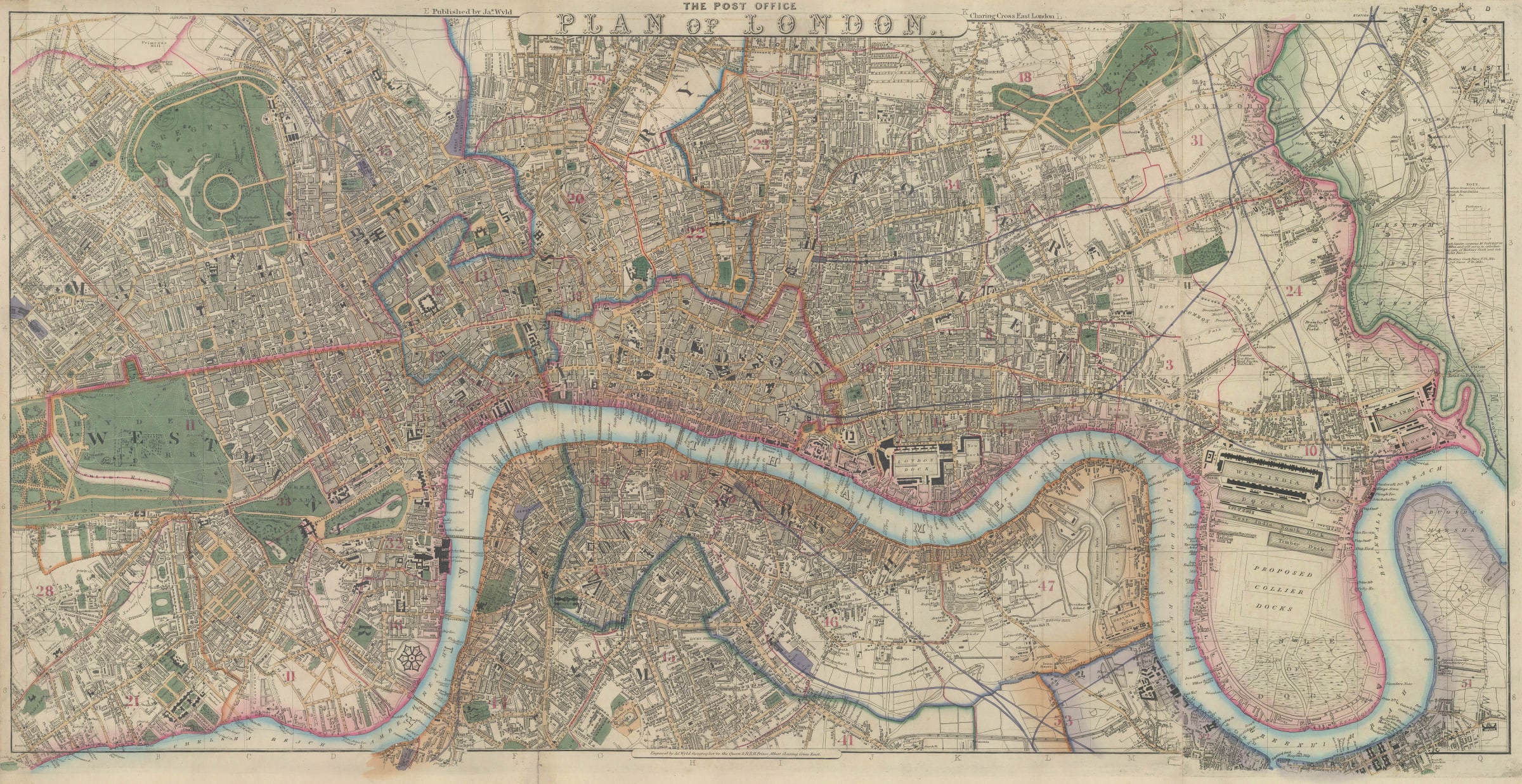
The Post Office Plan of London Central London from James Wyld's 9-sheet map of London stretching from Kensington and Chelsea in the west to Isle of Dogs in the...
The Post Office Plan of London
Central London from James Wyld's 9-sheet map of London stretching from Kensington and Chelsea in the west to Isle of Dogs in the east and Islington to Kennington north to south.
This map, first published as part of a 9-sheet atlas of London in 1848-49, is rarely found in this unjoined format, making these individual regional sections extremely scarce on the market. Early railway lines are shown on the map. Formal parks and gardens are shaded in green. The map is exceedingly detailed with virtually every building individually drawn and field boundaries outlined.
Original colour. [LDN7013]