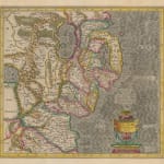
Mercator Hondius
36 x 38 cm
Beautiful example of Mercator's map of eastern Ulster focusing on the modern counties of Down and Antrim.
The map stretches from Carrickfergus in the north to the Bay of Dundalk in the south, with the greatest amount of detail on the eastern part of the region and the coast. The shape and added detail are a considerable advance on Mercator's previous map of Ireland published in 1564 and it has been suggested that Mercator gained access to new maps provided by the surveyor Robert Lythe.
Lythe's involvement in the mapping of Ireland was initiated by the Lord Deputy, Sir Henry Sidney, who requested a map maker for the country after the major rebellion by Shane O'Neill. Lythe began work in August of 1567 and, after much hardship and persona illness, delivered his map of Ireland in 1571. Unfortunately, this map is now lost but several copies were made by European publishing houses contemporaneously, thus enabling his work to be preserved by other map makers such as Mercator, Boazio and Speed.
French text on reverse. Image available upon request. Original colour. [IRE2107]


