James Wyld
Hampstead, Kentish Town, Highgate, Holloway, Islington & Crouch End, 1849
12 x 16 ½ in
30 x 42 cm
30 x 42 cm
LDN6995
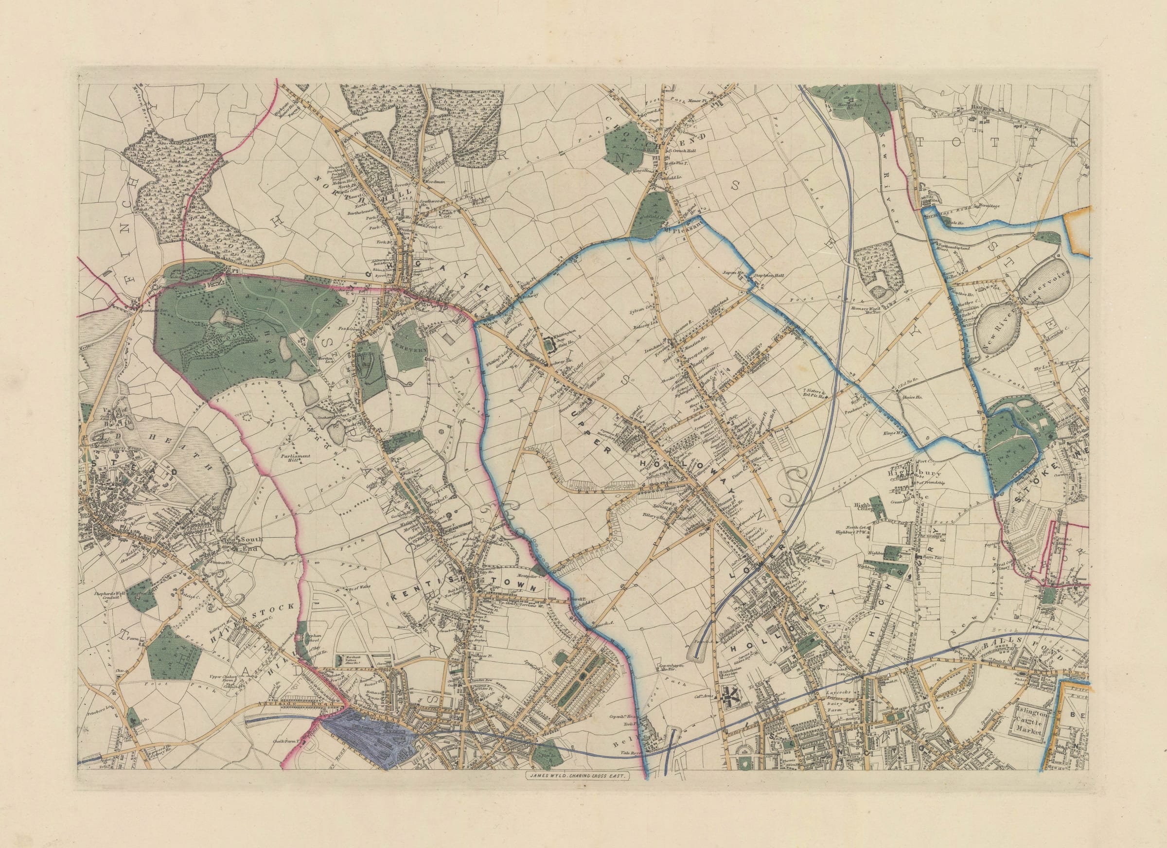
The northern sheet of James Wyld's 9-sheet map of London and its environs, focusing on Hampstead, Kentish Town, Highgate, Holloway, Islington & Crouch End. This map, first published as part...
The northern sheet of James Wyld's 9-sheet map of London and its environs, focusing on Hampstead, Kentish Town, Highgate, Holloway, Islington & Crouch End.
This map, first published as part of a 9-sheet atlas of London in 1848-49, is rarely found in this unjoined format, making these individual regional sections extremely scarce on the market. Early railway lines are shown on the map. Formal parks and gardens are shaded in green. The map is exceedingly detailed with virtually every building individually drawn and field boundaries outlined. At the time of publication, much of this area was still undeveloped farmland or woodland, scattered with small, independent villages.
Original hand-colour. [LDN6995]