
Edward Stanford
New Map of the County of London, 1901
52 x 80 in
132 x 203 cm
132 x 203 cm
LDN6989
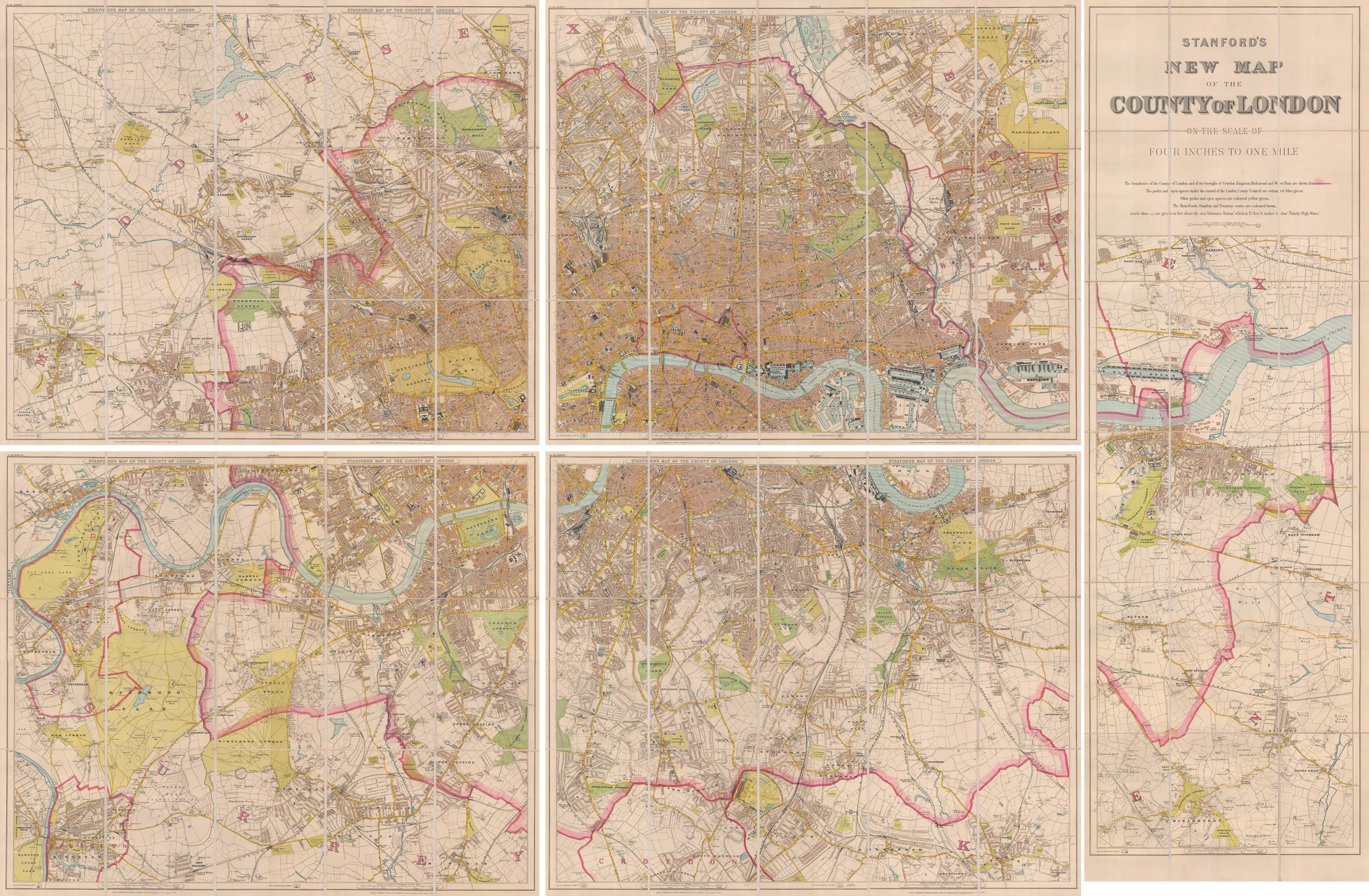
This spectacular 20-sheet Map of the County of London, first issued by Stanford's in 1894, was a revolutionary new map of the city and was almost certainly conceived as a...
This spectacular 20-sheet Map of the County of London, first issued by Stanford's in 1894, was a revolutionary new map of the city and was almost certainly conceived as a replacement for their previous flagship product, Stanford's Library Map of London. While not quite as detailed as the Library Map (the scale was reduced from 6-inches-to-the-mile to 4-inches-to-the-mile), Stanford's Map of the County of London extended much further outside of the city into the suburbs. Whereas the Library map stopped at Fulham and the Isle of Dogs, this new map of London extended all the way to Brentford and Woolwich, areas which previously had not been thought of as part of London, but which had been amalgamated into the newly-created County of London in 1889.
Recognizing the Metropolis's inevitable outward spread, Stanford's launched this brand new map of the County, designed around strong, bold colours and clean lines. Major roads are in yellow, parks are green, built-up areas are orange, and undeveloped land is white. Contemporary reviewers raved about the clarity and readability of the map and were struck by how much open land still remained within the new boundaries of the County of London. Stanford's map of the County of London was re-issued, with updates, in 1900, 1901, 1904, and several times thereafter into the 1920s. While customers could purchase individual sheets of the map as well, it was generally sold either as a collection of 20 loose sheets or it could be joined, mounted on linen, and folded into a leather case for storage on a library bookshelf.
Printed colour. Folded. [LDN6989]