Stanley Turner
44 x 99 cm
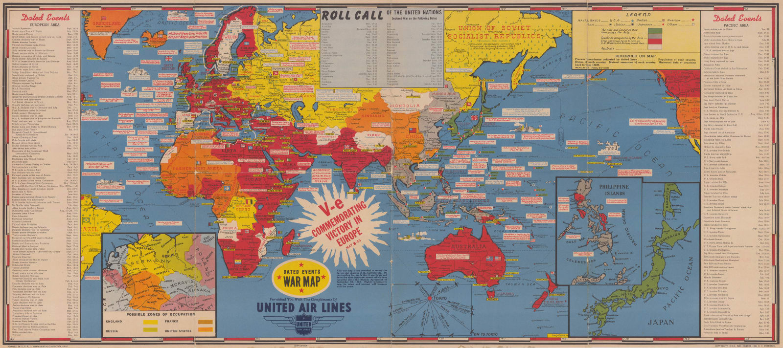
The artist, Stanley Turner, published 28 editions of this map throughout the war, starting in 1942 and ending in May, 1945. This example, updated to 8th May, 1945 celebrates the Allied victory in Europe and includes an inset suggesting possible zones for the occupation of Germany by Britain, France, the USA, and the Soviet Union after the war. This inset changes in each of the edition of Turner's map as it was used to show the most recent or most important events.
Other recent events of note include the death of President Roosevelt on April 12th, Hitler's death on the 1st May, and the liberation of Rangoon by British forces on the 3rd May. The most important events of the war are listed in two panels to the left and right of the map - European events are on the left and Pacific events are on the right. A third panel at the top of the map lists the members of the Allied coalition, the "United Nations", and the dates on which they each declared war on the Axis.
Turner's maps provide a fascinating record of the Second World War as they were updated so frequently yet retained the same base world map throughout. This allows the reader to compare between two editions to see at a glance how the war had progressed.
Printed colour. [WLD4723]


