Jacques-Nicolas Bellin
The Earliest Obtainable Map of New York City, 1764
9 x 7 in
23 x 18 cm
23 x 18 cm
USA9564
Ville de Manathe ou Nouvelle-Yorc The earliest obtainable map of New York City. Published in Bellin's Petit Atlas Maritime in 1764, but based on a small inset on a...
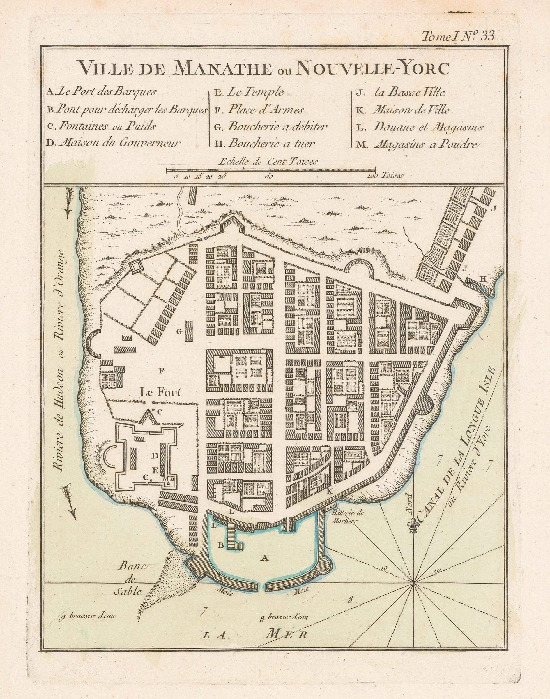
Ville de Manathe ou Nouvelle-Yorc
The earliest obtainable map of New York City. Published in Bellin's Petit Atlas Maritime in 1764, but based on a small inset on a French map of 1693 by J.B.L. Franquelin. The geography is thought to have been derived from testimony given by the French privateer John Reaux, briefly a citizen of New York himself.
As the prize of the English colonies in North America, English maps of New York would have been a vital national secret. It is no surprise, therefore, that a better, more recent map of New York City was not available to Bellin in 1764 despite 70 years passing since the Franquelin map was published.
The map focuses on the southern tip of Manhattan and shows the town as well fortified with a protected harbour, strong walls, and numerous gun batteries. Named locations include the Governor's house, the powder magazine, and the town hall.
This map was published one year after the English victory in the French & Indian War which largely ended the French threat to Britain's American colonies. Throughout the previous century, however, a French invasion of New York had seemed to be inevitable, leading to the construction of strong defences. Curiously, there is no archaeological evidence that the city was ever as well defended as it is shown on this map, so it is possible that John Reaux wanted to discourage a French attack by over-emphasizing the strength of New York's defences. If so, it may be to his credit that the French never attempted such an invasion.
Original hand-colour. [USA9564]