Edward Stanford
101 x 127 cm
This
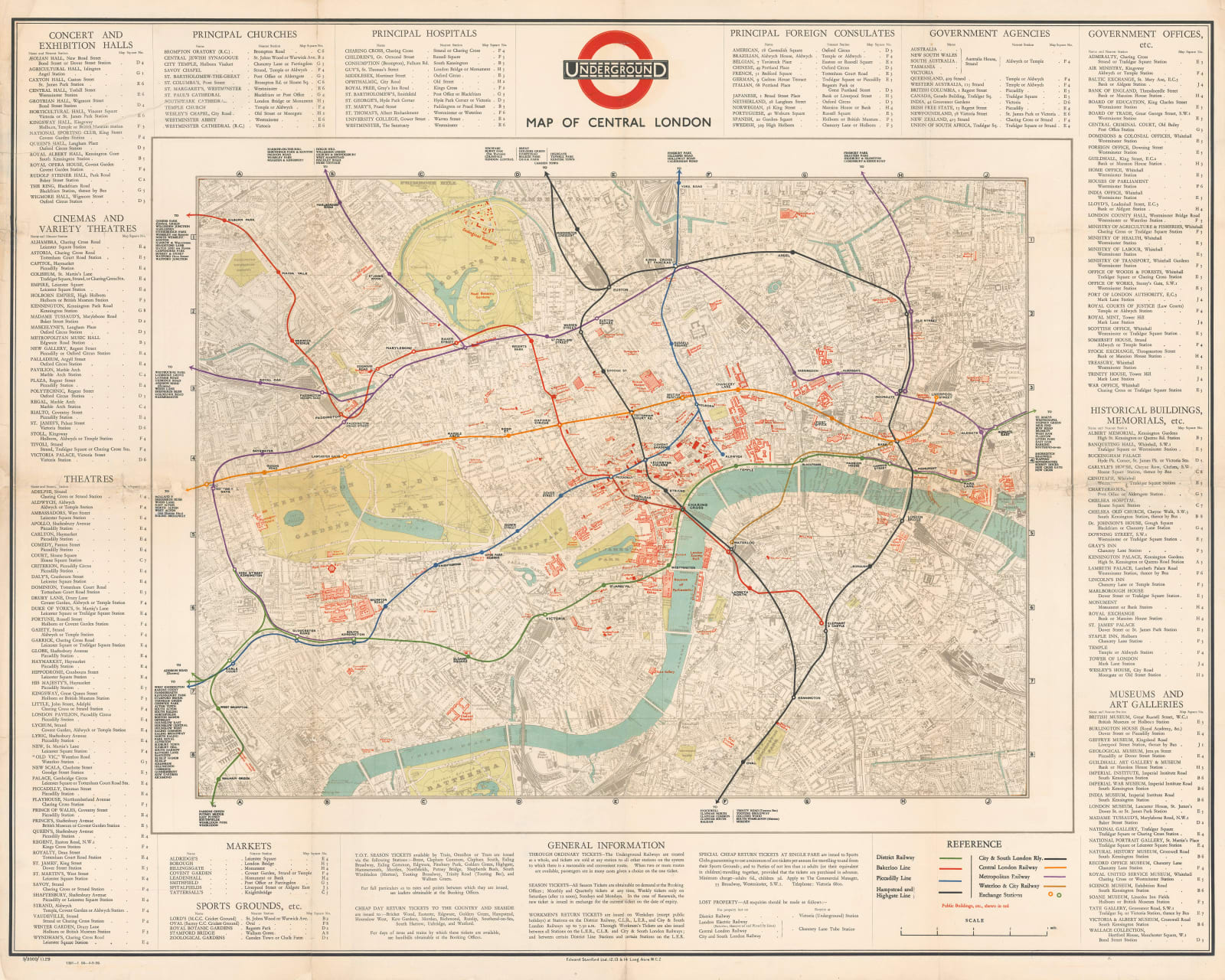
rare Quad Royal Tube map of Central London was designed and printed by Edward Stanford
Ltd., one of London’s greatest cartographic institutions. This is far more than
an ordinary Tube map. Rather, it is a guide to the attractions of Central
London.
Using their standard 4” map of London as a base layer, Stanfords have outlined
the major landmarks and public buildings in red, including theatres, churches,
consulates, government offices, and museums. These are then listed in large
panels around the edges of the map. The Underground lines are draped over the
map using the standard coloured lines of the time. The iconic black-and-red Underground roundel logo sits prominently above the map.
Printed colour. Laid down on archival linen. Framed. [LDN7216]


