
Geographia Ltd.
Elizabeth II Coronation Map, 1953
17 ½ x 22 ½ in
44 x 57 cm
44 x 57 cm
LDN7204
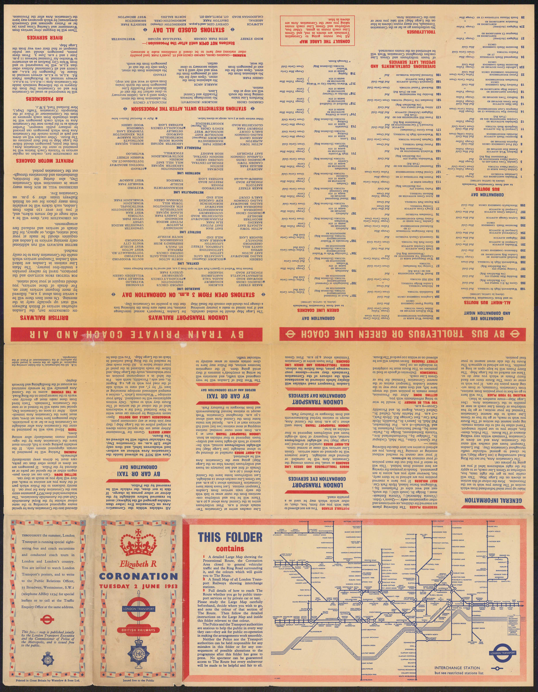
Large public events often inspired London Transport to trial unique Underground map designs. This map was published to guide the crowds of well-wishers visiting London for the coronation of Queen...
Large public events often inspired London Transport to trial unique Underground map designs. This map was published to guide the crowds of well-wishers visiting London for the coronation of Queen Elizabeth II in 1953. A near-identical map had been produced in 1937 for King George VI’s coronation. The map focuses on Central London and the areas closed to traffic surrounding the Coronation Procession. The roads which remained open for guests invited to the Coronation at Westminster Abbey are highlighted, though quite how many of those guests would have needed a public transport map is unclear.
Printed colour. Framed. [LDN7204]