Waterlow & Sons
Underground Map of London, 1924
14 x 17 ½ in
35 x 45 cm
35 x 45 cm
LDN7197
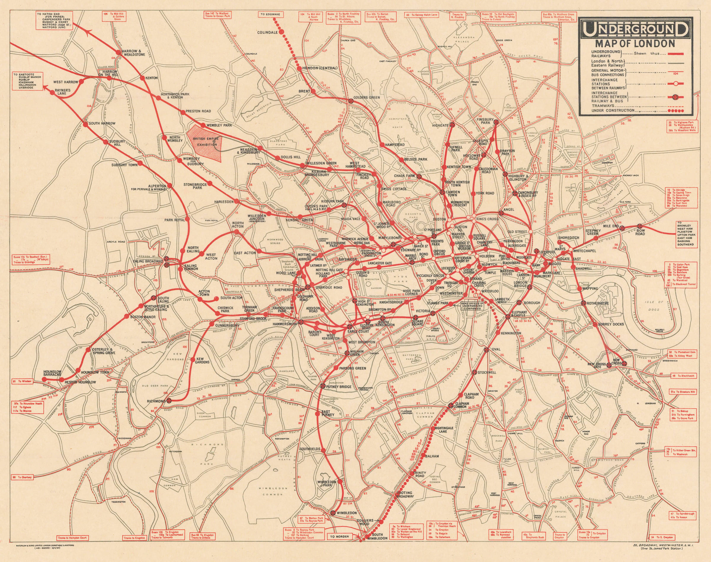
This unusual map of the London Underground, published entirely in red and black, includes not only the Underground lines, but also connecting bus routes and tramways. As a result, it...
This unusual map of the London Underground, published entirely in red and black, includes not only the Underground lines, but also connecting bus routes and tramways. As a result, it gives the impression of a unified, city-wide transport network almost a decade before the formation of the London Passenger Transport Board (LPTB) made this a reality. Great progress had been made towards unification by 1924 (the UERL’s acquisition of the General Omnibus Company in 1912 and the London and Suburban Traction Company in 1913 left only the Metropolitan Railway, the Waterloo & City Railway, some minor bus operators, and the LCC Tramways outside of its control), but there was still no overarching body managing London’s transport system, leading to complex ticketing, confusing marketing material, and duplication of services.
Several sections of the Underground are shown as under construction, including the Northern Line extensions north of Hendon and south of Clapham Common. Clapham South station (opened in 1926 as part of the Northern Line extension to Morden) is still shown under the proposed name ‘Nightingale Lane’. Other renamed stations include Aldersgate (Barbican), Mark Lane (Tower Hill), and Dover Street (Green Park).
Stylistically, this map is a curious fusion of the layout of the UERL’s 1919 Map of the Electric Railways of London with the colouring and detail of the General Omnibus Company’s 1916 Underground Map of London with some Motor Bus Extensions. Placing the ‘UndergrounD’ logo and the map’s key in a box in the upper-right corner is a design element which started with the 1919 map and was continued on Fred Stingemore’s station posters of the late-1920s and early-1930s, all the way up to the introduction of Harry Beck’s schematic map in 1933. This map embodies the conflict between experimentation and standardization which led to the creation of some of the most innovative Underground map designs but also delayed the establishment of a more coherent Underground branding.
Printed colour. [LDN7197]