
London Underground
The Underground Map of London, 1911
7 ½ x 10 in
19 x 26 cm
19 x 26 cm
LDN6996
Further images
Experimentation with the size, layout, and design of the map was the hallmark of the pre-WW1 period. Updated editions of the London Underground Railways map of 1908 continued to be...
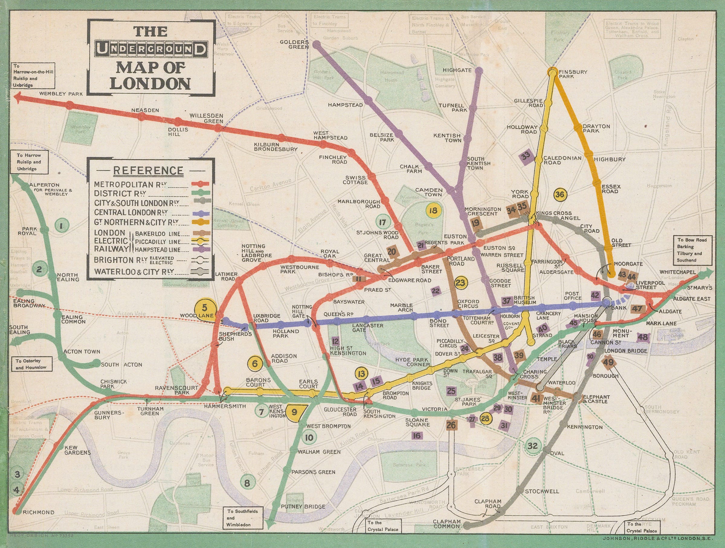
Experimentation with the size, layout, and design of the map was the hallmark of the pre-WW1 period. Updated editions of the London Underground Railways map of 1908 continued to be published in 1909 & 1910, but other designs also emerged during this time. The first trifold pamphlet map had been introduced in 1909 but was deemed to be too small for practical use. This folding map of 1911, issued free in stations and within guidebooks, was smaller than the 1908 map, but larger than the 1909 trifold pamphlet. The same green border from the 1908 map is used, but the ‘UndergrounD’ logo has been reduced from a large title in the upper margin to a smaller title within a box in the upper-left corner, allowing more space for the map itself.
Many of the lines have been straightened relative to the 1908 map or have been made into gentle curves. This is possibly the first time that the underlying map had been warped to allow the lines to be positioned more legibly, a hallmark of the modern Tube Map design. Some detail of the underlying map is still visible, particularly the parks in green and the Thames in blue, but it is printed in a much softer tone, giving full prominence to the railway lines. The numbers on the map refer to a key on the back of the map which lists 50 ‘Places of Interest and Amusement’ along with their closest Tube stations. This is indicative of the UERL’s publicity campaign to increase leisure travel and make the Underground network a means of transport for all.
This map also extends further to the west than the 1908 edition, proudly displaying the District Railway’s extension to Richmond, Putney Bridge, Ealing, and Alperton, and the Metropolitan Railway’s new stations at Wembley Park and beyond. Arrows are used to indicate that these lines continued beyond the edge of the map.
Printed colour. [LDN6996]