Hans Schleger
15 x 22 cm
Further images
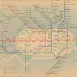
Schleger's redesign was a short-lived departure from Harry Beck's iconic schematic map, much to Beck's surprise as he believed he had full control over the Underground map's design. It has been suggested that Schleger's maps were part of a coordinated marketing campaign to celebrate the planned opening of the Central Line extensions in 1939. This celebration was halted by the war, but Schleger was later commissioned to produce a series of posters in 1947 when the extensions finally opened.
The map shows planned extensions to the Central Line, Northern Line, and Bakerloo Line - they are marked with dashed lines. Ultimately, the Second World War disrupted these plans and some were scrapped entirely during the post-war economic downturn. The back of the map features two close-up maps of Central London, one extending from Green Park to Charing Cross, and the other showing the City of London from Blackfriars to Liverpool Street.
Printed colour. Framed. [LDN6921]


