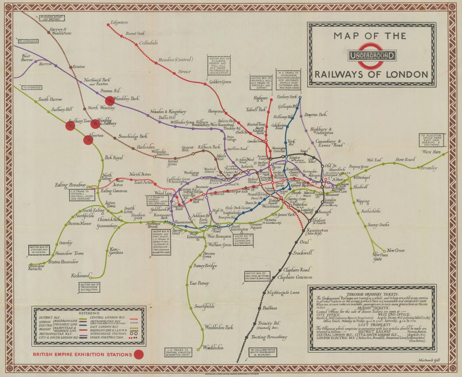
Macdonald Gill
37 x 45 cm
The most important of these changes is a graphical first. This is the earliest map distributed by the UERL to include the now-iconic black-and-red Underground roundel logo on the face of the map. Variations of the roundel logo had appeared on the cover of folding maps, including the 1922 Gill map (12), as early as 1914, but this 1923 edition is the first time the logo was repeated on the front of the map as well. The 1921 edition of Gill’s map does not include a logo, the 1922 edition has a unique logo design (most likely by Gill himself), and the 1923 edition features the standardized Underground roundel. This mirrors the wider evolution of London Underground branding taking place through the 1920s and driven by Frank Pick. Ironically, the spacing of the red roundel against the ‘UndergrounD’ lettering in the logo on this November 1923 edition is uneven, slightly undermining the design. This could be a result of rushed printing, or may just indicate how new and unfamiliar the roundel logo concept was at the time.
Another significant difference between this edition and the previous Gill edition is that the expansion of several lines forced Gill to shrink the central area slightly in favour of showing more of outer London. Hendon (Central) and Brent station, both of which would open in November 1923 as part of the Hampstead & Highgate Line’s extension from Golders Green to Edgware, are shown as completed, whilst Colindale, Burnt Oak, and Edgware are still under construction. A short southern extension from Charing Cross to Kennington, the construction of which been started in June 1923, is marked on the map.
Similarly, the planned expansion of the City & South London Railway from Clapham Common to Morden, which did not appear on the 1922 map, has now been added. Bromley & West Ham stations, operational since 1902, are now also shown on the map thanks to the wider coverage area. Three Metropolitan Line stations have been added beyond Preston Road (Northwick Park, Harrow, and West Harrow) and two Bakerloo Line stations (Kenton and North Wembley) also now appear.
The map has also been adjusted to reflect the great public event of the day: the British Empire Exhibition of 1924. Four prominent red circles mark the most convenient stations for accessing the Exhibition. These include Wembley Park, Sudbury Town, Alperton, and Wembley for Sudbury. The British Empire Exhibition would not open until April 1924, but these stations were highlighted on maps as early as January 1923, suggesting a concerted publicity effort by London Underground to convince Exhibition visitors to travel by Tube.
Printed colour. [LDN6853]


