Chas. Baker & Co.
London - A Bird's-Eye View, 1912
18 x 38 ½ in
46 x 98 cm
46 x 98 cm
LDN7214
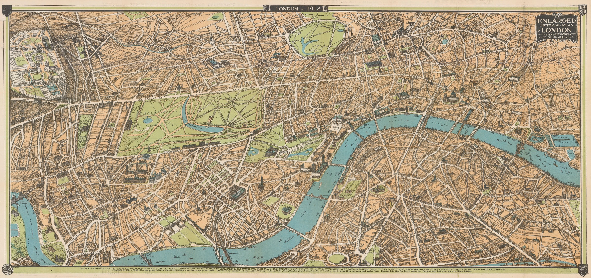
The Enlarged Pictorial Plan of London Baker's famous Pictorial Plan of London, stretching from Hammersmith and White City in the west to London Docks in the east and the...
The Enlarged Pictorial Plan of London
Baker's famous Pictorial Plan of London, stretching from Hammersmith and White City in the west to London Docks in the east and the Oval in the south to Camden in the north.
Baker and Co. were actually gentlemen's outfitters who also had a lucrative sideline in publishing both this map and the ABC Guide to London, which also included this map. Both of these were sold in their outlets throughout London and were enormously popular. The map was first published for them by John Bartholomew in 1897 with annual issues from then on. Its look, size and scope changed, reflecting the character of the city.
On this example, The Great White City in the west is particularly prominent, focusing on its function as the premier exhibition for London. It was first built for the 1908 Olympics and was the site of the Franco-British Exhibition of that year. In 1912, it was the site of the Latin-British Exhibition. As was usually the case, the reverse of the map bears several notes to guide the visitor to sights and experiences in London as well as several advertisements, particularly for products of Charles Baker & Co.
Image of reverse available upon request. Printed colour. [LDN7214]