Erwin Tschudi
87 x 120 cm
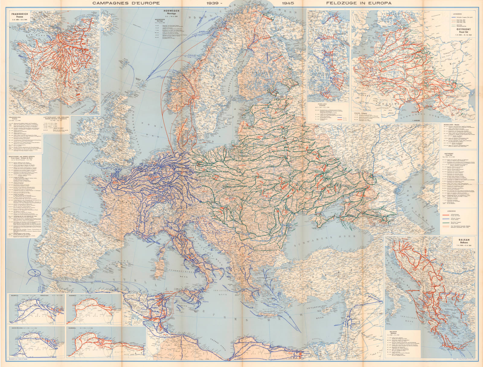
The main focus of this large map of Europe is to geographically illustrate the phases and campaigns of the European and affiliated North African theaters of World War II.
The main participants of the war, the Allies, the Axis powers and the Russian troops are represented by blue, red and green arrows respectively. The large central map shows the counter attack by the Allies from the west and the south and the Russian campaign together with the Russian counter attack from the east.
Multiple insets throughout the map focus on specific campaigns such as the North African theater, the invasion of Poland in 1939 and the Balkan campaign. The inset on the upper left shows the German invasion and conquest of France and the retreat at Dunkirk. Finally, a curiosity is the inset of the Winter War of 1939-40 between Finland and Russia. Small charts on the left and right track the historical timing of the war.
The map was published in Bern, Switzerland and has been tentatively dated to c. 1947. It is very unusual to get such a comprehensive overview of the war so early after its completion.
Printed colour. [EUR1555]


