A.D. Noel and Louis Vivian de St. Martin
111 x 118 cm
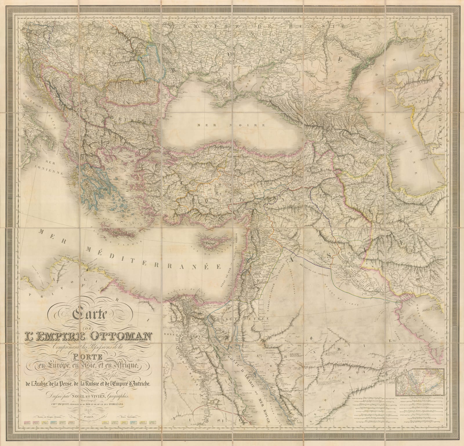
Geographically, the map extends from Tripoli or modern Lybia in Africa, through the Levant, into Anatolia and the Balkans. Its depiction of the Sinai Peninsula is particularly accurate for the time. Further east, it covers the northern part of the Arabian Peninsula, showing the Gulf just north of Qatar, Iraq and an extremely accurate rendition of the Caucasus. The geographical overview also incorporates the Black and Caspian Seas.
This map was originally published in 1825 and reflects the high level of diplomatic tension within the area driven by the war of Greek Independence (1821-29). It is modelled on a series of maps by the eminent French map maker Pierre Lapie who specialised in large scale maps. The French government had a traditionally close relationship with the Ottoman Court and presumably a higher level of access than most other European powers of the period. Unusually, the map also lists a series of collaborating publishers for its compilation and marketing. These include James Wyld and John Cary in London, Villardi in Milan and Artaria and Fontaine in Mannheim among others. The main publisher in Paris is listed a Giraldon – Bovinet who were also the engravers. The credit for the compilation of the information is given to Louis Vivien de St. Martin and A. D. Noel.
This example is a later issue of 1840 and shows the consequences of the turmoil of the 1820s. There is a colour key on the lower left border, starkly showing the reduced possessions of the Ottoman Empire, particularly after the disastrous Russo-Turkish War of 1828-9 and the loss of Greece. On the left is a series of colour boxes specific to colours present in the provinces in the Empire. On the right of the cartouche is a series of colour boxes showing new independent nations with their borders. These include Greece and the short lived Republic of Ionian Islands as well as the newly established borders with Russia, the Austrian Empire and Persia. Of particular note is a small inset on the lower right which shows the southern part of Arabia, including an early rendition of the Qatari Peninsula. None of the above features are present on the 1825 edition of the map.
Although the map is still credited to Vivian and Noel, it no longer bears the list of contributors from abroad and the publisher has now changed to Charles Picquet, who revised and updated the map.
A mention must also be made of the very fine marbled paper original slip case with matching chemise.
Original colour. [MEAST4572]


