
John Speed
Radnorshire, 1616
16 x 21 in
41 x 53 cm
41 x 53 cm
WCTS1452
The Countie of Radnor Described and the Shyretownes Sittuatione This is a magnificent example of a first edition of Speed's county map of Radnorshire in extremely rare and glorious...
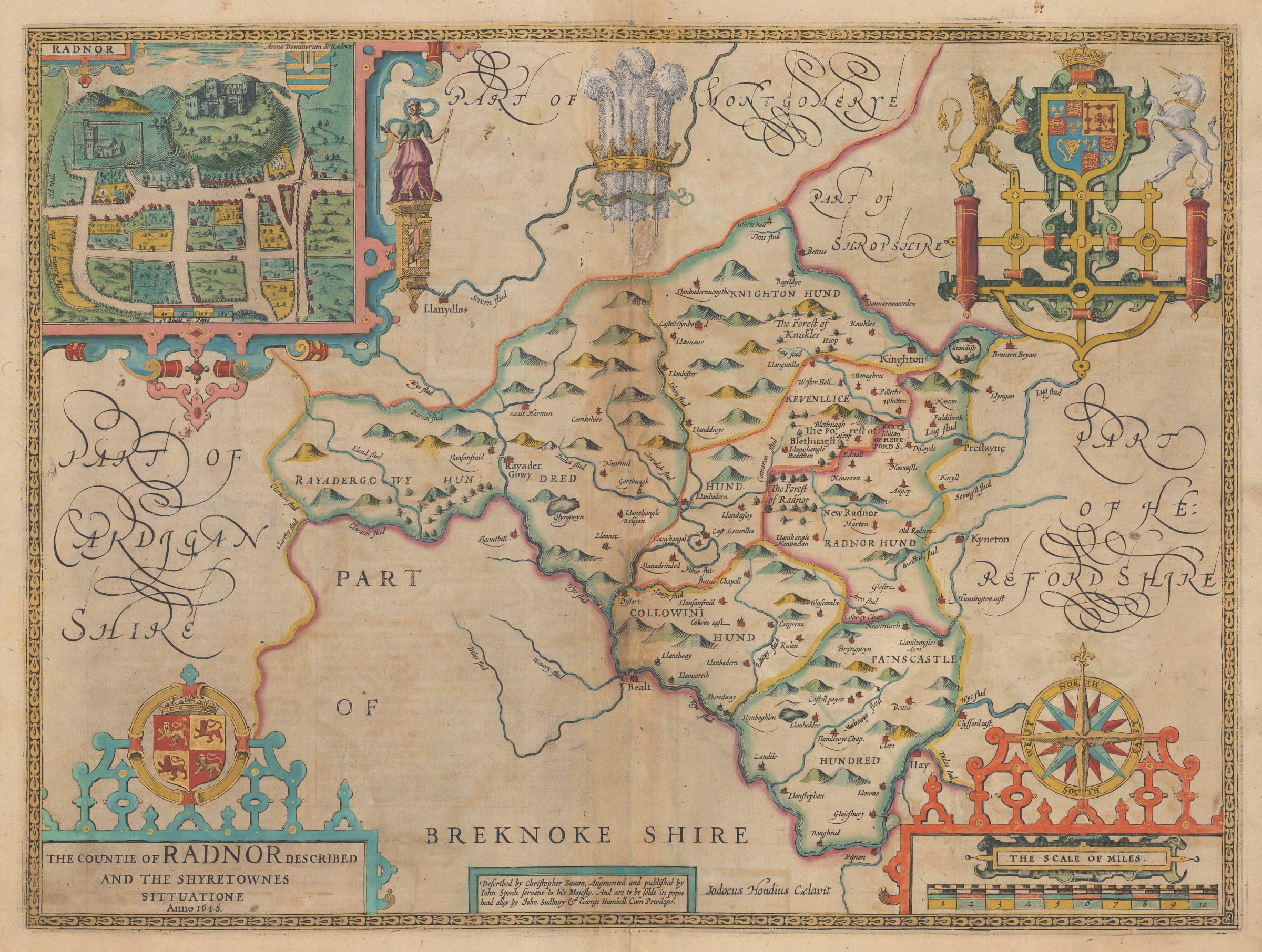
The Countie of Radnor Described and the Shyretownes Sittuatione
This is a magnificent example of a first edition of Speed's county map of Radnorshire in extremely rare and glorious original colour, heightened in gold. The map is fundamentally based on the survey performed by Christopher Saxton in 1578, but Saxton combined Radnor, Brecon, Cardigan, and Carmarthen on the same sheet when publishing his atlas in 1579. Speed separated these counties into four separate maps in his "Theatre of the Empire of Great Britaine" and developed the aesthetic of the map to a new level with the addition of the city plan of Radnor, the splendid coats of arms, and the handsome compass rose.
Although the survey is based on Saxton, Speed's maps are famous for the inset city plans. These are very often Speed's own work which he either made or purchased locally as well as often being the first printed plans of these towns. This is the case with this inset map of Radnor; no earlier printed plans of the town have been recorded.
The example offered for sale is distinguished by the addition of truly magnificent original colour, heightened in gold - an exceptional rarity!
English text on the verso. [WCTS1452]