J. Loeb
35 x 55 cm
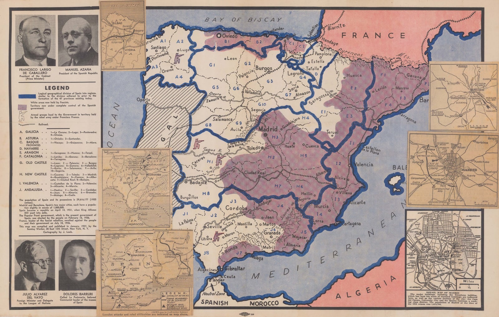
Territory held by the Republican government of Spain is shaded purple, while areas captured by the Fascists under Franco are in white. Areas of high anti-Fascist partisan resistance are also noted. The additional inset maps all focus on areas currently under the control of the Republicans, but at risk of falling to the Fascists.
In the left border are portraits of four of the key leaders of Republican Spain: Francisco Largo de Caballero, the Prime Minister; Manuel Azaña, the last President of the Republic; Julio Alvarez del Vayo, Foregin Minister and Delegate to the League of Nations; and Dolores Ibarruri, "La Pasionaria", a beloved Communist Leader of the masses. Between the portraits is a legend and further statistics about the Spanish population. In the lower-right corner of the map is a small inset map of Madrid, below which it is noted that the Telephone Building has been the scene of repeated bombings.
The Spanish Civil War was of intense interest to many Americans, particularly those with pro-Communist or anti-Fascist sympathies. American journalists, such as Ernest Hemingway, sent back first-hand accounts of the fighting, particularly from resistance fighters, and many Americans volunteered to fight alongside the Republicans.
We have seen a second example of this map which was printed in February 1937 by the Friends of the Soviet Union. It differed by the inclusion of a large title banner above the map. Both of these maps were likely intended to serve the dual purpose of informing the readership about current events whilst also eliciting support from readers for the Republican cause and for the global struggle for Communism.
Printed colour.


