-

-
George Anson, A Chart of the Channel in the Philippine Islands, through which the Manila Galeon Passes, 1740 c.£ 1,250.00
-
Mount & Page, A New and Correct Chart of England, Scotland and Ireland, 1740 c.£ 895.00
-
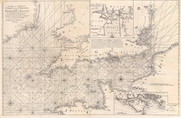
Mount & Page, A New and Correct Chart of the Channel, 1740 c.£ 1,750.00
-
Paul de Rapin & Nicolas Tindal, Battle of Malplaquet, 1740 c.£ 325.00
-
Paul de Rapin & Nicolas Tindal, Battle of Oudenard, 1740 c.£ 325.00
-
Paul de Rapin & Nicolas Tindal, Battle of Ramillies, 1740 c.£ 325.00
-
Matthaus Seutter, Diversi Globi-Terr-Aquei Statione Variante it Visu Intercedente, 1740 c.£ 4,950.00
-
Matthaus Seutter, Novus Orbis sive America, 1740 c.£ 2,850.00
-
Paul de Rapin & Nicolas Tindal, Siege map of Toulon, 1740 c.£ 80.00
-
Jacques-Nicolas Bellin, Chart of the Pacific Ocean, 1742£ 3,750.00
-
Jacques-Nicolas Bellin, Chart of the Pacific Coast of South and Central America, 1744£ 525.00
-
Johann Wolfgang Heydt, Sunda Straits and Jakarta, 1744£ 595.00
-
Jacques-Nicolas Bellin, South Atlantic Ocean, 1746£ 395.00
-
Mount & Page, Chart of Hispaniola or Haiti and the Dominican Republic, 1750 c.£ 1,750.00
-
Mount & Page, English chart of the Caribbean and Gulf of Mexico, 1750 c.£ 4,500.00
-
Robert de Vaugondy, The Ancient World, 1752£ 2,750.00
-
Jonas Hanway, Chart of the Caspian Sea, 1753£ 985.00
-
Jacques-Nicolas Bellin, French sea chart of the South Atlantic, 1753£ 985.00
-
Jacques-Nicolas Bellin, Chart of the Magellan Straits, 1753£ 165.00
-
Jacques-Nicolas Bellin, Portobelo, Panama, 1754£ 175.00
-
Jacques-Nicolas Bellin, Chart of the Azores, 1755£ 475.00
-
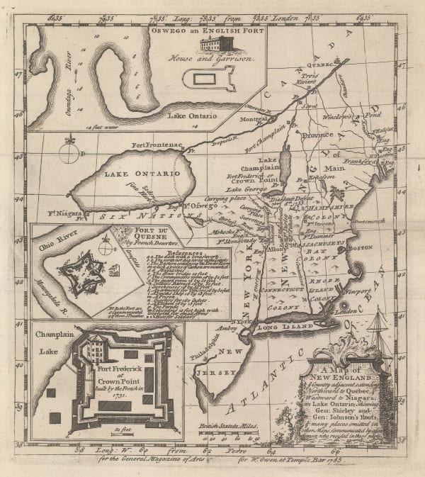
William Owen, French & Indian War Map of New England, 1755£ 950.00
-
Jacques-Nicolas Bellin, Chart of the Bay of Trincomalee (Gokanna or Gokarna), 1757£ 185.00
-
Jacques-Nicolas Bellin, French sea chart of the Atlantic Ocean, 1757£ 985.00
-
Jacques-Nicolas Bellin, North Atlantic & Scandinavia, 1758£ 395.00
-
Jacques-Nicolas Bellin, Carte des Entrees de la Tamise, 1759£ 625.00
-
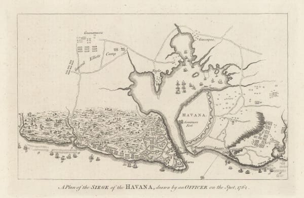
Political Magazine, A Plan of the Siege of the Havana, drawn by an Officer on the spot, 1762., 1762£ 325.00
-
Jacques-Nicolas Bellin, Chart of the Bay of Cadiz, 1762£ 785.00
-
Jacques-Nicolas Bellin, Bay and harbour of Brest, 1764£ 115.00
-
Jacques-Nicolas Bellin, Dunkirk and environs, 1764£ 62.00
-
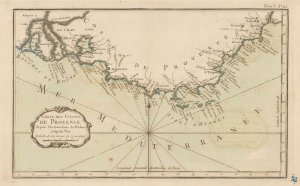
Jacques-Nicolas Bellin, Coast of Provence from La Crau d'Arles to Nice, 1764£ 195.00
-
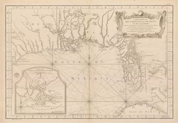
Jacques-Nicolas Bellin, Florida and Louisiana coast, 1764£ 4,950.00
-
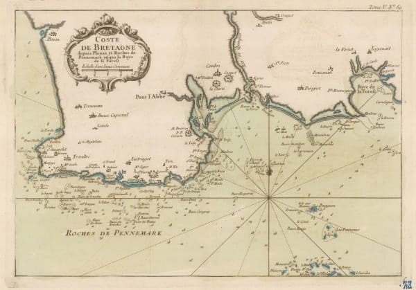
Jacques-Nicolas Bellin, Coast of Brittany, 1764£ 88.00
-
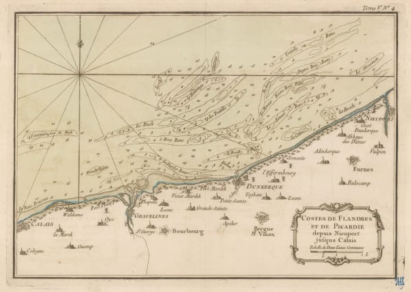
Jacques-Nicolas Bellin, Chart from Calais to Nieuwpoort, 1764£ 65.00
-
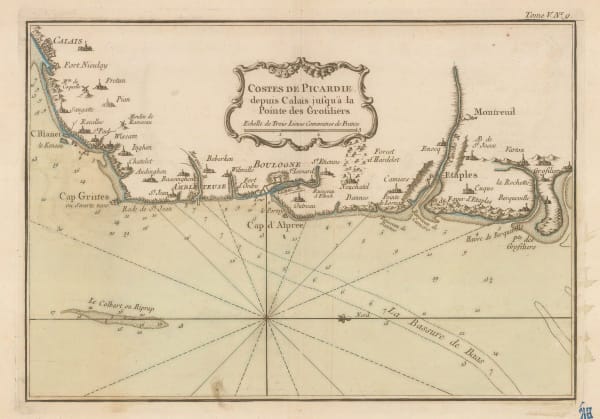
Jacques-Nicolas Bellin, Picardie coast, 1764£ 62.00
-
Jacques-Nicolas Bellin, Le Havre and environs, 1764£ 72.00
-
Jacques-Nicolas Bellin, Plymouth & the Tamar, 1764£ 165.00
-
Jacques-Nicolas Bellin, Essex, Kent & the Mouth of the Thames, 1764£ 165.00
-
Jacques-Nicolas Bellin, Chart of the Cape Verde Islands and the coast of Africa , 1765£ 225.00
-
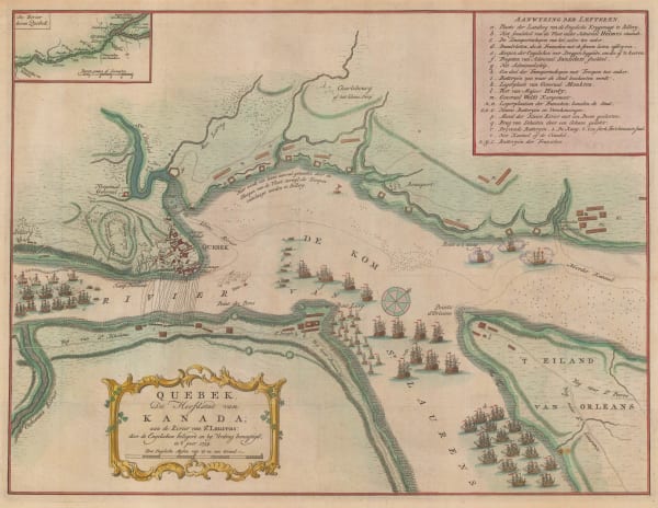
Isaac Tirion, Plan of the Battle of Quebec, 1765£ 845.00
-
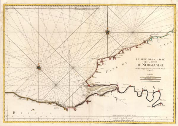
Jacques-Nicolas Bellin, Coast of Normandy from Dieppe to Bayeux, 1765 c.£ 350.00
-
Tobias & Georg Lotter, North America, 1770 c.£ 1,950.00
-
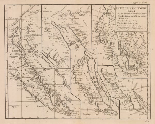
Robert de Vaugondy, Cartographic history of California, 1772£ 1,150.00
-
Jacques-Nicolas Bellin, Chart of the Sea of Marmara, 1772£ 985.00
-
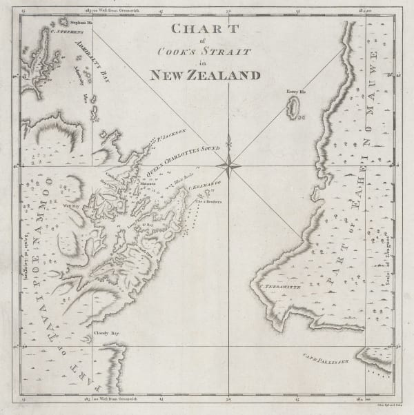
Capt. James Cook, Chart of Cook's Strait in New Zealand, 1773£ 775.00
-
Capt. James Cook, Society Islands, 1773£ 475.00
-
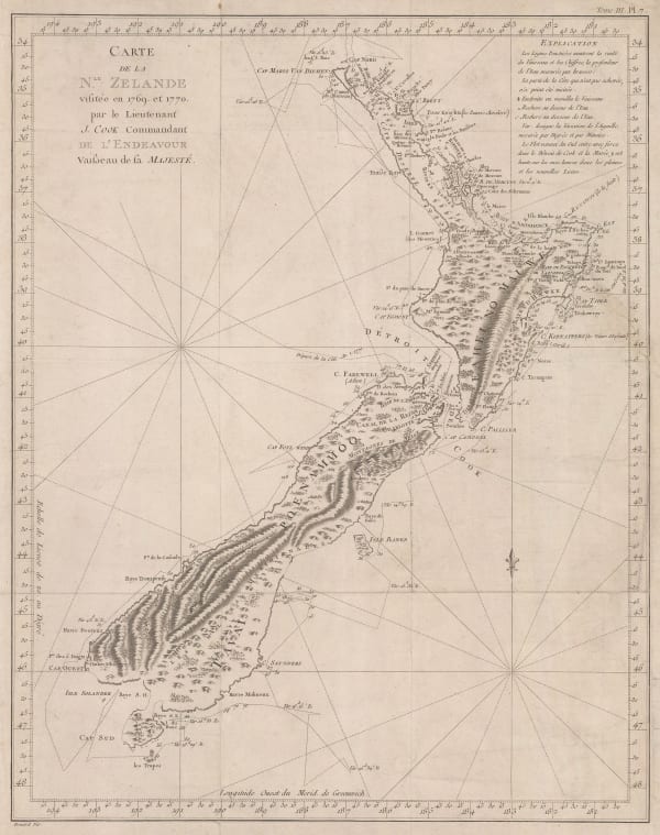
Capt. James Cook, New Zealand, 1773£ 4,950.00
-
Capt. James Cook, Captain Cook's route in the South Pacific, 1774£ 1,550.00
-
Capt. James Cook, James Cook's Map of New South Wales & Queensland, 1774£ 1,250.00
-
Capt. James Cook, New Zealand, 1774£ 3,750.00
-
Capt. James Cook, Cook's and Dampier's routes, Papua New Guinea, 1774£ 345.00
-
Jacques-Nicolas Bellin, Chart of the West Indies and Gulf of Mexico, 1774£ 1,950.00
-
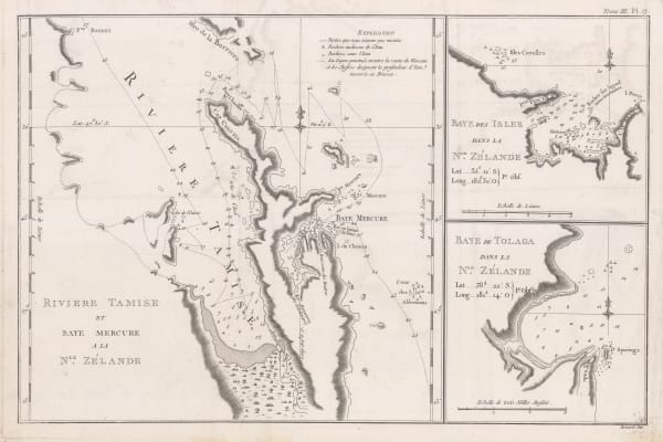
Capt. James Cook, River Thames and Mercury Bay | Bay of Islands | Tolaga Bay in New Zealand, 1774£ 625.00
-
Thomas Jefferys, Chart of the St Lawrence River, 1775£ 1,250.00
-
Sayer & Bennett, Amelia Island, 1776£ 1,800.00
-
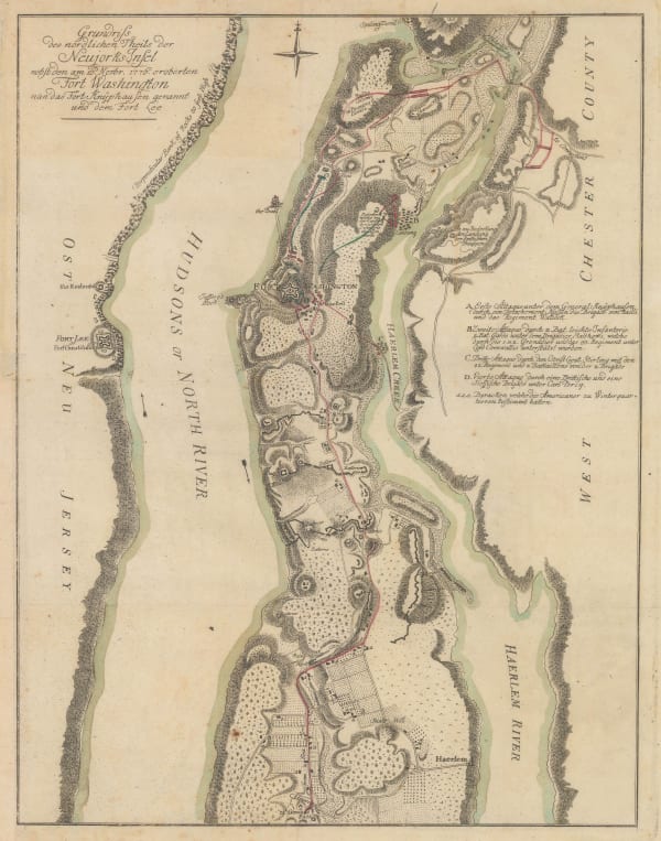
Gabriel Nikolaus Raspe, Revolutionary War map of New York island north of Harlem, 1777£ 2,850.00
-
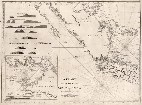
Robert Sayer, A Chart of the Straits of Sunda and Banca, 1778£ 775.00
-
William Faden, Chart of the Coast of the Iberian Peninsula and Western Mediterranean, 1780£ 425.00
-
J.C. & J.A. Dezauche, Planisphere Physique, 1780£ 1,150.00
-
Robert Sayer, Ancient Egypt, 1780 c.£ 195.00
-
Jacques-Nicolas Bellin, The Bay of Biscay, 1780 c.£ 575.00
-
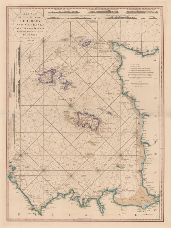
William Faden, Chart of the Channel Islands, 1781£ 2,250.00
-
John Bew, A Map and Chart of the Cape of Good Hope, with the Soundings in Table Bay, False Bay & Saldaniia Bay, 1781£ 595.00
-
Michel René Hilliard d' Auberteuil, Scarce and important Revolutionary War battle plan of the Battle of Monmouth, 1782£ 2,250.00
-
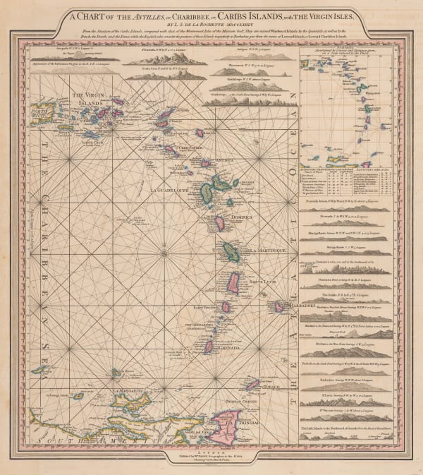
William Faden, Leeward and Windward Islands, 1784£ 3,650.00
-
Capt. James Cook, Hawaii, 1785£ 1,850.00
-
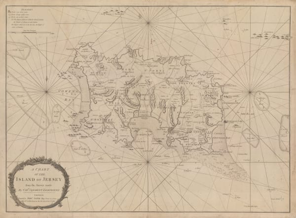
Robert Sayer, A Chart of the Island of Jersey, 1786£ 1,850.00
-
Robert Sayer, A New Hydrographic Sketch of the North, South and Middle Channels, 1786£ 495.00
-
Jacques-Nicolas Bellin, Chart of the North Atlantic Ocean, 1786£ 1,200.00
-
-
Jacques-Nicolas Bellin, Chart of Turks and Caicos, 1787£ 1,275.00
-
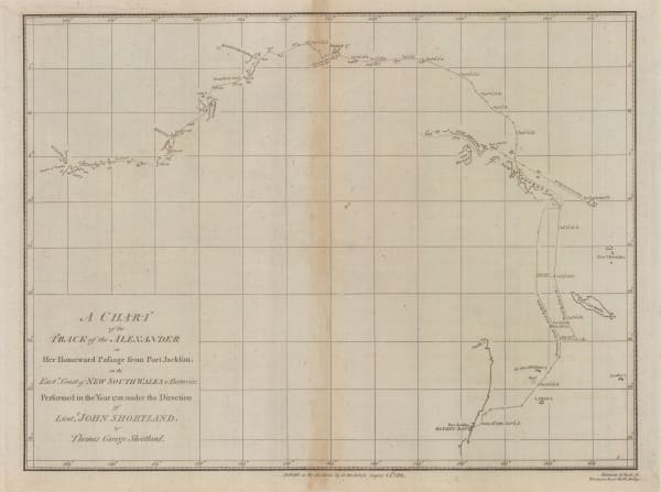
John Stockdale, Store ship Alexander's voyage from Port Jackson to Batavia, 1789£ 195.00
-
John Stockdale, Chart of the Track of the Scarborough from Port Jackson to Guam, 1789£ 245.00
-
J.M. Wauthier, Battlefields. A Graphical Guide to the Places described in the History of England, 1790 c.£ 495.00
-
Thomas Conder, Captain Cook's Map of Hawaii , 1790 c.£ 945.00
-
William Faden, Plan of the Road to Funchal, 1791£ 785.00
-
Charles Stedman, Sketch of General Grants Position on Long Island, 1793£ 1,250.00
-
Laurie & Whittle, A Chart of the Coast of India, from Goa to Cape Comorin, 1794£ 1,250.00
-
Laurie & Whittle, Madeira & the Canary Islands, 1794£ 925.00


Page
2
of 15