-
 Mercator Hondius, Lombardy & the Italian Lakes, 1635£ 165.00
 -
Willem & Jan Blaeu, Duchy of Savoy, 1640 c.£ 695.00
-
W. & A.K. Johnston, Illustrations of the Glacier Systems of the Alps, 1848£ 425.00
-
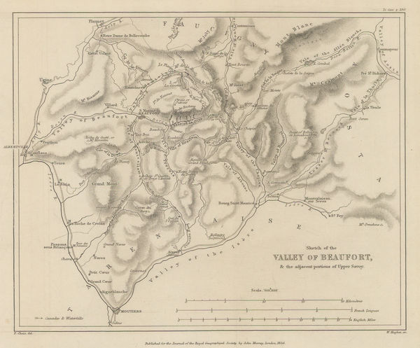
Royal Geographical Society (RGS), Valley of Beaufort and parts of Upper Savoy, 1856£ 175.00
-
Jean Joseph Mieulet, Controversial survey map of the Mont Blanc peaks., 1865£ 1,750.00
-
Justus Perthes, Northwest Switzerland, 1875£ 145.00
-
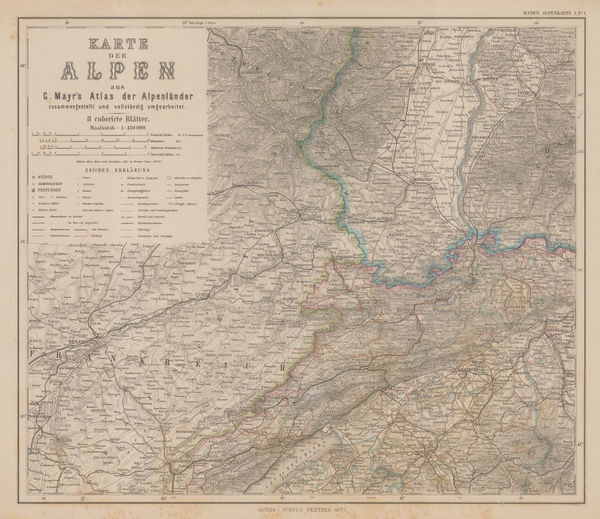
Justus Perthes, Swiss and Italian Alps, 1875£ 185.00
-
Justus Perthes, Salzburg, 1875£ 125.00
-
Edward Stanford, The Alpine Club Map of Switzerland, 1876£ 2,500.00
-
Justus Perthes, The Alps, 1880 c£ 175.00
-
Adolphe Joanne, Haute Savoie & Mont Blanc, 1882£ 165.00
-
George Virtue, Mont Blanc, 1890 c.£ 98.00
-
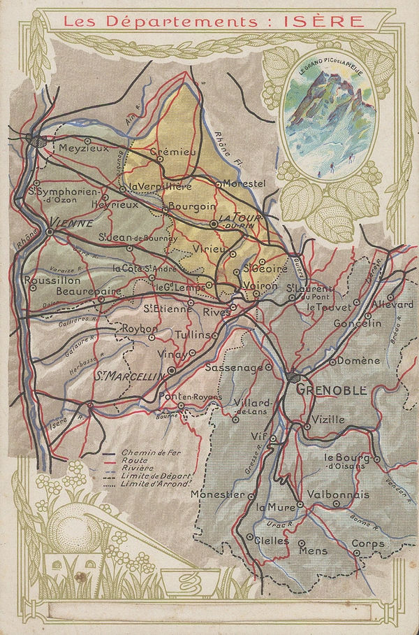
Chocolat d'Aiguebelle, Isère, 1900 c.£ 48.00
-
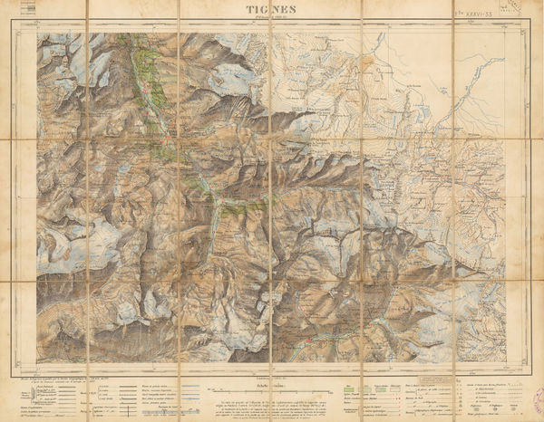
Service Géographique de l'Armée, Tignes/Val d'Isere, 1911£ 2,450.00
-
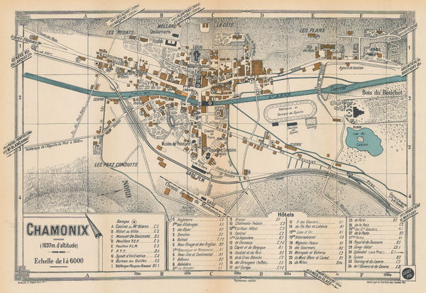
E. Fonne, Chamonix, 1920 c.£ 140.00
-
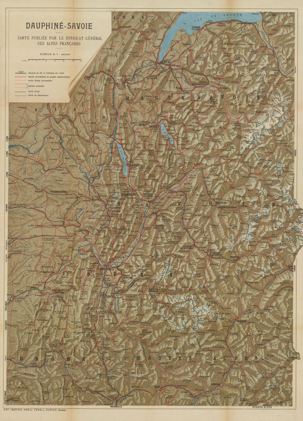
Orell Füssli, Dauphine-Savoie, 1930 c£ 650.00
The Alps
Our entire inventory of over 10,000 antique and vintage maps is now available to browse by region, date, cartographer, and subject