-
 Claudius Ptolemy & Laurent Fries, Ptolemaic woodcut map of Iran (Persia), 1541£ 3,250.00
 -
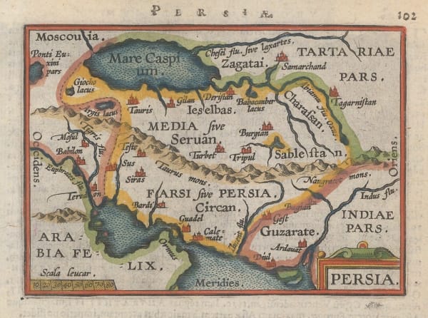
Abraham Ortelius, Persia, 1601£ 295.00
-
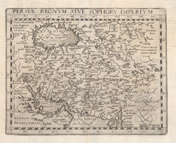
Matthias Quad, Persiae Regnvm Sive Sophorv Imperivm, 1609£ 775.00
-
Petrus Bertius, Persia, 1618£ 225.00
-
Samuel Purchas, Persian Empire (Iran), 1625£ 295.00
-
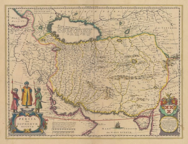
Willem & Jan Blaeu, Iran, 1634£ 1,450.00
-
Nicolas & Guillaume Sanson, Description de L' Empire du Sophi des Perses, 1658 c.£ 645.00
-
Jan Jansson, Persian Empire (Iran) during the Classical period, 1661£ 195.00
-
Adam Olearius, A Map of ye Province of Kilan as it lies on ye Caspian Sea, 1662£ 125.00
-
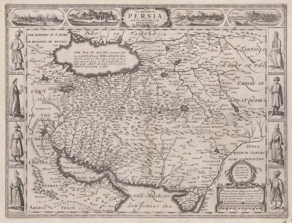
John Speed, The Kingdome of Persia, 1676£ 3,450.00
-
Alain Manesson Mallet, Iran, 1683£ 175.00
-
Robert Morden, Miniature map of Iran (Persia), 1688£ 245.00
-
Pierre Duval, Persia, 1694£ 225.00
-
Nicolas & Guillaume Sanson, Persian Empire (Iran), 1700£ 395.00
-
Pieter Schenk, Persian Empire (Iran), 1705 c£ 1,250.00
-
Pieter van der Aa, La Rade de Gammeron, 1714£ 295.00
-
Homann Heirs, Early bird's eye view of the city of Ardabil, 1740 c.£ 68.00
-
Georges-Louis Le Rouge, L'Empire de Perse, 1746£ 195.00
-
Jacques-Nicolas Bellin, Persia (Iran), 1764£ 375.00
-
Tobias Conrad Lotter, Persia (Iran), 1765 c.£ 850.00
-
Rigobert Bonne, Persian Empire (Iran), 1771£ 325.00
-
Willem Albert Bachiene, Persian Empire (Iran), 1773£ 575.00
-
Francois Santini, The Persian Empire (Iran), 1779£ 595.00
-
William Vincent, Plan of the Coast of Mekran from the Indus to the Persian Gulph copied by permission for this work only, 1797£ 675.00
-
Robert Wilkinson, Ancient Persian Empire, 1798£ 125.00
-
John Cary, A New Map of Persia from the Latest Authorities, 1801£ 425.00
-
Robert Wilkinson, Parthian Empire, 1807£ 125.00
-
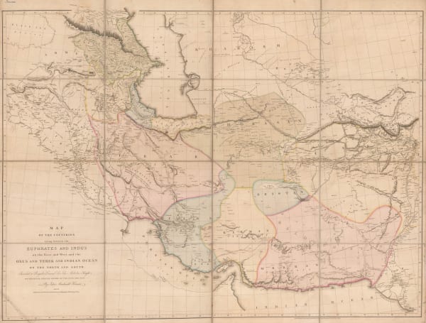
Aaron Arrowsmith, Monumental wall map of Iran, 1813£ 4,950.00
-
Daniel & William Lizars, Persia, 1820 c.£ 295.00
-
Philippe Vandermaelen, Western Iran, 1827£ 365.00
-
Carl Weiland, Iran, Afghanistan and Beludschistan, 1828£ 345.00
-
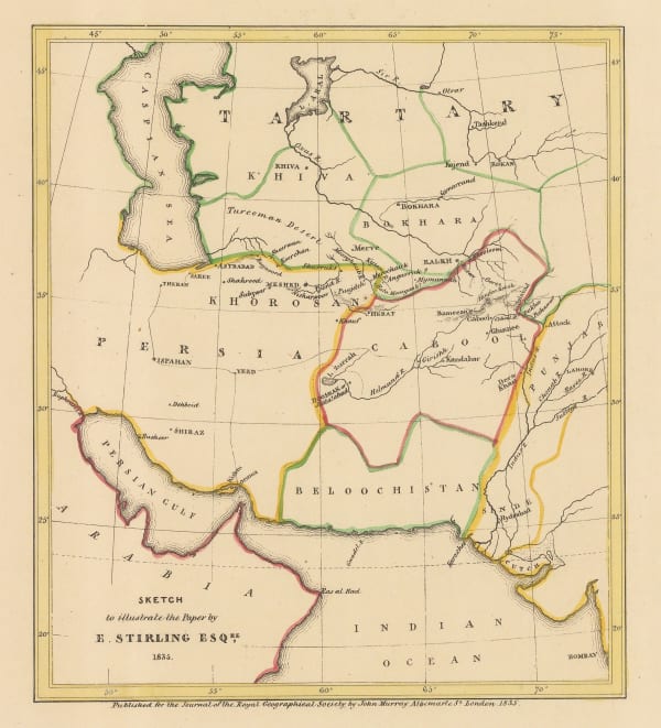
Royal Geographical Society (RGS), Sketch to Illustrate the Paper by E. Stirling Esq, 1835£ 58.00
-
Royal Geographical Society (RGS), Sketch map of the Iran and Iraq border, 1839£ 145.00
-
Royal Geographical Society (RGS), Tabriz by Takhti to Gilan, 1840£ 145.00
-
Samuel Augustus Mitchell, Arabia, Persia, 1840 c£ 575.00
-
Royal Geographical Society (RGS), Northwestern Iran, 1842£ 82.00
-
Royal Geographical Society (RGS), Map to Illustrate Mr. Layard's Paper on Khuzistan, 1846£ 92.00
-
Royal Geographical Society (RGS), Map to Illustrate Notes on Routes from Bushire to Shiraz by Lt. Genl. Monteith and from Shiraz to Darab & thence to Kazerin by Consul Keith E.Abbott, 1857£ 98.00
-
John Dower, Iran (Persia), 1860 c.£ 155.00
-
Royal Geographical Society (RGS), Route map from the Persian Gulf to Tehran and Herat, 1861£ 84.00
-
Royal Geographical Society (RGS), Islands of Qeshm (Kishm) and Hormuz, 1864£ 112.00
-
Royal Geographical Society (RGS), Persia, Beluchistan and Afghanistan, 1867£ 115.00
-
Royal Geographical Society (RGS), Seistan, 1873£ 125.00
-
Justus Perthes, German map of Central Persia (Iran), 1874£ 68.00
-
Royal Geographical Society (RGS), A Map of The Northern Frontier of Khorassan with parts of Irak & Mazandaran, 1876£ 445.00
-
Royal Geographical Society (RGS), Route Map from Jask to Bampūr, 1877£ 125.00
-
Royal Geographical Society (RGS), A Map of a Route Along the Alburz Mountains Between Tehran, Astrabad and Shahrud, 1883£ 495.00
-
Royal Geographical Society (RGS), Map of the Afgan and Persian Border, 1886£ 165.00
-
Royal Geographical Society (RGS), Central Iran (Persia), 1888£ 85.00
-
Arbuckle Brothers Company, Iran (Persia), 1889£ 98.00
-
-
Royal Geographical Society (RGS), Persia, Afghanistan and Beluchistan, 1892£ 525.00
-
Royal Geographical Society (RGS), Iran, Arghanistan and Pakistan, 1902£ 325.00
-
Royal Geographical Society (RGS), Country between Bandar Abbas and Shiraz, 1908£ 125.00
-
Royal Geographical Society (RGS), The Tigris Euphrates Delta, 1910£ 195.00
-
George Philip & Son Ltd., The Near East: Industries and Communications, 1910 c.£ 225.00
-
Royal Geographical Society (RGS), Sketch map of Northern Iran, 1911£ 125.00
-
Geographical Section, General Staff (GSGS), Persia (Iran) and Afghanistan, 1921£ 375.00
-
British Admiralty, Entrance of the Persian Gulf, 1951£ 4,500.00
-
-
Abbas Sahab, Isfahan: Half the World, 1961£ 675.00
Close
Search Inventory
Our entire inventory of over 10,000 antique and vintage maps is now available to browse by region, date, cartographer, and subject


![Maḥmūd & Qulī Khān, نقشۀ شهر دار الخلافۀ ناصرى طهران صانها الله تعالى عن الحدثان [Map of the city of the Nasserite caliphate of Tehran], 1891 c.](https://artlogic-res.cloudinary.com/w_600,c_limit,f_auto,fl_lossy,q_auto/artlogicstorage/themaphouse/images/view/ba254bcc61572c82a8055bad8e8e68f0j/themaphouse-ma-m-d-qul-kh-n-map-of-the-city-of-the-nasserite-caliphate-of-tehran-1891-c..jpg)


Join our mailing list
* denotes required fields
We will process the personal data you have supplied to communicate with you in accordance with our Privacy Policy. You can unsubscribe or change your preferences at any time by clicking the link in our emails.
![]()
Join our mailing list
* denotes required fields
We will process the personal data you have supplied to communicate with you in accordance with our Privacy Policy. You can unsubscribe or change your preferences at any time by clicking the link in our emails.