-

-
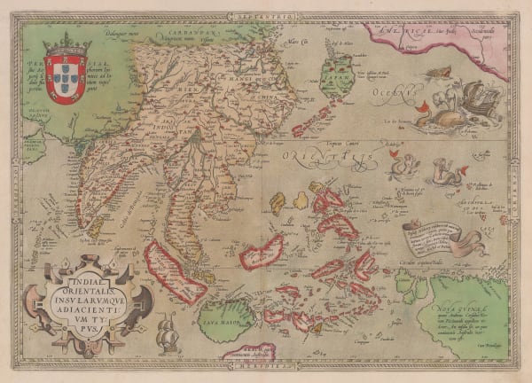
Girolamo Ruscelli, Early map of Southeast Asia, 1574£ 885.00
-
Abraham Ortelius, Miniature map of Southeast Asia, 1601£ 875.00
-
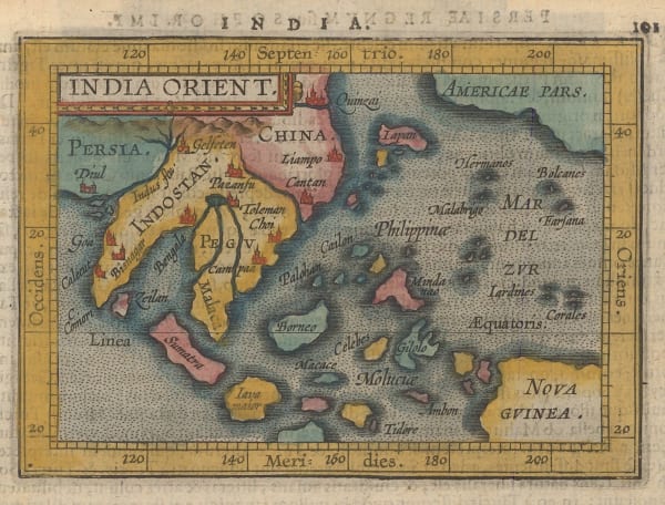
Giovanni Antonio Magini, Miniature map of Southeast Asia, 1617£ 645.00
-
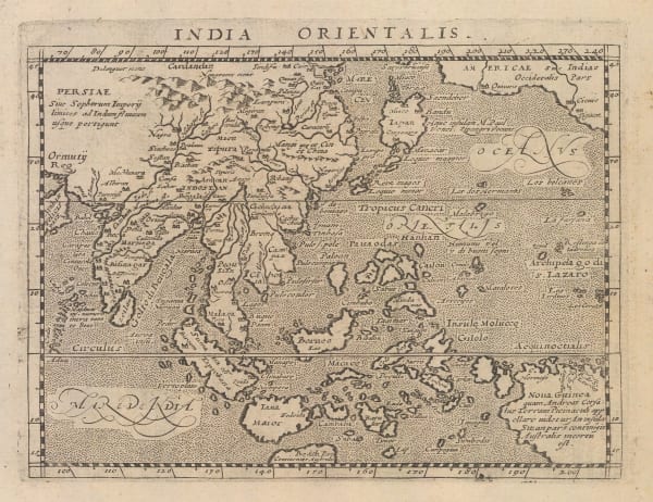
Samuel Purchas, Early map of South East Asia, 1625£ 485.00
-
Mercator Hondius, Early map of Southeast Asia, 1628£ 495.00
-
Mercator Hondius, India and Southeast Asia, 1630£ 825.00
-
Mercator Hondius, Southeast Asia, 1632£ 825.00
-
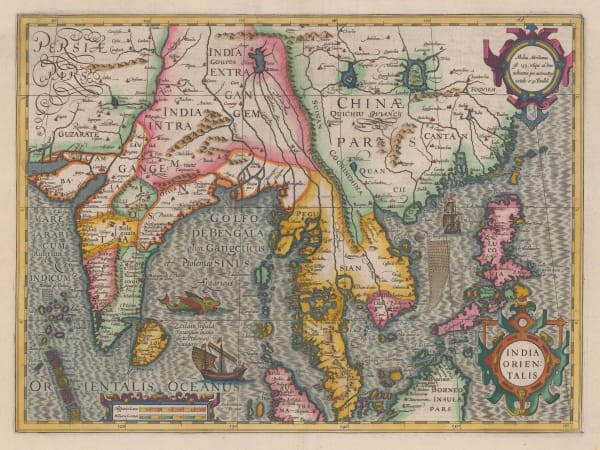
Mercator Hondius, Important early map of India, Sri Lanka, Southeast Asia, and the Philippines, 1636 c.£ 2,950.00
-
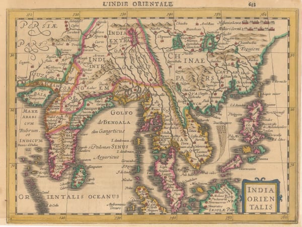
Nicolas & Guillaume Sanson, Southeast Asia, 1654£ 2,200.00
-
Vincenzo Coronelli, [New Holland and the Far East], 1690 c.£ 3,200.00
-
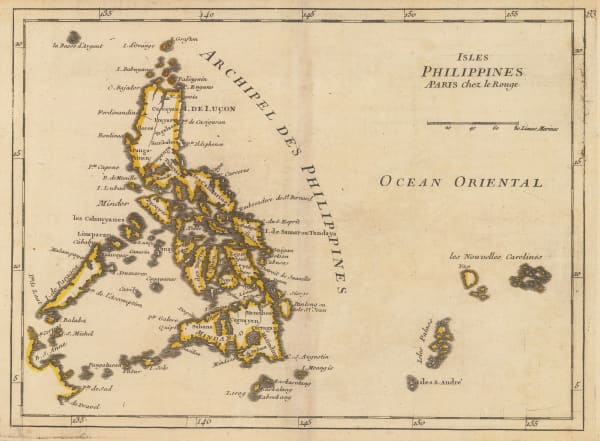
Nicolas & Guillaume Sanson, Philippine Islands, 1692£ 845.00
-
Vincenzo Coronelli, Italian map of Southeast Asia, 1696 c.£ 2,750.00
-
-
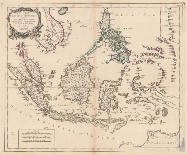
Nicolas de Fer, Scarce map of Southeast Asia, 1702£ 885.00
-
Heinrich Scherer, Southeast Asia, 1709£ 1,850.00
-
Heinrich Scherer, Southeast Asia, 1709£ 845.00
-
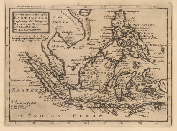
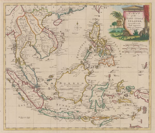
Herman Moll, The Principal Islands of the East Indies, 1723£ 375.00
-
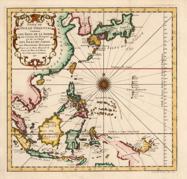
Henri du Sauzet, Southeast Asia, 1734£ 675.00
-
George Anson, A Chart of the Channel in the Philippine Islands, through which the Manila Galeon Passes, 1740 c.£ 1,250.00
-
George Anson, Chart of Manila Bay, 1740 c.£ 525.00
-
Isaac Tirion, Southeast Asia, 1744£ 345.00
-
Georges-Louis Le Rouge, Philippine Islands, 1746£ 745.00
-
Jacques-Nicolas Bellin, China, Japan, Philippines & Southeast Asia, 1746£ 445.00
-
Jacques-Nicolas Bellin, Chart of Malaysia, Borneo, Java and Sumatra, 1749£ 465.00
-
Jacques-Nicolas Bellin, Chart of the Philippines and Spice Islands, 1749 c.£ 425.00
-
Jacques-Nicolas Bellin, Northern Philippines, 1752£ 385.00
-
Jacques-Nicolas Bellin, Chart of the southern Philippines, 1752£ 245.00
-
Herman Moll, Philippines, Indonesia and Malaysia, 1755 c.£ 495.00
-
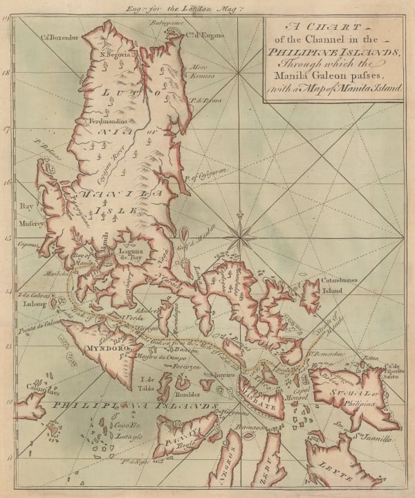
London Magazine, A Chart of the Channel through which the Manila Galeon Passes, 1763£ 795.00
-
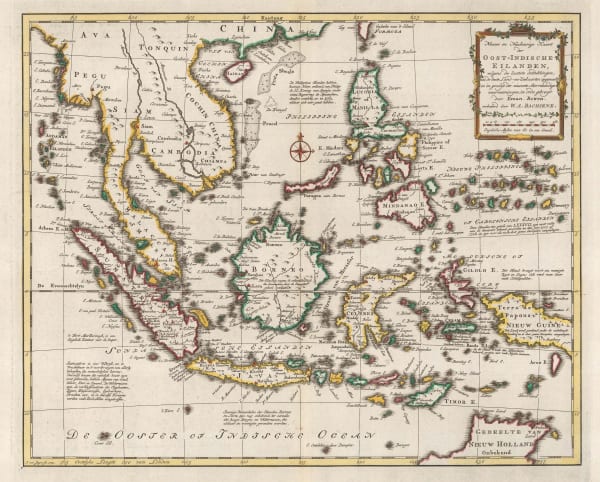
Willem Albert Bachiene, Southeast Asia, 1774£ 1,250.00
-
Thomas Conder, East Indies, 1778£ 895.00
-
Francois Santini, Southeast Asia, 1778£ 525.00
-
Antonio Zatta, South East Asia, 1780£ 325.00
-
Rigobert Bonne, Philippines with parts of part of Indonesia, New Guinea, Taiwan and southeast China, 1780 c£ 550.00
-
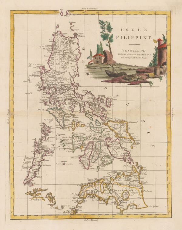
Antonio Zatta, Philippine Islands, 1785£ 1,950.00
-
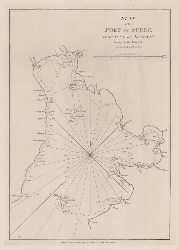
Laurie & Whittle, Chart of Subic Bay on Luzon Island, 1794£ 825.00
-
Charles Francois Delamarche, Southeast Asia, 1795£ 375.00
-
-
George Cooke, Southeast Asia, 1800£ 175.00
-
Aaron Arrowsmith, Chart of the East India Islands, 1808£ 375.00
-
John Pinkerton, East India Isles, 1813£ 985.00
-
John Thomson, Southeast Asia, 1815 c.£ 495.00
-
John Cary, Southeast Asia, 1825£ 645.00
-
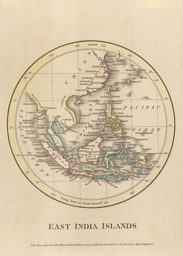
Thomas Starling, Miniature map of Southeast Asia, 1830 c.£ 95.00
-
Rest Fenner, Miniature map of Southeast Asia, 1836£ 85.00
-
W. & A.K. Johnston, First cartographic document to use the name "Malaysia", 1840£ 745.00
-
John Dower, East India Isles, 1860 c.£ 195.00
-
Joseph Meyer, Southeast Asia showing colonial possessions, 1868£ 245.00
-
Blackie & Son, Sumatra, Borneo, and the Philippines, 1870 c.£ 225.00
-
John Arrowsmith, Folding map of South East Asia, 1876£ 1,450.00
-
Society for the Diffusion of Useful Knowledge (SDUK), Southeast Asia, 1879£ 385.00
-
John Bartholomew, Southeast Asia, 1887£ 64.00
-
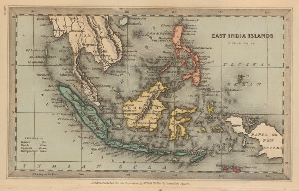
Edward Stanford, East Indies, 1896£ 145.00
-
George Cram, Philippine Islands, 1897£ 145.00
-
George F. Stewart, Map of the City of Manila and Vicinity, 1901£ 2,450.00
-
Geographia Ltd., Indonesia, Borneo, Brunei, and the Philippines, 1930 (c.)£ 195.00
-
René Jouon, Indonesia or the Dutch East Indies, 1932£ 85.00
-
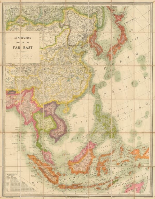
Edward Stanford, Folding wall map of South East Asia, 1941£ 1,450.00
-
US Army, Philippine Islands, 1944£ 980.00
-
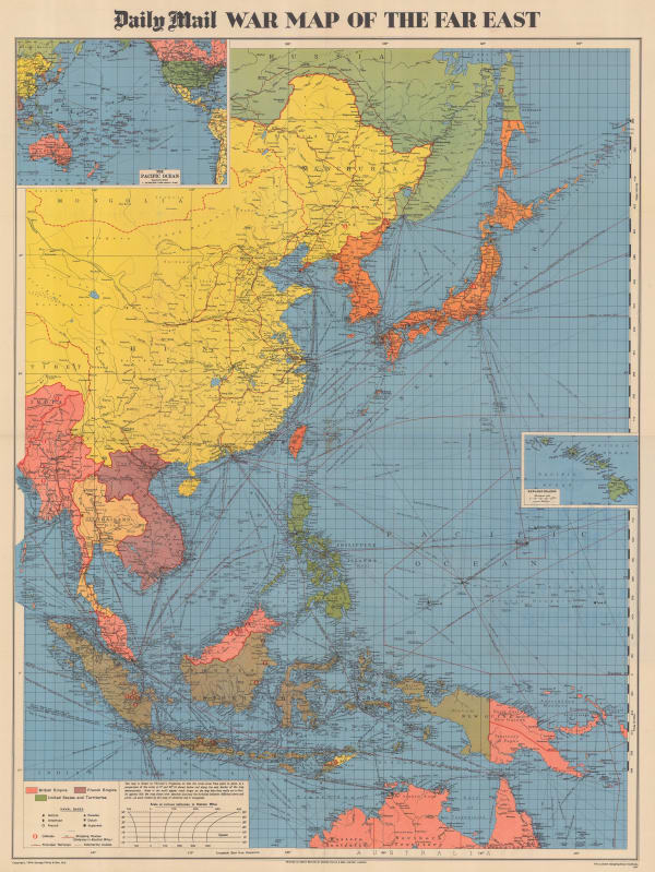
George Philip & Son Ltd., WW2 Map of the Far East, 1944£ 495.00
-
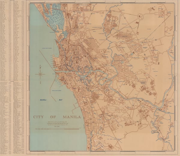
US Army, City of Manila, 1945£ 625.00
-
USAFFE, Central Manila, 1946 c£ 495.00
Close
Search Inventory
Our entire inventory of over 10,000 antique and vintage maps is now available to browse by region, date, cartographer, and subject


![Vincenzo Coronelli, [New Holland and the Far East], 1690 c.](https://artlogic-res.cloudinary.com/w_600,c_limit,f_auto,fl_lossy,q_auto/artlogicstorage/themaphouse/images/view/004f043618f2ad80876c954634ad647ej/themaphouse-vincenzo-coronelli-new-holland-and-the-far-east-1690-c..jpg)


Join our mailing list
* denotes required fields
We will process the personal data you have supplied to communicate with you in accordance with our Privacy Policy. You can unsubscribe or change your preferences at any time by clicking the link in our emails.
![]()
Join our mailing list
* denotes required fields
We will process the personal data you have supplied to communicate with you in accordance with our Privacy Policy. You can unsubscribe or change your preferences at any time by clicking the link in our emails.