-
 Valk & Schenk, New England and Virginia, 1710 c.£ 2,300.00
 -
Jacques-Nicolas Bellin, Lake Champlain, the Richelieu and the St Lawrence Rivers, 1744£ 275.00
-
Matthaus Seutter, Early map of Pennsylvania, New York and New Jersey, 1745 c.£ 3,450.00
-
Important German rendition of Bellin's seminal map of the Great Lakes, 1755Homann HeirsSeries: NurembergHomann Heirs, Important German rendition of Bellin's seminal map of the Great Lakes, 1755£ 3,650.00
-
William Owen, French & Indian War Map of New England, 1755£ 950.00
-
London Magazine, New York State and northern New Jersey, 1756£ 525.00
-
Marco Coltellini, New England, 1763£ 775.00
-
Louis Brion de la Tour, Eastern Coast of North America, 1766£ 495.00
-
-
London Magazine, New York State during the Revolutionary War, 1778£ 950.00
-
London Magazine, New York State during the Revolutionary War, 1778£ 950.00
-
Antonio Zatta, New York and Pennsylvania, 1779£ 825.00
-
John Bew, New York and part of the Jerseys, New England and Canada, 1780£ 1,495.00
-
Louis Capitaine du Chesne, Northeastern USA, 1789 (c.)£ 475.00
-
Plan of the Attack of the Forts Clinton & Montgomery, upon Hudsons River, 1793Charles StedmanSeries: LondonCharles Stedman, Plan of the Attack of the Forts Clinton & Montgomery, upon Hudsons River, 1793£ 2,450.00
-
Plan of the Position which the Army under Burgoine took at Saratoga, 1793Charles StedmanSeries: LondonCharles Stedman, Plan of the Position which the Army under Burgoine took at Saratoga, 1793£ 1,950.00
-
Charles Stedman, Sketch of General Grants Position on Long Island, 1793£ 1,250.00
-
John Reid, The State of New York, compiled from the Most Authentic Information, 1796£ 750.00
-
Tardieu, North-eastern United States, 1810 c.£ 495.00
-
Carey & Lea, Geographical, Statistical and Historical map of New York, 1822£ 1,550.00
-
Philippe Vandermaelen, Cape Cod to Chesapeake Bay, 1827£ 350.00
-
Philippe Vandermaelen, Northeastern United States, 1827£ 450.00
-
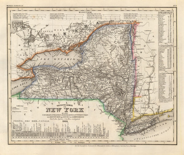
Joseph Meyer, State of New York, 1844£ 385.00
-
Society for the Diffusion of Useful Knowledge (SDUK), New England, 1844£ 145.00
-
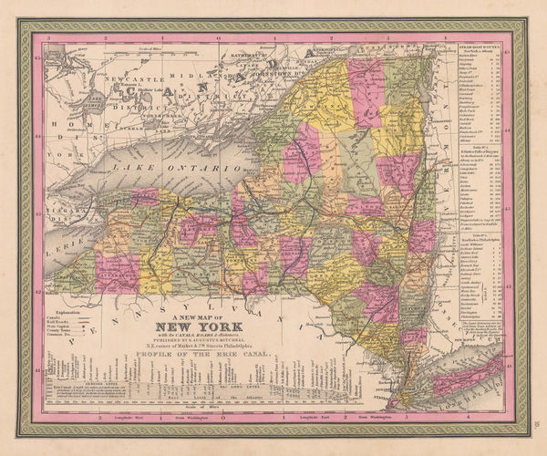
Samuel Augustus Mitchell, A New Map of New York, 1847 c.£ 395.00
-
Johnson & Ward, Johnson's New York, 1866£ 195.00
-
O.W. Gray & Son, New York, 1876£ 240.00
-
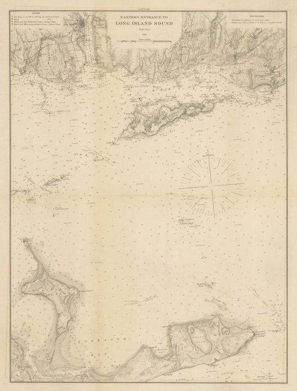
Atlantic Coast Pilot, Eastern Entrance to Long Island Sound, 1880£ 245.00
-
Atlantic Coast Pilot, Long Island Sound, 1880£ 225.00
-
Atlantic Coast Pilot, Long Island Sound, 1880£ 245.00
-
Samuel Augustus Mitchell, County Map of the State of New York, 1884£ 145.00
-
Perry Mason & Co., New York, 1891£ 98.00
-
The Position of the Main Ground-Water Table on Long Island, New York, 1904United States Geological Survey (USGS)Series: Washington, D.C.United States Geological Survey (USGS), The Position of the Main Ground-Water Table on Long Island, New York, 1904£ 495.00
-
Karl Baedeker, Buffalo, 1909£ 65.00
-
C.S. Hammond & Co., A Guide to Jewish New York, 1912 c.£ 1,950.00
-
Redfield-Kendrick Odell Co., Sunrise Trails on Long Island, 1926£ 545.00
New York
Our entire inventory of over 10,000 antique and vintage maps is now available to browse by region, date, cartographer, and subject